
National Register of Historic Places listings in Cass County, Minnesota facts for kids

This page lists special places in Cass County, Minnesota that are part of the National Register of Historic Places. These are important sites, buildings, or areas that have been officially recognized for their history, architecture, or archaeology. Think of it like a hall of fame for historical spots!
There are 18 places in Cass County on this list. There were also 3 other places that used to be on the list but are no longer there.
Contents
- Amazing Historic Places in Cass County
- Battle Point (Leech Lake)
- Pine River Train Station
- Chase Hotel
- Chippewa Agency Historic District
- Conservation Building
- Crow Wing State Park
- Great Northern Railway Company Bridge
- Gull Lake Mounds Site
- Hole-in-the-Day House Site
- Minnesota State Sanatorium for Consumptives
- Old Backus
- Pine River to Woman Lake and Longville Stagecoach Road-Widow Lake Segment Historic District
- Rice Lake Hut Rings
- Sherwood Forest Lodge Complex
- Soo Line Depot (Remer, Minnesota)
- South Pike Bay Site
- Supervisor's Office Headquarters
- Winnibigoshish Lake Dam
- Winnibigoshish Resort
- Former Listings
Amazing Historic Places in Cass County
Here are some of the cool historic places you can find in Cass County:
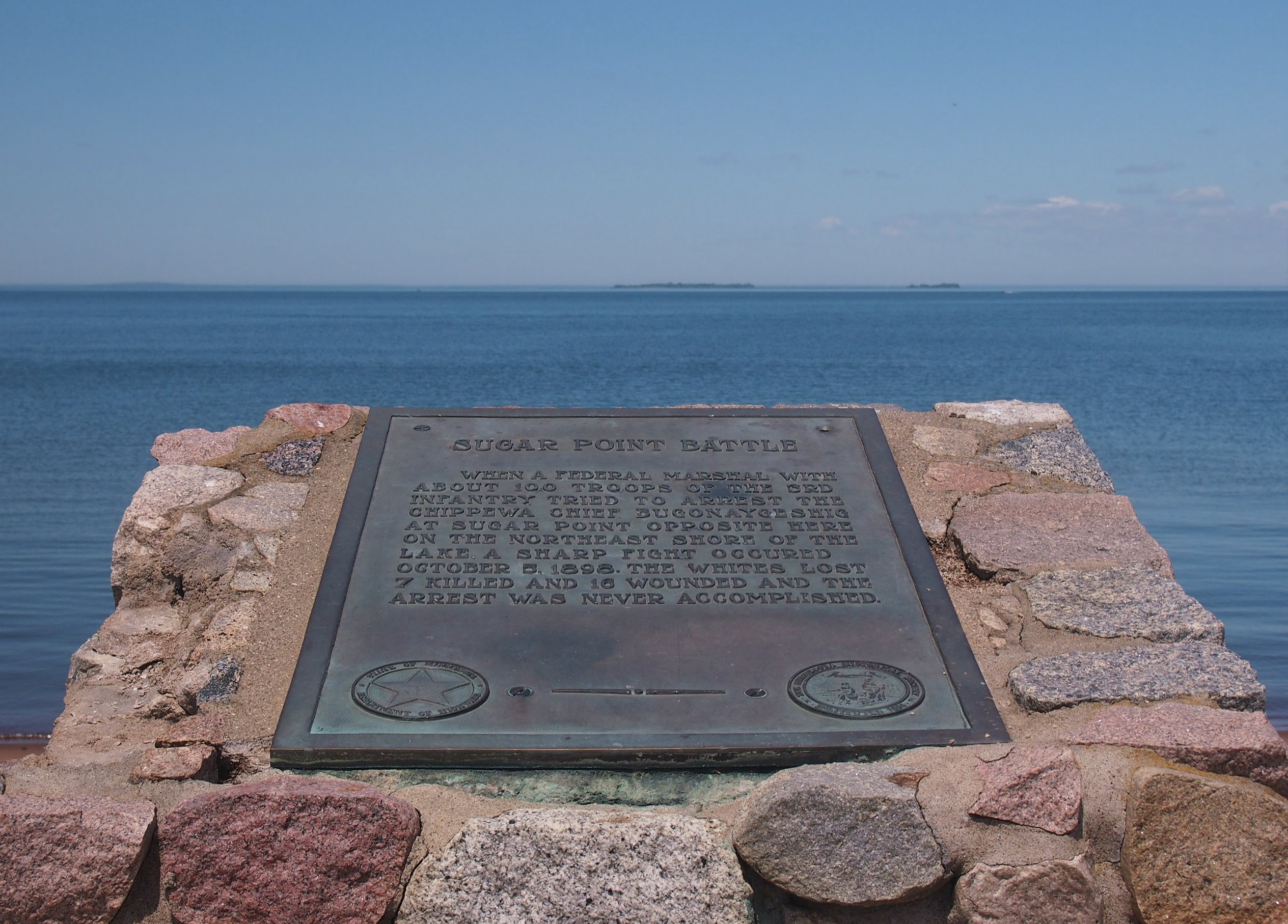
Battle Point (Leech Lake)
- What it is: This spot on Leech Lake is famous for the Battle of Sugar Point in 1898. This was the very last fight between Native Americans and the U.S. military.
- Why it's special: This battle led to big changes in how the government managed forests. It also has old burial sites and archaeological finds from both the Ojibwe people and even older groups.
- Location: About 6 miles west of County Highway 8 on Leech Lake, inside Leech Lake Indian Reservation.
- Image:

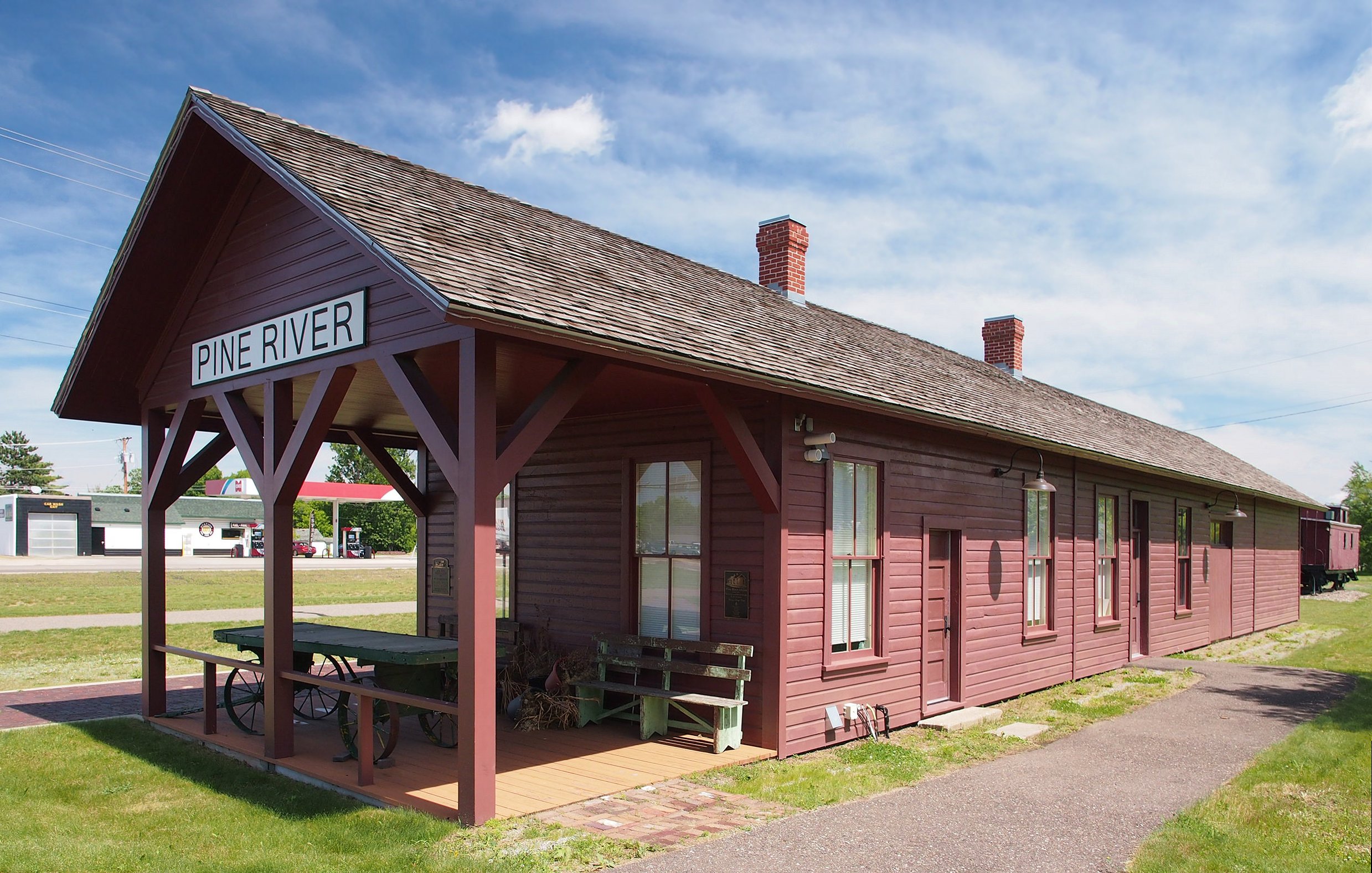
Pine River Train Station
- What it is: This is an old railway station built in 1895.
- Why it's special: It helped create the town of Pine River because it was on a new, important route for moving logs.
- Location: 102 Barclay Ave. W., Pine River.
- Image:

Chase Hotel
- What it is: A fancy hotel built in 1922.
- Why it's special: It's a great example of the first-class hotels built in Cass County when cars started becoming popular. People would drive here for vacations!
- Location: 329 Cleveland Ave., Walker.
- Image:


Chippewa Agency Historic District
- What it is: This area was a very important Indian agency from 1851 to 1869.
- Why it's special: It was a central hub for the region in the mid-1800s. It also includes sites of ancient mounds, an old village, the first logging camp on the Crow Wing River, and where the famous leader Hole in the Day was assassinated in 1868.
- Location: Near Pillager.
Conservation Building
- What it is: A building constructed between 1934 and 1936.
- Why it's special: It's a unique example of buildings funded by the New Deal programs during the Great Depression. It had a visitor center, a wildlife museum, and offices for many New Deal services.
- Location: 205 Minnesota Ave., Walker.
- Image:

Crow Wing State Park
- What it is: A state park with a long history.
- Why it's special: This site was used for a long time and was a key meeting point. It's linked to conflicts between the Dakota and Ojibwe tribes and the early town of Old Crow Wing. When the town was abandoned in the 1880s, it helped preserve the history of Native Americans, fur trading, and logging.
- Location: Off Minnesota Highway 371 near Pillager.
- Image:

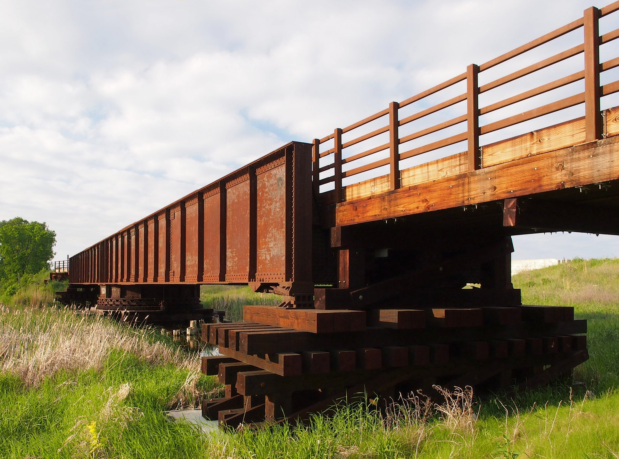
Great Northern Railway Company Bridge
- What it is: A railroad bridge built around 1915.
- Why it's special: It has a special swing section that could open to let lumber boats pass on the Steamboat River. It shows how logging and railroads worked together in northern Minnesota. Today, it's part of the Heartland State Trail.
- Location: Southwest of Cass Lake off Minnesota Highway 371.
- Image:

Gull Lake Mounds Site
- What it is: A group of ancient burial mounds.
- Why it's special: These mounds are rare survivors in an area that's now popular for resorts. There are 12 complete burial mounds here, some dating back to 800 BCE!
- Location: Gull Lake Recreation Area near Pillager.
- Image:

Hole-in-the-Day House Site
- What it is: The site of a farmhouse built in the early 1850s.
- Why it's special: This was the home of a very important Ojibwe leader named Hole in the Day (born around 1825). He believed in strategically adopting some new ways to help his tribe.
- Location: Near Pillager.
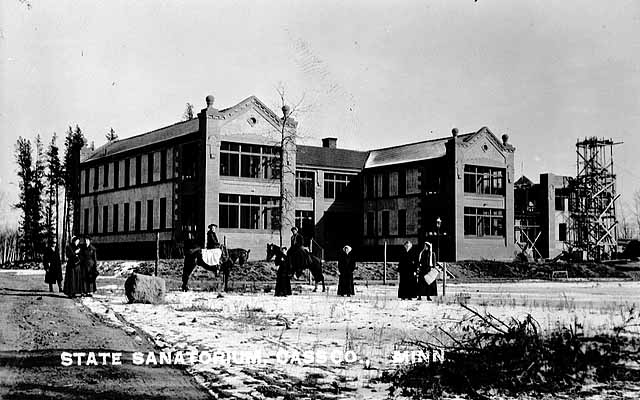
Minnesota State Sanatorium for Consumptives
- What it is: This was Minnesota's most important center for treating tuberculosis, a serious lung disease. It was also called Ah-Gwah-Ching.
- Why it's special: It operated from 1906 to 1962, helping many people. The original buildings were taken down in 2008.
- Location: 7232 Ah-Gwah-Ching Rd., NW., near Walker.
- Image:

Old Backus
- What it is: A very old place where people lived for a long time.
- Why it's special: It has signs of seasonal villages from the Woodland period, historical Ojibwe burial sites, a logging camp from 1885, and the original town of Backus (which was abandoned in 1902).
- Location: Near Backus.
Pine River to Woman Lake and Longville Stagecoach Road-Widow Lake Segment Historic District
- What it is: The only remaining part of an old road.
- Why it's special: From 1890 to 1930, this road was super important for opening up the area for logging, new settlers, and outdoor fun.
- Location: Near Hackensack.
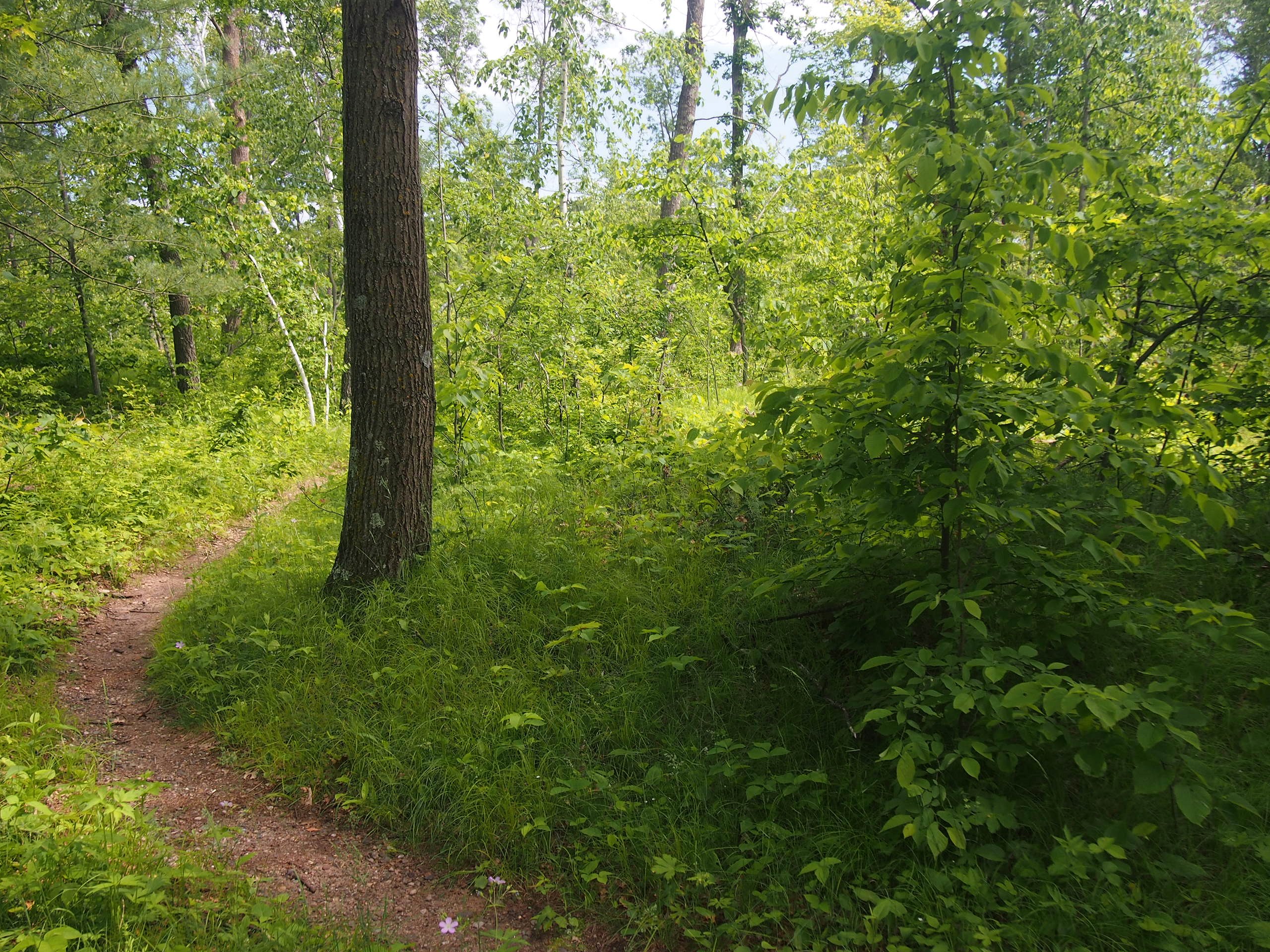
Rice Lake Hut Rings
- What it is: Four large dips in the ground.
- Why it's special: These are believed to be what's left of Native American earth lodges from around the time Europeans first arrived, or just before.
- Location: Near Pillager.
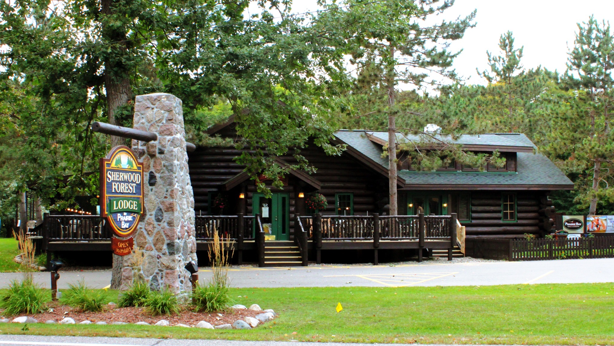
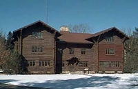
Sherwood Forest Lodge Complex
- What it is: A group of buildings that made up an early lake resort.
- Why it's special: It's a well-preserved example of the early resorts in north-central Minnesota. It has a main lodge and 20 cabins, all built around 1929. It's also known for its beautiful rustic architecture.
- Location: County Highway 77, Lake Shore.
- Image:

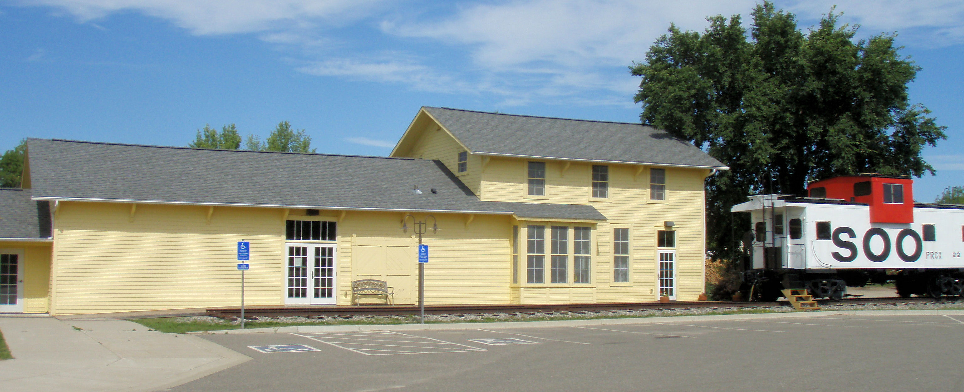
Soo Line Depot (Remer, Minnesota)
- What it is: A railway station built around 1910.
- Why it's special: It's a great example of the standard "second-class" train stations used by the Soo Line. It also played a big part in the founding and growth of the town of Remer.
- Location: Off Main St., Remer.
- Image:

South Pike Bay Site
- What it is: Beach areas on Cass Lake.
- Why it's special: These beaches have many archaeological finds from different times when people camped there. This includes the Late Paleoindian and Early Archaic periods, and also throughout the Woodland period.
- Location: South Pike Bay Campground, Chippewa National Forest, near Cass Lake.
Supervisor's Office Headquarters
- What it is: The main office for the Chippewa National Forest, built in 1935.
- Why it's special: It's important because of its unique log construction style, which doesn't use chinking (the material between logs). This style is traditional Scandinavian. It's also linked to the federal work projects of the New Deal.
- Location: 200 Ash Ave. NW, Cass Lake.
- Image:

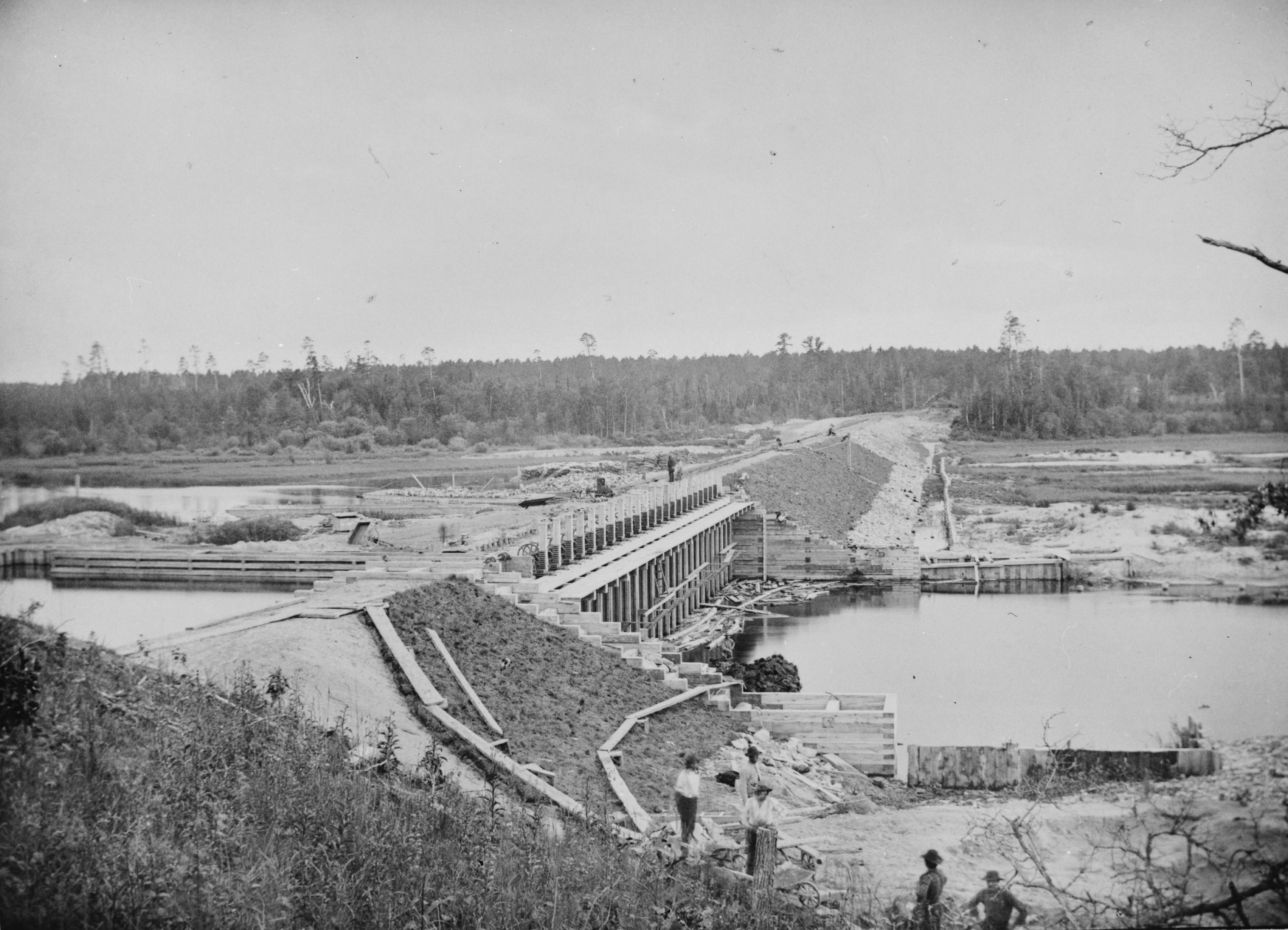
Winnibigoshish Lake Dam
- What it is: A dam built between 1899 and 1900.
- Why it's special: This was the first and largest of several reservoirs created by the government to control the flow of the Upper Mississippi River.
- Location: County Highway 9 at the Mississippi River near Bena.
- Image:

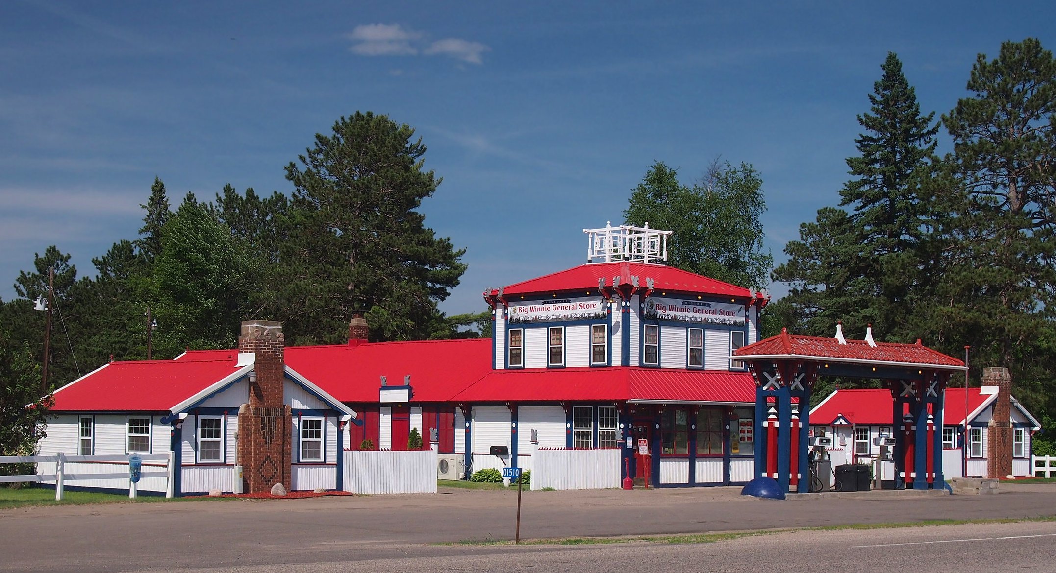
Winnibigoshish Resort
- What it is: A gas station and motel complex built in 1933.
- Why it's special: It's a rare and well-preserved example of a business built to attract early travelers on the highways. Today, it's known as the Big Winnie General Store and RV Park.
- Location: 1510 U.S. Route 2, Bena.
- Image:

Former Listings
Some places were once on the National Register but are no longer listed. This can happen if they are destroyed or lose their historical importance.
- Julius Neils House: This house, built in 1900 for a lumber businessman, was in Cass Lake. It burned down in 2005 and was removed from the list in 2006.
- Sixth Street Commercial Building: This brick store, built in 1910, was in Walker. It was taken down in 1985 and removed from the list in 1987.

All content from Kiddle encyclopedia articles (including the article images and facts) can be freely used under Attribution-ShareAlike license, unless stated otherwise. Cite this article:
National Register of Historic Places listings in Cass County, Minnesota Facts for Kids. Kiddle Encyclopedia.