New Baltimore, Virginia facts for kids
Quick facts for kids
New Baltimore, Virginia
|
|
|---|---|

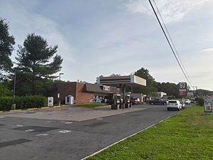
Commercial area along US 29 in New Baltimore
|
|
| Country | United States |
| State | Virginia |
| County | Fauquier |
| Area | |
| • Total | 12.3 sq mi (31.8 km2) |
| • Land | 12.0 sq mi (31.1 km2) |
| • Water | 0.3 sq mi (0.7 km2) |
| Elevation | 495 ft (151 m) |
| Population
(2010)
|
|
| • Total | 8,119 |
| • Density | 676/sq mi (261.1/km2) |
| Time zone | UTC−5 (Eastern (EST)) |
| • Summer (DST) | UTC−4 (EDT) |
| ZIP code |
20187
|
| FIPS code | 51-55528 |
| GNIS feature ID | 1499792 |
New Baltimore is a small community in Fauquier County, Virginia, in the United States. It is known as a census-designated place (CDP). This means it's an area identified by the government for gathering population data. In 2010, about 8,119 people lived there.
New Baltimore has been around since the early 1800s. However, it has grown a lot since the 1980s. Many people who live here travel to Washington, D.C. for work. This is because New Baltimore is easy to reach from the capital city. Other nearby towns include Warrenton, Gainesville, and Manassas. In 2006, New Baltimore was chosen as a "service district." This helps the area grow by providing better access to things like water and sewer systems.
Contents
History of New Baltimore
New Baltimore was an important place during the American Civil War. It was located on a main road, called a turnpike, that connected Warrenton and Alexandria. It was also close to Warrenton, which was the county seat (the main town of the county). Because of its location, the village changed hands many times during the war.
Civil War Battles and Skirmishes
Several small fights and larger battles happened near New Baltimore. These included parts of the Battle of Brandy Station, the First Battle of Bull Run, the Second Battle of Bull Run, and the Battle of Cedar Mountain. Warrenton, just four miles south, had a railroad line. It was taken over by different armies 67 times during the war!
General McClellan's Farewell
After the Battle of Antietam in 1862, President Abraham Lincoln was unhappy with General George B. McClellan. Lincoln felt McClellan had not done enough to defeat Lee's army. So, on November 5, 1862, Lincoln ordered McClellan to be removed from his command.
McClellan's headquarters were at the home of Julia F. Claggett in New Baltimore. This house was along the main roads. On November 9, 1862, McClellan visited his troops to say goodbye. A ceremony took place on the Claggett farm. General Ambrose Burnside officially took over command of the army there.
Soldiers on the Claggett Farm
In the fall of 1862, about 3,000 Union soldiers camped on the Claggett's farm. The soldiers used the farm's food and supplies. They took horses, pigs, and cows. They also cut down many trees and tore down barns and fences for firewood. The Claggett family later filed a claim for damages.
Confederate Raid in 1863
Later in the war, another group of Union soldiers camped in New Baltimore. This was from July to September 1863. On September 4, a Confederate officer named Captain Frank Stringfellow led 20 soldiers on a raid. They tried to capture the Union general, Joseph Jackson Bartlett. Bartlett's headquarters were also at the Claggett home. The Confederates fired shots but were not able to capture the general.
Old New Baltimore Village
The original New Baltimore village was a bit northwest of where the main highway is now. In the early 1800s, it was a small town. It relied on the Alexandria Turnpike, which is now called Lee Highway. This old community had an Episcopal church and a Baptist church. In the 1850s, it also had a post office and a school.
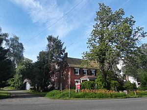
Over time, the main Lee Highway was moved to the south of the old village. This made the original town a quiet area with older houses. The very first central building, James Hampton's Tavern (built in 1823), is still standing. It is now a private home. The area where these old buildings are located is called the New Baltimore Historic District. It was added to a special list of historic places in 2004.
Geography of New Baltimore
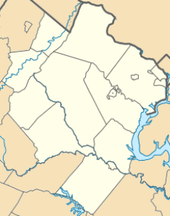
New Baltimore is located about 2 miles (3 km) southwest of the border between Prince William County and Fauquier County. It is 6 miles (10 km) northeast of Warrenton, which is the main town of Fauquier County. New Baltimore is also 6 miles (10 km) west of Gainesville.
Roads and Transportation
The main road in New Baltimore is still Lee Highway. This road is part of U.S. Route 15 and U.S. Route 29. Another important road is Beverley's Mill Road / Broad Run Church Road. This road is used by many people who travel to work.
Area and Waterways
The New Baltimore CDP (census-designated place) is quite large. It now includes areas south and east of the original settlement. The total area of New Baltimore is about 31.8 square kilometers (12.3 square miles). Most of this area, 31.1 square kilometers (12.0 square miles), is land. About 0.7 square kilometers (0.3 square miles), or 2.07%, is water.
The community is part of the Cedar Run and Broad Run watersheds. A watershed is an area of land where all the water drains into a common point. These two streams join together to form the Occoquan River. The Occoquan River then flows into the Potomac River.
See also
 In Spanish: New Baltimore (Virginia) para niños
 | Claudette Colvin |
 | Myrlie Evers-Williams |
 | Alberta Odell Jones |


