New Cuyama, California facts for kids
Quick facts for kids
New Cuyama
|
|
|---|---|

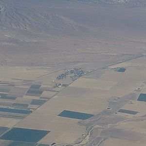
New Cuyama in an aerial photo looking west, taken in 2015
|
|
| Country | |
| State | |
| County | Santa Barbara |
| Settled | 1822 |
| Area | |
| • Total | 0.706 sq mi (1.827 km2) |
| • Land | 0.706 sq mi (1.827 km2) |
| • Water | 0 sq mi (0 km2) 0% |
| Elevation | 2,150 ft (660 m) |
| Population
(2020)
|
|
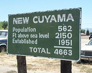
| • Total | 542 |
| • Density | 767.7/sq mi (296.7/km2) |
| Time zone | UTC-8 (PST) |
| • Summer (DST) | UTC-7 (PDT) |
| ZIP code |
93254
|
| Area code(s) | 661 |
New Cuyama is a small community located in the Cuyama Valley in Santa Barbara County, California. Its name comes from the Chumash word Kuyam, which means "clam". This name was likely chosen because millions of fossilized clams have been found in the area.
New Cuyama is an important hub for the people living nearby, providing many services. It's also located close to where four different counties meet: Santa Barbara, San Luis Obispo, Ventura, and Kern. The town is connected by Highway 166 and has its own public airport, the New Cuyama Airport. In 2020, about 542 people lived here.
Contents
History of New Cuyama
The land where New Cuyama is today was once home to the Yokuts people. Chumash Indians from the coast also visited this area often. You can still see traces of an old Indian trail that crossed the hills into what is now Ventura County. The name "Cuyama" comes from an old Indian village and means "clam" or "freshwater mollusk."
Early Settlements and Land Grants
The recorded history of this area goes back to 1822. This was when Mexico became independent from Spain and took control of Alta California, which was a Spanish colony. In the 1840s, two large pieces of land, called Rancho Cuyama (Lataillade) and Rancho Cuyama (Rojo), were given out by Mexican governors. These land grants were in the lower Cuyama Valley, near where New Cuyama is now. This changed the land from public to private ownership.
Oil Discovery and Town Development
A big change happened in 1949 when oil was discovered at the South Cuyama Oil Field. Because of this, the Atlantic Richfield Company (ARCO) decided to build the town of New Cuyama in 1952. They built homes and businesses for their workers. They also built the New Cuyama Airport, which was reopened in 2015. This airport is special because it's the only paved public airport within 50 miles of Los Angeles.
Many of the buildings and services that ARCO built are still used by the town's residents today. The original gas processing plant built by ARCO is still working, even though ARCO no longer owns it.
New Cuyama's Changing Economy
When New Cuyama was first built, it was very important to eastern Santa Barbara County because of all the oil being produced. The Richfield Oil Company helped fund schools and provided most of the town's services, except for electricity.
Now that oil and gas production have slowed down, the main industry in New Cuyama is once again agriculture. In 2024, Santa Barbara County approved a new project to build more homes and businesses in the town.
Geography of New Cuyama
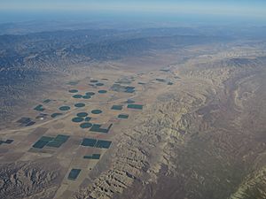
New Cuyama is located in the Cuyama Valley. It covers an area of about 0.7 square miles (1.8 square kilometers), and all of it is land.
Climate in New Cuyama
New Cuyama has a steppe climate. This means it has hot and dry summers. The warmest month usually has an average daily temperature of about 75 degrees Fahrenheit (24 degrees Celsius).
Population and People
In 2020, the population of New Cuyama was 542 people. Most of the people in New Cuyama live in family homes.
Community Life
The community has a mix of different age groups. About 30% of the people are under 18 years old. The average age in New Cuyama is around 35 years. Many homes are owned by the people who live in them, while others are rented.
See also
 In Spanish: New Cuyama para niños


