Niangala, New South Wales facts for kids
Quick facts for kids NiangalaNew South Wales |
|
|---|---|

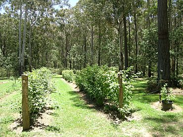
Koolkuna Berry Farm
|
|
| Population | 142 (2011 census) |
| Postcode(s) | 2354 |
| Elevation | 1,300 m (4,265 ft) |
| Time zone | AEST (UTC+10) |
| • Summer (DST) | AEDT (UTC+11) |
| Location | |
| LGA(s) |
|
| Region | New England Hunter |
| County | Parry |
| Parish | Walcha |
| State electorate(s) | Tamworth |
| Federal Division(s) | |
Niangala is a small village in New South Wales, Australia. It sits on the edge of the Northern Tablelands area. The village is part of the Moonbi Range, which is a section of the huge Great Dividing Range. It's about 1,300 meters (4,265 feet) above sea level.
Niangala is quite isolated, surrounded by tall pine tree farms. Getting there means driving on some dirt roads. These roads can be tricky when it's wet or snowy. Winters in Niangala are very cold, and it often snows several times each season.
The name Niangala means 'eclipse'. Before that, it was known as Bungadore, which means 'blackrocks'. The village is located at the start of Bungendore Creek. In 2011, Niangala and the areas around it had a population of 142 people.
Contents
Niangala's Past: A Gold Rush Story
How Niangala Began
In 1836, a man named William Telfer marked a path for sheep. This path went from Port Stephens through places like Barrington and Nowendoc. It was called the 'Peel Line'. The Australian Agricultural Company used this route for their sheep. It was a tough path but faster than the old one. Today, roads like Thunderbolts Way and Topdale Road follow a similar route.
Gold Mining Days
Niangala started as a place where people searched for gold. By late 1890, it was a busy settlement. It had five boarding houses, two butcher shops, a blacksmith, a bakery, and two stores. The Niangala post office opened on December 1, 1890, but it closed in 1977. Coaches regularly traveled from Walcha to Niangala.
The first Public School opened in 1891 for 28 children of the gold miners. It had only one teacher until 1980. In 1991, the school had its highest number of students, with 51. In 1891, about 300 people lived in Niangala. On September 14, 1893, Niangala was officially named a village.
Modern Connections and Industries
In 1901, people in Niangala could finally use telephones. But it wasn't until 1966 that 33 homes got electricity. For a long time, not many people bought land here because it was a gold mining area.
Besides gold, people also mined manganese from the 1930s to the 1950s. Today, the main jobs are raising sheep and cattle. But there are also other businesses, like growing berries and large pine tree farms. These trees supply wood to a local timber mill. Trout fishing is also a popular activity for tourists in the Niangala area.
Natural Events Affecting Niangala
Niangala has experienced some strong weather.
- On October 13, 2002, a powerful F2 tornado hit the area. It caused serious damage to buildings, trees, and farm animals.
- On November 28 and 29, 2008, Niangala had very heavy rain. This caused severe flooding, and the area was declared a natural disaster zone.
Niangala Today
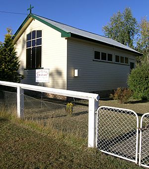
Today, Niangala is a quiet reminder of the gold rush era. You can still see an old cemetery, a broken gold crusher, and some old buildings. There is a Church of England church built in 1964, a community hall, and tennis courts. The village of Niangala now has a population of about 30 people.
A famous person from the Niangala area is Casey Stoner. He was a World Champion in MotoGP in 2007. He was also named Young Australian of the Year in 2008.
 | Janet Taylor Pickett |
 | Synthia Saint James |
 | Howardena Pindell |
 | Faith Ringgold |


