Nigel Peak facts for kids
Quick facts for kids Nigel Peak |
|
|---|---|

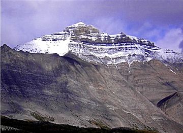
Nigel Peak (west aspect)
|
|
| Highest point | |
| Elevation | 3,211 m (10,535 ft) |
| Prominence | 611 m (2,005 ft) |
| Parent peak | Sunwapta Peak (3315 m) |
| Listing | Mountains of Alberta |
| Geography | |
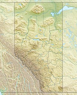
| Location | Alberta, Canada |
| Parent range | Canadian Rockies |
| Topo map | NTS 83C/03 |
| Type of rock | Sedimentary |
| Climbing | |
| First ascent | 1919 by Interprovincial Boundary Commission |
| Easiest route | Scramble |
Nigel Peak is a tall mountain in the Canadian Rockies. It stands 3,211 meters (10,535 feet) high. This mountain is special because it sits right on the border between Banff National Park and Jasper National Park. Both parks are in Alberta, Canada.
Nigel Peak actually has two main tops, called summits. The one to the north is the very highest point. You can easily spot Nigel Peak from the Icefields Parkway, a famous scenic road. It's also visible from the huge Athabasca Glacier. The mountain is just north of Sunwapta Pass. The closest higher mountain is Mount Athabasca, which is about 6.4 kilometers (4 miles) away.
Mountain History
Nigel Peak was named after a man named Nigel Vavasour. He was a "packer," which means he helped carry supplies for explorers. In 1897, he joined famous explorers J. Norman Collie and Hugh Stutfield in the Columbia Icefield area.
The mountaineers named the mountain in 1898 while they were on a sheep hunt with Nigel. The name "Nigel Peak" became official in 1935. The first time anyone climbed to the top of Nigel Peak was in 1919. This climb was done by a group called the Interprovincial Boundary Commission. They were likely mapping the border between provinces.
Mountain Geology
Nigel Peak, like many other mountains in Banff National Park, is made of sedimentary rock. This type of rock forms from layers of sand, mud, and tiny sea creatures that settled at the bottom of ancient seas. These layers were laid down over millions of years, from the Precambrian to the Jurassic periods.
Later, during a time called the Laramide orogeny, huge forces pushed these rock layers. They were pushed east and even slid over younger rocks. This process created the towering mountains we see today in the Rockies.
Mountain Climate
Nigel Peak is in a subarctic climate zone. This means it has very cold winters with lots of snow. The summers are usually mild. Temperatures can often drop below -20 °C (-4 °F). With the wind, it can feel even colder, sometimes below -30 °C (-22 °F).
The water from melting snow and rain on Nigel Peak flows in two directions. Some water drains south into the North Saskatchewan River. Other water flows north into the Sunwapta River. The Sunwapta River then joins the larger Athabasca River.
 | Jackie Robinson |
 | Jack Johnson |
 | Althea Gibson |
 | Arthur Ashe |
 | Muhammad Ali |


