Nishnabotna River facts for kids

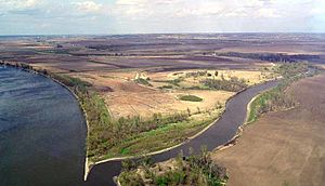
The Nishnabotna River is a river in the United States that flows into the much larger Missouri River. It runs through parts of southwestern Iowa, northwestern Missouri, and southeastern Nebraska.
For most of its journey, the Nishnabotna River actually flows as two separate, parallel streams in Iowa: the East Nishnabotna River and the West Nishnabotna River. Each of these branches is about 120 miles (190 km) (193 km) long. After they join together, the main Nishnabotna River flows for another 16 miles (26 km) (26 km).
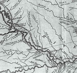
Over the years, some parts of these rivers have been made straighter by people. This process is called channelization. The name "Nishnabotna" comes from an old Otoe word that means "canoe-making river."
Contents
Where the River Flows
East Nishnabotna River's Path
The East Nishnabotna River starts in southwestern Carroll County, Iowa. It generally flows towards the south and southwest.
It passes through several counties, including Audubon, Cass, and Fremont Counties. Along its way, it flows past towns like Atlantic, Red Oak, and Shenandoah.
West Nishnabotna River's Path
The West Nishnabotna River also begins in southwestern Carroll County, Iowa. Like its eastern twin, it flows mostly south and southwest.
This branch travels through counties such as Shelby, Pottawattamie, and Fremont Counties. Towns along its route include Harlan, Avoca, and Oakland.
The West Nishnabotna River also collects water from smaller streams. The West Fork West Nishnabotna River joins it near Harlan. The East Branch West Nishnabotna River flows into it near Avoca.
The Lower River's Journey
The East and West Nishnabotna rivers finally meet in southwestern Fremont County, Iowa. From there, the combined Nishnabotna River flows for a short distance. It passes by Hamburg before entering northwestern Atchison County, Missouri.
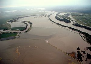
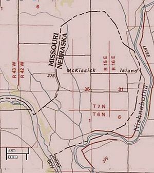
The river then flows into the Missouri River about 2 miles (3 km) west of Watson. Interestingly, in its last mile, the river briefly flows from Missouri into Nebraska and then back into Missouri before joining the Missouri River. This unusual path is because a big flood in 1867 changed the course of the Missouri River.
The Nishnabotna River also forms part of the southeastern border of a 5,000-acre area called McKissick Island. Both Nebraska and Missouri once claimed this land. In 1904, the Supreme Court decided that Nebraska would get the land, even though it's east of Nebraska's usual eastern border, which is the Missouri River itself.
Fun Things to Do
There are several parks and wildlife areas along the Nishnabotna River where people can enjoy nature.
- Botna Bend Park in Hancock offers canoe rentals.
- Willow Slough Wildlife Management Area is southwest of Henderson.
- Riverton Wildlife Management Area is just north of Riverton.
- Nishina Bend Park is south of Corley.
If you like paddling, the best places for canoeing are between Hancock and Carson on the West Nishnabotna. On the East Nishnabotna, the best spots are between Lewis and Griswold.
The Wabash Trace hiking trail crosses both branches of the river. If you cross the west branch on the trail, you might even see the remains of a freight train that derailed and fell into the river back in the 1960s!
Other Names for the River
Over time, the Nishnabotna River has been known by several different names. Here are some of them:
- Good Canoe River
- Nishabotna River
- Nishabotny River
- Nishabotony River
- Nishebotona River
- Nishnabotony River
- Nishnebotna River
- Nishnebotne River
- Nishnebotona River
- Nishnebottona River
- Willo River
- Willow Slough
- Ichinipokine River
- Neeshba Creek
- Neeshnahbotona Creek
- Nichinanbatonais River
- Nichinibatone River
- Nishnahbatona River
- Nishnay Baton River
- Washbatonan River
 | Selma Burke |
 | Pauline Powell Burns |
 | Frederick J. Brown |
 | Robert Blackburn |


