Numbered highways in Lake County, Ohio facts for kids
  
Lake County highway markers
|
|
Quick facts for kids System information |
|
|---|---|
| Formed: | 1912, renumbered in 1923, 1927, 1962 |
| Highway names | |
| Interstates: | Interstate nn (I-nn) |
| US Routes: | U.S. Route nn (US nn) |
| System links | |
| Ohio highways Interstates • U.S. Routes • State Routes |
|
Have you ever wondered how you get from one place to another in Ohio? Our state has a huge network of roads, from small local streets to big highways that cross the entire country! These roads are super important for travel, trade, and just getting around. This article will tell you all about the different kinds of highways in Ohio and how they help connect our communities.
Contents
What Are Highways?
Highways are major roads that connect cities and towns. They are designed for faster travel than local streets. Think of them as the main arteries of a state, helping people and goods move efficiently. Ohio's highway system started way back in 1912. Over the years, the roads have been updated and renumbered to make travel even better.
Different Kinds of Roads
In Ohio, you'll see different types of highway signs, each telling you about the kind of road you're on.
Interstate Highways
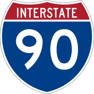
These are the biggest and fastest roads. They are part of a national network that connects states across the USA. You can spot them by their red, white, and blue shield signs, like
. Interstate highways often have numbers like I-70 or I-90. They are built for long-distance travel and usually have multiple lanes.
U.S. Routes
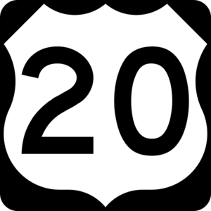
U.S. Routes are also important national roads, but they are older than Interstates. They connect cities and towns, often passing through the centers of communities. Their signs are black and white shields, like
. A famous one in Ohio is U.S. Route 20, which runs all the way across the northern part of the state.
State Routes
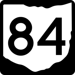
State Routes are roads managed by the state of Ohio. They connect different parts of Ohio and often link up with U.S. Routes and Interstates. Their signs are white shields with a black outline and the state name, like
. These roads help you get to smaller towns and local attractions within Ohio.
How Roads Get Their Names and Numbers
Roads are given numbers to help people find their way. Lower numbers often mean the road was one of the first to be established. Sometimes, roads are "decommissioned," which means they are no longer called by that number. This happens when a new, better road is built, or the old road is renamed. For example, some old Ohio roads were replaced by U.S. Route 20.
Famous Ohio Highways
Ohio has many important highways that have been around for a long time or are used by many people every day.
Interstate 90
Interstate 90 (I-90) is a major highway that crosses northern Ohio. It connects Ohio to Indiana in the west and Pennsylvania in the east. This road is part of one of the longest Interstate highways in the United States! It was established in 1961 and is still a very busy road today.
U.S. Route 20
U.S. Route 20 is another long road that runs across Ohio. It goes from near Edon in the west to near Conneaut in the east. This route was established in 1926. It's a great example of an older U.S. Route that still serves many communities.
Ohio State Route 84
State Route 84 is a state highway that starts in Euclid and goes all the way to the Pennsylvania border. It was established in 1923. This road helps connect cities like Euclid to smaller towns in Ashtabula County.
Ohio's highway system is always changing and growing to meet the needs of travelers. From the big Interstates to the smaller State Routes, these roads are essential for life in the Buckeye State!
| Number | Length (mi) | Length (km) | Southern or western terminus | Northern or eastern terminus | Formed | Removed | Notes | |
|---|---|---|---|---|---|---|---|---|
| MMR 1 | 263.1 | 423.4 | ICH 309 at the Indiana state line near Edgerton | ICH 2 at the Pennsylvania state Line near Conneaut | 1914 | 1917 | ||
| 353.15 | 568.34 | I-75 at the Kentucky State Line in Cincinnati | I-90 at the Pennsylvania State Line in Conneaut | 1961 | 1965 | |||
| 71.2 | 114.6 | Indiana state line near Edgerton | PA 9 in Conneaut | 1912 | 1926 | Replaced by US 20 | ||
| 227.13 | 365.53 | SR 37 in Hicksville Township | US 20 in Painesville Township | 1939 | current | |||
| MMR 6 | 263.1 | 423.4 | ICH 309 at the Indiana state line near Edgerton | ICH 2 at the Pennsylvania state Line near Conneaut | 1920 | 1921 | ||
| 29.46 | 47.41 | SR 85 in Cleveland | US 20 in Painesville | 1929 | 1931 | Replaced by SR 283 | ||
| 248.002 | 399.121 | US 6 at Edgerton | US 6 at Pierpont | 1931 | current | |||
| 260.4 | 419.1 | US 20 near Edon | US 20 near Conneaut | 1926 | current | |||
| ICH 34 | 17.5 | 28.2 | Cleveland | ICH 324 / ICH 327 in Chardon | 1912 | 1922 | Replaced by SR 85 | |
| 81.23 | 130.73 | SR 43 in Sandy Township | Headlands Beach State Park in Painesville Township | 1923 | current | |||
| 63.34 | 101.94 | US 6 / US 20 in Euclid | PA 226 in Monroe Township | 1923 | current | |||
| 2.66 | 4.28 | US 6 / SR 7 in Andover | PA 285 in Andover Township | 1923 | 1938 | Replaced by US 6 | ||
| 21.98 | 35.37 | US 20 in Painesville | SR 534 in Windsor Township | 1923 | current | |||
| ICH 90 | 16.1 | 25.9 | ICH 35 near Chagrin Falls | ICH 2 in Willoughby | 1912 | 1922 | Replaced by SR 174 | |
| 244.75 | 393.89 | I-80 at Indiana State Line | Pennsylvania State Line | 1961 | current | |||
| 44.12 | 71.00 | US 224 in Springfield Township | SR 283 on Timberlake–Eastlake municipal line | 1912 | current | |||
| ICH 153 | 46.4 | 74.7 | ICH 2 / ICH 324 in Painesville | ICH 80 / ICH 88 / ICH 322 / ICH 325 / ICH329 / ICH 330 / ICH 516 in Warren | 1912 | 1922 | Replaced by SR 86 | |
| 11.40 | 18.35 | US 6 in Hambden Township | SR 534 in Trumbull Township | 1923 | 1940 | Replaced by SR 528 | ||
| 9.56 | 15.39 | Old Mill Road in Gates Mills | US 20 / SR 640 in Willoughby | 1923 | current | |||
| 15.70 | 25.27 | SR 43 on Bedford Heights–Solon city line | SR 283 in Euclid | 1923 | 1929 | Replaced by SR 6 | ||
| 46.06 | 74.13 | I-71 in Medina | I-90 in Willoughby Hills | 1961 | current | |||
| 29.46 | 47.41 | US 6 in Cleveland | US 20 in Painesville | 1932 | current | |||
| 3.35 | 5.39 | SR 283 in Willowick | US 20 / SR 174 in Willoughby | 1931 | 1940 | Replaced by SR 640 | ||
| 27.41 | 44.11 | SR 43 in Aurora | SR 283 in Mentor | 1932 | current | |||
| 22.99 | 37.00 | SR 528 in Madison Township | SR 193 in Dorset Township | 1933 | current | |||
| ICH 324 | 40.4 | 65.0 | ICH 12 / ICH 74 / ICH 322 / ICH 323 / ICH 326 in Ravenna | ICH 2 / ICH 153 in Painesville | 1912 | 1922 | Replaced by SR 44 | |
| ICH 327 | 20.4 | 32.8 | ICH 34 / ICH 324 in Chardon | Madison | 1912 | 1922 | Replaced by SR 166 | |
| ICH 466 | 16.5 | 26.6 | ICH 91 / ICH 460 in Solon | ICH 2 in Willoughby | 1914 | 1922 | Replaced by SR 91 | |
| 30.36 | 48.86 | US 422 / SR 88 / SR 528 in Parkman Township | US 20 in North Madison | 1940 | current | |||
| 4.85 | 7.81 | SR 283 in Painesville | US 20 in Painesville Township | 1937 | current | |||
| — | — | US 20 in Mentor Township | SR 283 in Mentor Township | 1937 | 1942 | |||
| 19.47 | 31.33 | SR 528 in Middlefield Township | CR 360 / CR 412 in Concord Township | 1938 | current | |||
| 6.87 | 11.06 | SR 306 in Kirtland | SR 283 in Mentor-on-the-Lake | 1937 | current | |||
| 0.58 | 0.93 | US 20 in Wickliffe | Lakeland Boulevard in Wickliffe | 1946 | current | |||
| 3.35 | 5.39 | SR 283 in Willowick | US 20 / SR 174 in Willoughby | 1946 | current | |||
|
||||||||


