
Oaks Creek facts for kids
Quick facts for kids Oaks Creek |
|
|---|---|

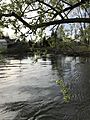
Oaks Creek looking north in Oaksville
|
|


Location of the mouth of Oaks Creek
|
|
| Country | United States |
| State | New York |
| Region | Central New York Region |
| County | Otsego |
| Towns | Otsego, Hartwick, Exeter |
| Physical characteristics | |
| Main source | Canadarago Lake Schuyler Lake 1,266 ft (386 m) 42°47′31″N 75°00′57″W / 42.7920174°N 75.0157126°W |
| River mouth | Susquehanna River Index 1,161 ft (354 m) 42°39′43″N 74°57′02″W / 42.6620197°N 74.9504339°W |
| Length | 9.32 mi (15.00 km) |
| Basin features | |
| Basin size | 102 sq mi (260 km2) |
| Tributaries |
|


Oaks Creek is a river in Otsego County, New York. It flows out of Canadarago Lake in the north-central part of the county. The creek starts near the small community of Schuyler Lake.
It flows southeast for about 9.32 miles (15.00 km). Along its journey, it drops about 105 feet (32 m) in height. Oaks Creek eventually joins the Susquehanna River near Index, south of Cooperstown. For part of its path, from its start to Oaksville, the creek flows alongside Panther Mountain. A major stream that flows into Oaks Creek is Fly Creek.
In 1779, the Iroquois people called this creek "O-at'-tis."
Contents
Journey of Oaks Creek
Oaks Creek begins where Canadarago Lake empties out. It starts by flowing south for a short distance. Then it goes under County Route 22. After that, it reaches the Panther Mountain Dam, which used to be a trolley bridge.
The creek continues to wind its way south. It picks up water from Lidell Creek and Phinney Creek on its right side. It also gets water from smaller streams flowing off Panther Mountain. A little past where Phinney Creek joins, it flows by the Parslow Road Conservation Area.
Next, Oaks Creek reaches the community of Cattown. Here, the creek splits around a small island. Hoke Road crosses over this island. In Cattown, the creek starts flowing more to the southeast. It heads towards Oaksville. It passes under State Route 28 and State Route 80. It also goes under where the old trolley bridge used to be.
After the former trolley bridge, it flows under another road. Then it meets Fly Creek. After Fly Creek joins, Oaks Creek travels a short distance to Toddsville. In Toddsville, it turns southwest. It crosses under County Route 59 and then Lower Toddsville Road.
After Lower Toddsville Road, it keeps going southwest. It passes the Greenough Road Conservation Area. Soon after, it curves to the east. After this curve, it quickly reaches an old dam and trolley bridge. Then it crosses under State Route 28 again in Index. Shortly after Index, it curves southeast for a short bit. Finally, it reaches its end where it flows into the Susquehanna River.
History of Oaks Creek
The name "Oaks Creek" comes from a farm called "The Oaks." This farm belonged to Major John Tunnicliff. It was named for the many oak trees growing there. The very first fruit orchard in the county was planted on this farm.
In 1786, a man named Samuel Tubbs bought a large piece of land. He built a grist mill (for grinding grain) and a saw mill (for cutting wood) in the area now known as Toddsville. The mill dam was built where the stream dropped into a valley. This made it easier and cheaper to build the dam.
After Tubbs passed away in 1805, the Todd family bought his property. The Todds were skilled mill builders. They added the Otsego Paper Works to the area. In 1809, Lemuel and Jehiel Todd, along with others, built the Union Cotton Mill. By 1810, bridges were built near the mills to make it easier to cross the creek.
Other mills were also built along Oaks Creek. In 1798, David Marvin finished a mill south of Oaksville. This mill was later sold and became a fulling mill (for making cloth thicker) and a dye-house.
In 1797, George Johnson built a saw and grist mill in Cattown. This area was on an early main road from Cooperstown. Later, a new main road was built to Oaksville. By 1824, Johnson also had a clothing factory.
Russell Williams built a cotton mill in Oaksville in 1830. Many mills used the creek's power for different tasks. They made cloth, processed wool, and even made paper.
After the War of 1812, some local businesses struggled. For example, a wire factory closed because it couldn't compete with cheaper goods from Britain. Paper production also stopped by 1838. Later, the mills changed to make other things, like large barrels.
After the Civil War, smaller local mills found it hard to compete with larger factories. These big factories had cheaper workers and more money to invest. Because of this, most mills along Oaks Creek closed down by the early 1900s.
Interestingly, David Shipman, who inspired characters in James Fenimore Cooper’s famous novels like "Leatherstocking," lived in a log cabin on the east bank of Oaks Creek. His cabin was between Toddsville and where Fly Creek joins Oaks Creek.
Creek Studies
Scientists have studied Oaks Creek to understand how it flows. In 2009, a survey showed that the streambed (the bottom of the creek) gets slightly higher between the dam and where Lidell and Phinney Creeks join. This causes water to back up, which can limit how much water flows out of Canadarago Lake.
In 2011, another study looked at whether digging out the creek bed (called dredging) downstream from the dam would help. They found that dredging wouldn't really help the creek flow better. It would also be very expensive and could harm the creek's environment. So, they decided not to dredge the creek.
Water Flow and Quality
How Much Water Flows?
The United States Geological Survey (USGS) used to measure the water flow in Oaks Creek. They had a special station in Index that operated from 1929 to 1995.
- On average, the creek flowed at 147 cubic feet per second (4.2 m3/s).
- The most water ever measured was 2,280 cubic feet per second (65 m3/s).
- The least water measured was 1.4 cubic feet per second (0.040 m3/s).
The USGS also took measurements near Schuyler Lake between 1963 and 1974. The highest flow there was 864 cubic feet per second (24.5 m3/s) on September 13, 1974. The lowest was 1.68 cubic feet per second (0.048 m3/s) on September 8, 1970.
Is the Water Clean?
In 2008, a study looked at the living things in the creek near Index. The results showed that the water quality was good. It was slightly affected by natural conditions, but it didn't harm the animals living there. This was similar to a study done in 1997.
The water in Oaks Creek is good for aquatic life (plants and animals that live in water). It's also safe for fun activities like fishing. The Department of Environmental Conservation (DEC) rates the water quality as Class C. This means it's good for fishing and other activities where you don't fully touch the water. They also add a "(T)," which means it's suitable for trout populations.
Fun Activities on Oaks Creek
Oaks Creek is a great place for outdoor fun, especially fishing and paddling!
The DEC often adds fish to the creek. In spring 2019 and other years, they stocked 1420 brown trout that were 8 to 9 inches (20 to 23 cm) long. They also added 100 brown trout that were 12 to 15 inches (30 to 38 cm) long. Other types of fish you might find in the creek include brook trout and rainbow trout.
There are several special areas along the creek for people to enjoy:
- Oaks Creek Conservation Area: Opened in August 2010, this area is near Schuyler Lake. It runs for about .5 miles (0.80 km) along the creek. You can access it for fishing, but only by kayak or canoe.
- Parslow Road Conservation Area: This area opened in April 2012. It's located on Parslow Road in the Town of Otsego. It's 86 acres (0.134 sq mi) big and runs for .5 miles (0.80 km) along the creek. There's a 900 feet (270 m) trail from the parking lot to the creek. You can go fishing, kayaking, or canoeing here.
- Greenough Road Conservation Area: Opened in March 2011, this spot is on Greenough Road in the Town of Hartwick. It's open for fishing and paddling. A 375 feet (114 m) trail leads to the creek.
- Compton Bridge Conservation Area: This area opened in August 2008. It's located right where Oaks Creek meets the Susquehanna River. You can go hiking, fishing, and canoeing here. A short trail leads from the parking lot to the creek.
Images for kids
-
Oaks creek looking north in Oaksville
