Ochlockonee River facts for kids
Quick facts for kids Ochlockonee River |
|
|---|---|
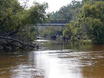
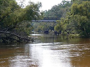
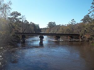
Ochlockonee River at the Old Bainbridge Road Bridge
|
|
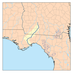
Ochlockonee River watershed
|
|
| Country | United States |
| State | Georgia, Florida |
| District | NWFWMD |
| Physical characteristics | |
| Main source | Gordy, Georgia 31°29′06″N 83°52′49″W / 31.48500°N 83.88028°W |
| River mouth | Ochlockonee Bay Surf, Florida 29°58′36″N 84°26′15″W / 29.97667°N 84.43750°W |
| Length | 206 mi (332 km) |
| Basin features | |
| Basin size | 2,450 sq mi (6,300 km2) |
| Tributaries |
|
The Ochlockonee River (o-KLOK-nee) is a river that starts in Georgia. It flows for about 206 miles (332 km) before reaching Florida. In Florida, it has a dam that creates Lake Talquin. The river then ends in Ochlockonee Bay.
Contents
About the Ochlockonee River
The name "Ochlockonee" comes from the Hitchiti language. It means "yellow river." The river begins south of Sylvester in Worth County, Georgia. It flows into Ochlockonee Bay and then into Apalachee Bay in Florida.
The Ochlockonee River forms borders for several counties in Florida. These include Leon County, Wakulla County, Gadsden County, Liberty County, and Franklin County. The river passes through different areas like the Red Hills Region and the Apalachicola National Forest. It also flows past Ochlockonee River State Park.
Near its end, the river is affected by tides. This means the water is a mix of fresh, salty, and brackish water. The tidal effects can be felt more than 15 miles (24 km) upstream from where the river meets the bay.
River History
When the Spanish first came to northern Florida, the Ochlockonee River was the western edge of the Apalachee Province. Old Spanish papers from the late 1600s called the river "Claraquachine" or "Amarillo," which means "yellow" in Spanish. Another Spanish document from 1716 called it "Rio de Lagna," where "lagna" likely meant "yellow" in the Apalachee language.
An English map from 1720 also showed it as the "Yellow River." Later maps used names like "Okalockney" (1778) and "Oklokonee" (1856). The name we use today, Ochlockonee, probably comes from the Hitchiti/Mikasuki words "Oki" (water) and "Lagana" (yellow).
From 1839 to 1842, a place called Fort Virginia Braden was built on the river. It was named after the commander's wife, who sadly died from yellow fever.
The Civil War and the River
The Ochlockonee River was important during the American Civil War. In 1863, two Union Navy ships, the USS Stars and Stripes and the USS Somerset, attacked salt-making sites nearby. These sites were important for the Confederate army.
The USS Stars and Stripes also stopped ships trying to get supplies through the Union blockade. It sank a ship called Caroline Gertrude in December 1863. In January 1864, it captured another ship, the Laura. Later, in October 1864, the Stars and Stripes destroyed a large fishing operation used by the Confederates.
Jackson Bluff Dam
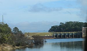
In 1927, the Jackson Bluff Dam was built on the Ochlockonee River. This dam was made to create electricity from the river's water. The water held back by the dam formed Lake Talquin, which is a large lake today.
Why the River is Important
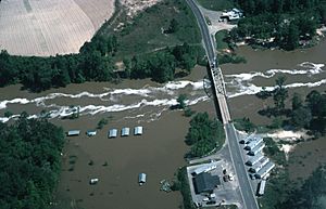
The area around the Ochlockonee River is home to many rare and special plants and animals. Because of this, Florida has named it an "Outstanding Florida Water." This means it's a very important natural area to protect. The Florida Fish and Wildlife Conservation Commission also calls it a "Strategic Habitat Conservation Area."
Some rare animals found here include the red-cockaded woodpecker, the least tern, and the Apalachicola dusky salamander. The river is especially rich in rare freshwater mussels. Three types of mussels found here are even on the endangered species list: the Ochlockonee moccasinshell, the Shinyrayed pocketbook, and the Oval pigtoe. Also, a special tree called the Florida maybell only grows along the Ochlockonee and Chipola Rivers.
The Ochlockonee River also helps fill Lake Iamonia, especially when there are floods.
Fun Activities on the River
The Ochlockonee River is a great place for fishing! You can catch fish like largemouth bass, black crappie, Bream, striped bass, and catfish. There's also a special canoe trail on the river, both above and below Lake Talquin. Other popular spots for canoeing are Telogia Creek and the Little River. Part of the Florida National Scenic Trail also follows the river for two miles.
The Ochlockonee River is very important for seafood in Apalachee Bay. When the river floods, it carries natural materials downstream into Ochlockonee Bay. This bay acts like a nursery for many types of fish and shellfish. These creatures are the basis for both fun fishing trips and the seafood industry in the area. Fishing in Ochlockonee Bay is excellent for Flounder, Redfish, Black Drum, Spotted Sea Trout, Blue Crab, and sharks.
River Crossings
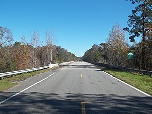
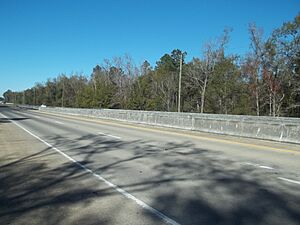
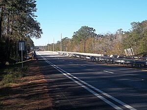
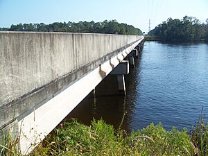
Many major roads cross the Ochlockonee River. These include Interstate 10 and U.S. highways like 19, 27, 84, and 319.
| Crossing | Carries | Image | Location | Coordinates |
|---|---|---|---|---|
Georgia |
||||
| Brooks Road | 31°24′01″N 83°53′32″W / 31.4004°N 83.8923°W | |||
| Bridgeboro-Anderson Road | 31°23′39″N 83°53′40″W / 31.3943°N 83.8945°W | |||
| Liberty Hill Road | 31°22′21″N 83°53′49″W / 31.3724°N 83.8969°W | |||
| Childree Road | 31°21′00″N 83°53′31″W / 31.3501°N 83.8919°W | |||
| Evergreen Road | 31°20′07″N 83°53′01″W / 31.3353°N 83.8835°W | |||
| Doerun | 31°19′10″N 83°52′45″W / 31.3194°N 83.8791°W | |||
| Hagin Still Road | 31°17′56″N 83°52′24″W / 31.2990°N 83.8733°W | |||
| Swift Canteen Road | 31°16′02″N 83°50′33″W / 31.2671°N 83.8424°W | |||
| Sigsbee | 31°14′50″N 83°50′02″W / 31.2471°N 83.8340°W | |||
| Rail bridge | Norfolk Southern Railway Line formerly known as the Georgia Northern Railway |
31°14′50″N 83°50′02″W / 31.2471°N 83.8340°W | ||
| Old Doerun Rd | Moultrie | 31°13′46″N 83°50′06″W / 31.2295°N 83.8349°W | ||
| Moultrie | 31°10′57″N 83°48′33″W / 31.1826°N 83.8091°W | |||
| Lower Meigs Road | Moultrie | 31°08′32″N 83°48′12″W / 31.1421°N 83.8032°W | ||
| Fred Webb Road | 31°06′20″N 83°49′59″W / 31.1056°N 83.8331°W | |||
| Smithwick Bridge | Smithwick Bridge Road | 31°04′09″N 83°52′18″W / 31.0692°N 83.8716°W | ||
| Rocky Ford Bridge | Zion Grove Church Road | 31°04′09″N 83°52′18″W / 31.0692°N 83.8716°W | ||
| Bannister Road | 31°02′23″N 83°55′08″W / 31.0396°N 83.9189°W | |||
| Beeline Road Road | 31°02′01″N 83°56′08″W / 31.0336°N 83.9356°W | |||
| 31°00′09″N 83°56′20″W / 31.0024°N 83.9390°W | ||||
| 30°57′01″N 83°57′44″W / 30.9502°N 83.9622°W | ||||
| Old Confederate Bridge | Egg-Butter Road (Defunct) | Dawesville | 30°55′43″N 83°59′48″W / 30.9287°N 83.9967°W | |
| Dawesville | 30°55′43″N 83°59′48″W / 30.9287°N 83.9967°W | |||
| Rail bridge | CSX Line formerly known as the South Georgia and Florida Railroad |
Dawesville | 30°55′02″N 84°00′18″W / 30.9173°N 84.0049°W | |
| Dawesville | 30°54′44″N 84°00′31″W / 30.9121°N 84.0086°W | |||
| 30°52′33″N 84°02′47″W / 30.8758°N 84.0464°W | ||||
| Rail bridge | CSX Line formerly known as the Atlantic and Gulf Railroad |
30°52′33″N 84°02′47″W / 30.8758°N 84.0464°W | ||
| Cairo | 30°47′30″N 84°09′15″W / 30.7917°N 84.1543°W | |||
| Hadley Ferry Bridge | CR 54 Hadley Ferry Road |
Rocky Hill | 30°43′54″N 84°14′08″W / 30.7316°N 84.2356°W | |
| Old Hadley Ferry Bridge | (Defunct) | 30°43′53″N 84°14′11″W / 30.731444°N 84.236319°W | ||
Florida |
||||
| Fairbanks Ferry/Bridge | Concord | 30°40′08″N 84°18′18″W / 30.6690°N 84.3050°W | ||
| Tallahassee | 30°35′22″N 84°21′36″W / 30.5895°N 84.3601°W | |||
| Tallahassee | 30°33′15″N 84°23′02″W / 30.5541°N 84.3840°W | |||
| Rail bridge | CSX Line formerly known as the Georgia, Florida and Alabama Railway. |
Tallahassee | 30°33′02″N 84°23′15″W / 30.5505°N 84.3875°W | |
| Midway | 30°29′07″N 84°23′50″W / 30.4852°N 84.3972°W | |||
| Midway | 30°28′24″N 84°24′26″W / 30.4734°N 84.4073°W | |||
| Rail bridge | CSX Line formerly known as the Pensacola and Georgia Railroad |
Midway | 30°28′23″N 84°24′29″W / 30.4730°N 84.4080°W | |
| Talquin Dam | Bloxham | 30°23′18″N 84°38′47″W / 30.3884°N 84.6464°W | ||
| Bloxham | 30°23′01″N 84°39′18″W / 30.3837°N 84.6551°W | |||
Forest Highway 13 |
Porter Lake | 30°10′36″N 84°40′06″W / 30.1767°N 84.6684°W | ||
| Rail bridge | Georgia, Florida and Alabama Railway (Defunct) | McIntyre | 30°10′36″N 84°40′06″W / 30.1767°N 84.6684°W | |
| Sopchoppy | 29°59′17″N 84°30′08″W / 29.9881°N 84.5022°W | |||
| Ochlockonee Bay Bridge (a/k/a Walker Bridge) | Ochlockonee Bay | 29°58′06″N 84°23′02″W / 29.9682°N 84.3840°W | ||
See also
 In Spanish: Río Ochlockonee para niños
 | Aaron Henry |
 | T. R. M. Howard |
 | Jesse Jackson |


