
Franklin County, Florida facts for kids
Quick facts for kids
Franklin County
|
|
|---|---|

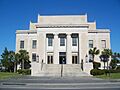
Franklin County Courthouse
|
|

Location within the U.S. state of Florida
|
|
 Florida's location within the U.S. |
|
| Country | |
| State | |
| Founded | February 8, 1832 |
| Named for | Benjamin Franklin |
| Seat | Apalachicola |
| Largest city | Apalachicola |
| Area | |
| • Total | 1,026 sq mi (2,660 km2) |
| • Land | 535 sq mi (1,390 km2) |
| • Water | 492 sq mi (1,270 km2) 47.9%% |
| Population
(2020)
|
|
| • Total | 12,451 |
| • Estimate
(2023)
|
12,594 |
| • Density | 12.135/sq mi (4.6855/km2) |
| Time zone | UTC−5 (Eastern) |
| • Summer (DST) | UTC−4 (EDT) |
| Congressional district | 2nd |
Franklin County is a place in Florida, right along the Gulf of Mexico. It's in the part of Florida called the Florida Panhandle. In 2020, about 12,451 people lived here. This makes it one of the least populated counties in Florida. The main town, or county seat, is Apalachicola.
Franklin County has many protected natural areas and rivers. For a long time, people here worked in the timber (wood) and fishing industries. More recently, it has become a popular spot for tourists and people who want to retire. The county is home to several rivers, state parks, and islands.
Contents
History of Franklin County
Franklin County was started in 1832. It was named after Benjamin Franklin, a famous American inventor and statesman.
The second biggest town in Franklin County is Carrabelle. It is about 25 miles east of Apalachicola, located on the Carrabelle River.
Camp Gordon Johnston and World War II
During World War II, a large part of Franklin County was used by the United States Army. Soldiers trained here for amphibious warfare (landings from the sea) and jungle fighting. The beaches and islands were perfect for this type of training.
After the war ended, the military left. The buildings where officers lived were used to create a new community called Lanark Village.
Geography and Nature
Franklin County covers a total area of about 1,026 square miles. About 535 square miles of this is land, and 492 square miles (almost half) is water.
The county includes a part of Tate's Hell State Forest. Bald Point State Park is also nearby. Rivers in the county include the Carrabelle River and its smaller branches, the New River (Florida Panhandle) and Crooked River (Florida). These rivers are popular for paddling (like kayaking or canoeing). The very eastern edge of the county is next to the Ochlockonee River.
Neighboring Counties
Franklin County shares borders with these other counties:
- Liberty County, Florida – to the north
- Wakulla County, Florida – to the northeast
- Gulf County, Florida – to the west (the northern part of Gulf County uses a different time zone)
Protected Natural Areas
Several important natural areas are found in or near Franklin County:
- Apalachicola National Forest (a part of it)
- St. Vincent National Wildlife Refuge (a part of it)
Islands of Franklin County
Franklin County has several important barrier islands, which are long, narrow islands that protect the mainland from ocean storms:
Also, St. James Island is technically an island. Even though it's connected to the mainland, rivers and an estuary (where a river meets the sea) separate it from the rest of Franklin County.
Historic Places
- Crooked River Light (a lighthouse)
- Prospect Bluff Historic Sites
People of Franklin County
In 2020, there were 12,451 people living in Franklin County. There were 4,691 households and 2,926 families.
The population has grown over the years:
| Year | Population |
|---|---|
| 1840 | 1,030 |
| 1900 | 4,890 |
| 1950 | 5,814 |
| 2000 | 11,057 |
| 2010 | 11,549 |
| 2020 | 12,451 |
Most people in Franklin County are White (about 78.69% in 2020). About 11.27% are Black or African American. Other groups, including Native American, Asian, and people of mixed races, also live here. About 5.42% of the population is Hispanic or Latino.
In 2000, the average age of people in the county was 41 years old. About 18% of the population was under 18 years old.
Education in Franklin County
Students in Franklin County go to schools within the Franklin County School District. Most students from kindergarten to 12th grade attend the Franklin County School in Eastpoint, Florida. Some students might go to the Apalachicola Bay Charter School or other private schools.
Libraries
The Franklin County Public Library system works with the Wilderness Coast Public Libraries. There are two main library branches:
- Carrabelle
- Eastpoint
Franklin County also has the Apalachicola Margaret Key Library. This is an independent library that has been serving the community for over 100 years. It is not part of the Wilderness Coast system but is recognized by the state.
Communities in Franklin County
Towns
Census-Designated Places
These are areas that are like towns but are not officially incorporated as cities:
Unincorporated Communities
These are smaller communities that are not part of any town or city:
Transportation
Airports
- Apalachicola Regional Airport
- Carrabelle-Thompson Airport
- St. George Island Airport
Images for kids
-
Franklin County Courthouse
See also
 In Spanish: Condado de Franklin (Florida) para niños
