Old Baldy (Fisher Range) facts for kids
Quick facts for kids Old Baldy |
|
|---|---|

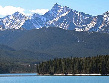
Old Baldy seen from Barrier Lake
|
|
| Highest point | |
| Elevation | 2,726 m (8,944 ft) |
| Prominence | 226 m (741 ft) |
| Parent peak | Mount Kidd (3053 m) |
| Listing | Mountains of Alberta |
| Geography | |
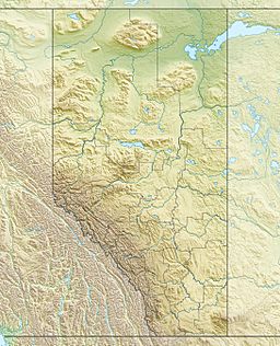
| Location | Alberta, Canada |
| Parent range | Fisher Range Canadian Rockies |
| Topo map | NTS 82J/14 |
| Geology | |
| Age of rock | Cambrian |
| Type of rock | sedimentary rock |
| Climbing | |
| Easiest route | Scramble |
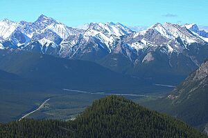
Old Baldy is a mountain peak in the beautiful Kananaskis Country in Alberta, Canada. It stands tall at 2,726 meters (about 8,944 feet) high. This impressive mountain is part of the Canadian Rockies and belongs to the Fisher Range.
Old Baldy has some mountain neighbors! Its closest taller peak is Mount Kidd, which is about 4.0 kilometers (2.5 miles) away to the west-southwest. Another mountain, Mount McDougall, is the same height as Old Baldy and is about 2.0 kilometers (1.2 miles) to the southeast.
What is Old Baldy Made Of?
Old Baldy is made up of a type of rock called sedimentary rock. This rock formed a very long time ago, between the Precambrian and Jurassic periods. Imagine shallow ancient seas where layers of sand, mud, and tiny bits of shells settled over millions of years. These layers eventually hardened into rock.
Later, during a huge event called the Laramide orogeny, these rocks were pushed and folded. They were even pushed up and over younger rocks, creating the mountains we see today!
Weather and Climate Around Old Baldy
Old Baldy is located in a subarctic climate zone. This means it has very cold and snowy winters. Summer months are usually mild and pleasant.
Winter temperatures can drop below −20 °C (which is about −4 °F). With the wind chill, it can feel even colder, sometimes below −30 °C (−22 °F). If you want to visit, the best time for climbing is usually from June through September.
The rain and melting snow from the mountain flow into smaller streams. These streams then join the Kananaskis River.


