Painted Rock Dam facts for kids
Quick facts for kids Painted Rock Dam |
|
|---|---|

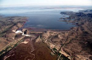
Photo taken during period of high runoff, with the resultant reservoir completely full and verging the emergency spillway
|
|
|
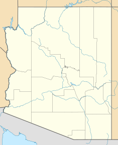
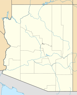
Location of Painted Rock Dam in Arizona
|
|
| Official name | Painted Rock Dam |
| Location | Maricopa County, Arizona, United States |
| Coordinates | 33°4′22″N 113°0′56″W / 33.07278°N 113.01556°W |
| Construction began | 25 July 1957 |
| Opening date | 18 January 1960 |
| Construction cost | $13,670,000 |
| Operator(s) | United States Army Corps of Engineers |
| Dam and spillways | |
| Impounds | Gila River |
| Height | 181 feet (55 m) |
| Length | 4,780 feet (1,460 m) |
| Reservoir | |
| Creates | Painted Rock Reservoir |
| Total capacity | 2,491,700 acre-feet (3.0735×10⁹ m3) |
| Painted Rock Reservoir | |
|---|---|
| Location | Arizona |
| Coordinates | 33°4′22″N 113°0′56″W / 33.07278°N 113.01556°W |
| Type | reservoir |
| Primary inflows | Gila River |
| Primary outflows | Gila River, evaporation |
| Catchment area | 50,800 sq mi (132,000 km2) |
| Basin countries | United States |
| Surface area | 53,200 acres (215 km2) (maximum) |
| Max. depth | 181 ft (55 m) |
| Water volume | 2,491,700 acre⋅ft (3.0735 km3) (maximum) |
| Surface elevation | 661 ft (201 m) |
The Painted Rock Dam is a large dam made of earth. It is located in Arizona, west of Gila Bend. Its main job is to stop floods.
Contents
Building the Dam
The United States Army Corps of Engineers built the Painted Rock Dam. Construction took three years, from 1957 to 1960. The dam helps control big floods on the Gila River. Before this dam, there wasn't much to stop the river's flow. This was true for hundreds of miles between the Colorado River and the Coolidge Dam.
Why the Dam Was Needed
Many smaller rivers flow into the Gila River in this area. These include the Hassayampa, Agua Fria, and especially the Salt River and Verde River. The Gila River has a very large watershed, covering about 50,800 square miles (132,000 km2). More than half of this area is not controlled by other dams. This meant that small farming towns downstream on the Gila River faced a big threat from floods. Before the dam was built, these areas often had serious seasonal floods.
History Around the Dam
The area around the Painted Rock Dam has a rich history. The old Butterfield Overland Mail route passed through here. This was a famous stagecoach route. The Mormon Battalion also traveled through this region. You can still find signs of their journeys.
Ancient Markings and Petroglyphs
The expedition of Juan Bautista De Anza in 1774 also came through this area. People from these groups left inscriptions, or writings, at different spots. Near the dam, there is a campground managed by the Bureau of Land Management. This site shows many ancient petroglyphs. These are drawings carved into rocks by early humans. They show that people lived in this region long before European settlers arrived. The area and the dam get their name from the Painted Rock Petroglyph Site.
Painted Rock Reservoir
The Painted Rock Reservoir is an artificial lake created by the Painted Rock Dam. This reservoir can hold a lot of water, up to 2,491,700 acre-feet (3.0735×10⁹ m3). This makes it potentially the second largest reservoir completely within Arizona. However, the Gila River and its main branch, the Salt River, are usually used for irrigation and city water in Phoenix. Because of this, the lake is often dry.
Water Levels and Contamination
In 2005, heavy rainfall filled the reservoir to very high levels. It became the second largest lake by area in Arizona, after Theodore Roosevelt Lake. But, high levels of certain chemicals, like DDT, had built up in farmlands upstream. These chemicals flowed into the lake during the flood. The lake became unsafe for people to use. Because of this, public access to both the lake and the dam was restricted. Similar floods filled the lake in 1993 and 1980. Each time, the lake only stayed full for a few months. The water would then disappear due to evaporation, releases downstream, and soaking into the ground. As of 2009, the lake and reservoir were dry. The area was closed to the public due to water quality concerns. No hunting, hiking, or camping is allowed. The Army Corps of Engineers now takes care of the property.
Impact on Native Americans
When the Painted Rock Dam was built, the water it held flooded about 10,000 acres of the Tohono O'odham's Gila Bend Reservation. This flooding destroyed a 750-acre tribal farm and several communities. The people living there had to move to a new area called San Lucy Village, Arizona. In 1986, the U.S. government and the Tohono O'odham Nation reached an agreement. The Nation agreed to give up its legal claims related to the flooding. In return, they received $30,000,000 and the right to add up to 10,000 acres of newly purchased land to their Reservation.
 | Valerie Thomas |
 | Frederick McKinley Jones |
 | George Edward Alcorn Jr. |
 | Thomas Mensah |


