Pamlico County, North Carolina facts for kids
Quick facts for kids
Pamlico County
|
||
|---|---|---|

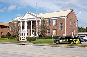
Pamlico County Courthouse in Bayboro
|
||
|
||

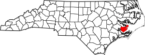
Location within the U.S. state of North Carolina
|
||
 North Carolina's location within the U.S. |
||
| Country | ||
| State | ||
| Founded | 1872 | |
| Named for | Pamlico Sound | |
| Seat | Bayboro | |
| Largest community | Bayboro | |
| Area | ||
| • Total | 561.63 sq mi (1,454.6 km2) | |
| • Land | 336.52 sq mi (871.6 km2) | |
| • Water | 225.11 sq mi (583.0 km2) 40.08% | |
| Population
(2020)
|
||
| • Total | 12,276 | |
| • Estimate
(2023)
|
12,423 | |
| • Density | 36.45/sq mi (14.07/km2) | |
| Time zone | UTC−5 (Eastern) | |
| • Summer (DST) | UTC−4 (EDT) | |
| Congressional district | 3rd | |
Pamlico County (pronounced PAM-lik-oh) is a county located in the state of North Carolina, USA. In 2020, about 12,276 people lived here. Its main town, or county seat, is Bayboro.
Pamlico County is part of the larger New Bern area.
Contents
History of Pamlico County
Pamlico County was created in 1872. It was formed from parts of two other counties: Beaufort and Craven. The county got its name from Pamlico Sound, a large body of water nearby.
Before 1872, this area was part of Craven County. People in Craven County used to say they were going "down in the county" when they visited this low-lying area. This old nickname is still sometimes used today.
Pamlico County is mostly a rural area, meaning it has lots of open land and small towns. In recent years, more people have moved here. Many are retirees or investors who like the beautiful waterfront properties.
The town of Oriental is on the eastern side of the county. It's a popular stop for boaters traveling along the Intracoastal Waterway. New Bern, which is in the next county over, is the main place for shopping and trade for people in Pamlico County.
Geography of Pamlico County
Pamlico County covers a total area of about 561 square miles. A large part of this area, about 225 square miles, is water. The land area is about 336 square miles.
Protected Areas and Water Bodies
Pamlico County has several natural areas that are protected. These include parts of:
- Goose Creek Game Land
- Neuse River Game Land
- Light Ground Pocosin Game Land
The county is also home to several important water bodies:
- Bay River
- Goose Creek
- Intracoastal Waterway
- Neuse River
- Pamlico River
Neighboring Counties
Pamlico County shares its borders with these counties:
- Beaufort County – to the north
- Hyde County – to the northeast
- Carteret County – to the southeast
- Craven County – to the southwest
Main Roads
Several highways run through Pamlico County, connecting its communities:
 NC 33
NC 33 NC 55
NC 55 NC 304
 NC 306
 NC 307
Transportation
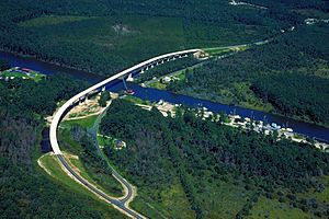
The Cherry Branch–Minnesott Beach Ferry connects Pamlico County to Craven County. This ferry helps people travel across the water.
People of Pamlico County
In 2020, the population of Pamlico County was 12,276 people. There were 5,416 households and 3,589 families living in the county.
Population Makeup (2020 Census)
The 2020 census showed the different groups of people living in Pamlico County:
| Group | Number | Percentage |
|---|---|---|
| White (not Hispanic) | 9,104 | 74.16% |
| Black or African American (not Hispanic) | 2,055 | 16.74% |
| Native American | 58 | 0.47% |
| Asian | 50 | 0.41% |
| Pacific Islander | 5 | 0.04% |
| Other/Mixed | 508 | 4.14% |
| Hispanic or Latino | 496 | 4.04% |
Communities in Pamlico County
Towns
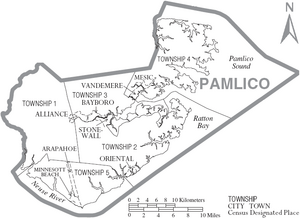
- Alliance
- Arapahoe
- Bayboro (This is the county seat and the largest community.)
- Grantsboro
- Mesic
- Minnesott Beach
- Oriental
- Stonewall
- Vandemere
Census-Designated Place
Unincorporated Communities
These are smaller communities that are not officially towns:
- Florence
- Janerio
- Lowland
- Maribel
- Merritt
- Olympia
- Reelsboro
- Whortonsville
Townships
Pamlico County is divided into five areas called townships. These are simply numbered:
- Township 1
- Township 2
- Township 3
- Township 4
- Township 5
Notable People
- David B. Mintz, a Methodist minister who served Pamlico in 1804.
See also
 In Spanish: Condado de Pamlico para niños


