Panther Run facts for kids
Quick facts for kids Panther Run |
|
|---|---|

Panther Run in The Hook Natural Area
|
|
| Physical characteristics | |
| Main source | valley in Haines Township, Centre County, Pennsylvania between 1,780 and 1,800 feet (540 and 550 m) |
| River mouth | North Branch Buffalo Creek in Hartley Township, Union County, Pennsylvania 1,289 ft (393 m) 40°57′39″N 77°10′49″W / 40.96095°N 77.18030°W |
| Length | 3.9 mi (6.3 km) |
| Basin features | |
| Progression | North Branch Buffalo Creek → Buffalo Creek → West Branch Susquehanna River → Susquehanna River → Chesapeake Bay |
| Basin size | 3.79 sq mi (9.8 km2) |
| Tributaries |
|
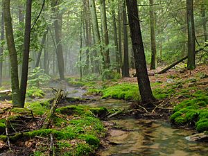
Panther Run is a small stream, or tributary, located in Centre County and Union County, Pennsylvania. It flows into a larger stream called North Branch Buffalo Creek. Panther Run is about 3.9 miles (6.3 km) long. It flows through forests and is home to wild trout. The land around the stream, called its watershed, covers about 3.79 square miles (9.8 km2).
Contents
The Path of Panther Run
Panther Run starts in a valley in Haines Township, Centre County. It flows east-northeast for a short distance. Then, it enters Hartley Township, Union County.
The stream continues flowing east-northeast for a few miles. It then turns southeast, passing a place called Buck Ridge. Panther Run then enters an area known as The Hook. Here, it meets its only named tributary, Slide Hollow, which joins from the left side.
After this, Panther Run turns southwest for a short stretch. It then reaches its confluence (where two streams join) with North Branch Buffalo Creek. This meeting point is across from Dogback Mountain. Panther Run joins North Branch Buffalo Creek about 9.42 miles (15.16 km) upstream from where North Branch Buffalo Creek ends.
Slide Hollow: Panther Run's Tributary
Panther Run has one named tributary, which is called Slide Hollow. Slide Hollow joins Panther Run about 0.46 miles (0.74 km) before Panther Run meets North Branch Buffalo Creek. The area that drains into Slide Hollow, its watershed, is about 0.61 square miles (1.6 km2).
Geography and Elevation
The elevation of the land where Panther Run ends, its mouth, is about 1,289 feet (393 meters) above sea level. The stream's beginning, its source, is much higher. It is between 1,780 and 1,800 feet (540 and 550 meters) above sea level.
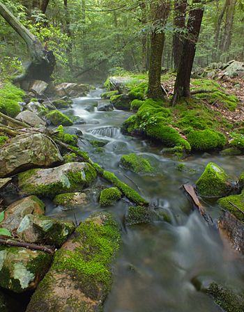
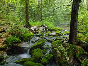
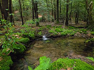
Panther Run starts from a spring on the forest floor. In some parts, it is a good-sized stream. However, it is still much smaller than North Branch Buffalo Creek, which it flows into.
Panther Run's Watershed
The watershed of Panther Run is the entire area of land where water drains into the stream. This watershed covers about 3.79 square miles (9.8 km2). The stream is located entirely within the Hartleton area, as mapped by the United States Geological Survey.
The Panther Run watershed makes up about 2 percent of the larger Buffalo Creek drainage basin. Almost all of the land in Panther Run's watershed, about 100 percent, is covered by forest.
History and Fun Activities
Panther Run was officially added to the Geographic Names Information System on August 2, 1979. This system keeps track of names for places in the United States.
In 2008, a report looked at different stream areas in the Buffalo Creek region. Panther Run's watershed was ranked eighth for needing restoration work.
There is a hiking trail in The Hook Natural Area that follows Panther Run. This trail even crosses the stream several times, making it a great spot for outdoor adventures.
Biology and Wildlife
Panther Run is a special place for fish. Wild trout naturally reproduce (have babies) in the stream. They live from the upper parts of the stream all the way down to its mouth. The stream's source area is even called a Wilderness Trout Stream. This means it's a very important place for wild trout.
The streambanks of Panther Run are lined with different types of plants. In the upper parts, you'll find hardwood forest. As you go downstream, you'll see white pine trees. There are also various types of sedges and grasses. In other areas, the plants growing under the trees, called the understory, are mostly rhododendrons. You might also spot patches of a plant called Lycopodium annotinum, which is a type of clubmoss, growing close to the stream.
 | Mary Eliza Mahoney |
 | Susie King Taylor |
 | Ida Gray |
 | Eliza Ann Grier |


