Park Range (Nevada) facts for kids
Quick facts for kids Park Range |
|
|---|---|
| Highest point | |
| Peak | Unnamed peak |
| Elevation | 2,783 m (9,131 ft) |
| Dimensions | |
| Length | 10.7 mi (17.2 km) NNE - SSW |
| Width | 7.2 mi (11.6 km) WNW - ESE |
| Geography | |
| Country | United States |
| State | Nevada |
| District | Nye County |
| Range coordinates | 38°53′27.757″N 116°9′28.202″W / 38.89104361°N 116.15783389°W |
| Topo map | USGS Park Mountain |
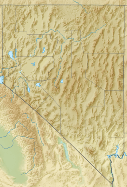
The Park Range is a group of mountains in Nevada, a state in the western United States. It's located in the northeastern part of Nye County. This mountain range is about 40 miles south of a town called Eureka.
Other mountain ranges and valleys are nearby. To the northwest, you'll find the Antelope Range. The Little Smoky Valley is to the northeast. To the east are the Big Sand Springs Valley and the Pancake Range. The Hot Creek Range is located southwest of the Park Range.
The Park Range has several notable peaks. An unnamed peak in the southern part of the range reaches about 9,131 feet (2,783 meters) high. Park Mountain, located in the northern part, is also tall at about 9,058 feet (2,761 meters).
Just southeast of the main Park Range is Andesite Ridge. This ridge runs next to the Park Range, separated by a place called Prichards Canyon. Andesite Ridge reaches an elevation of about 8,045 feet (2,452 meters). In the past, there were historic stations nearby. Summit Station was to the east, Prichards Station to the south, and Hicks Station to the west.
Exploring the Park Range Wilderness
Almost the entire Park Range is part of a special area called the Park Range Wilderness Study Area. This means the land is protected and kept wild. It's a rugged area, meaning it has rough, natural terrain.
Unlike some other areas, livestock like cows do not graze here. This helps keep the natural environment untouched. The range has natural meadows, which are open grassy areas. These meadows often have good water sources, thanks to the volcanic rocks in the ground.
You can find different types of forests growing in the Park Range. These include pinyon pine trees, juniper trees, and mountain mahogany trees. These trees add to the beauty and natural habitat of the area.
Understanding the Geology of Park Range
The Park Range is a great example of the Basin and Range region in Nevada. This region is known for its many mountain ranges separated by flat valleys. The Park Range is surrounded by high-angle faults on all sides. Faults are cracks in the Earth's crust where rocks have moved.
Most of the mountains are made of volcanic rocks. These rocks formed during the Oligocene epoch, which was millions of years ago. They include rhyolitic and latitic volcanic flows. These are types of lava that flowed from volcanoes. There are also pyroclastic deposits, which are rocks formed from explosive volcanic eruptions. Some andesite rocks are also present.
The layers of volcanic rock are tilted. They dip, or slope, about 20 degrees to the east. This tilting shows how the Earth's crust has moved over time.
At the northern end of the Park Range, you can find older rocks. These are Paleozoic sedimentary rocks, which formed from layers of sediment. They include Goodwin Limestone from the Ordovician period and Devils Gate Limestone from the Silurian period. These older rocks appear as fault blocks within the younger volcanic rocks.
People have explored these Paleozoic sedimentary rocks for gold. This gold is often found in places linked to hot springs. The Andesite Ridge area, southeast of the main range, has also been prospected for gold.
 | Kyle Baker |
 | Joseph Yoakum |
 | Laura Wheeler Waring |
 | Henry Ossawa Tanner |


