Patchogue Bay facts for kids
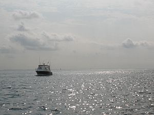
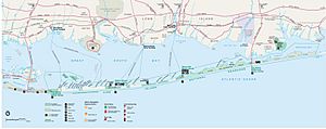
Patchogue Bay is a beautiful part of the Great South Bay on the south shore of Long Island in New York. It's like a large, calm cove nestled between two points of land called Blue Point and Howells Point. From Patchogue Bay, you can catch ferries that take you south to Fire Island.
Contents
Who Owns Patchogue Bay?
Historical Ownership
For a very long time, the town of Brookhaven has owned Patchogue Bay, including the land under the water. This ownership comes from a special grant given by the King of Britain way back in 1686, long before the United States even existed! Courts have repeatedly agreed that this old grant is still valid today.
Government Claims
However, since 1968, the U.S. Federal Government has also tried to claim parts of the bay bottom. They have shown maps that make it look like the Fire Island National Seashore extends far into the bay. But the actual boundary of the seashore is the shoreline of the barrier beach, not out in the water. This means there's a disagreement about who truly owns certain parts of the bay.
Amazing Bay Habitat
Patchogue Bay is home to many different kinds of natural areas, called habitats. These include sandy areas, muddy areas, and especially large beds of eelgrass. Eelgrass is a special type of underwater plant that is super important for many bay creatures.
Plants and Animals
Many animals live in Patchogue Bay. In the sandy and muddy parts, you can find worms, slipper shells, and blue mussels. Mud crabs are also common. In the eelgrass beds, you might see Atlantic oyster drills, which are snails that like to eat clams and oysters, and rock crabs.
The health of the eelgrass beds affects where and how many animals live there. Things like how dense the eelgrass is, the water temperature, how salty the water is, and what kind of sediment is on the bottom all play a role.
Fish and Shellfish
The bay is also full of different fish. Small fish like silversides, killifish, menhaden, and bay anchovies swim through the water at different times of the year. Atlantic silversides are very common for most of the year. Bay anchovies are often found in the middle of the bay during summer.
You can also find sticklebacks, which are small fish with spines. Northern pipefish are thin, long fish that eat tiny water creatures. American sandlance are very common in winter and are an important food source for many other animals.
Patchogue Bay is a great place for blue crabs to lay their eggs, grow up, and find food. It's also known for its hard clams, which are a type of shellfish.
Other Bay Creatures
Other common animals in the bay include blue mussels, bay scallops, eastern oysters, horseshoe crabs, and American eels. You might also spot fish like spot, Atlantic croaker, northern kingfish, and northern puffer.
Trout Streams
Several streams flow into Patchogue Bay, and some of these are home to special brook trout. In fact, nine of the twelve known wild brook trout populations on Long Island live in streams that drain into this bay! The Swan River, Patchogue Creek, and Mud Creek are some examples of streams where these trout naturally reproduce.
Changes in the Bay
While hard clams are a main resource today, this wasn't always the case. The bay used to have a big eastern oyster fishery, but it collapsed in the 1940s and 1950s. This happened because of tiny algae blooms that stopped the shellfish from growing. These blooms were likely caused by pollution, especially from large duck farms that used to be on the bay's tributaries.
Today, a similar problem exists with lawn fertilizer runoff. This runoff can cause "brown tide" algae blooms, which have hurt the bay scallop population. For example, in 1999, after a dry spring, the bay was incredibly clean. People who had lived there for a long time said they had never seen it so clear, and there was no "brown tide" that year. This shows how important it is to keep the bay clean.
Places Near Patchogue Bay
- Davis Park
- Watch Hill
- Fire Island National Seashore
- The Great South Bay
- Moriches Bay
- Swan River New York Google maps
- Pine Neck – (Boat launch)
- Patchogue River www.lat-long.com
- Sandspit Park Beach & Marina
- Shorefront Park – Patchogue (Bandshell)
- Mascot Dock & Marina
- South Shore Estuary
- Fire Island Wilderness
- Fire Island Inlet Bridge
- Great South Bay Bridge
- Outer Barrier Islands
Images for kids
 | George Robert Carruthers |
 | Patricia Bath |
 | Jan Ernst Matzeliger |
 | Alexander Miles |


