
Poinsett County, Arkansas facts for kids
Quick facts for kids
Poinsett County
|
|
|---|---|

Poinsett County Courthouse, June 2011
|
|

Location within the U.S. state of Arkansas
|
|
 Arkansas's location within the U.S. |
|
| Country | |
| State | |
| Founded | February 28, 1838 |
| Named for | Joel Roberts Poinsett |
| Seat | Harrisburg |
| Largest city | Trumann |
| Area | |
| • Total | 763 sq mi (1,980 km2) |
| • Land | 758 sq mi (1,960 km2) |
| • Water | 5.2 sq mi (13 km2) 0.7%% |
| Population
(2020)
|
|
| • Total | 22,965 |
| • Density | 30.098/sq mi (11.621/km2) |
| Time zone | UTC−6 (Central) |
| • Summer (DST) | UTC−5 (CDT) |
| Congressional district | 1st |
Poinsett County is a county in the state of Arkansas. In 2020, about 22,965 people lived there. The main town and county seat is Harrisburg. Poinsett County is part of the larger Jonesboro–Paragould Combined Statistical Area.
Contents
History of Poinsett County


Poinsett County was created on February 28, 1838. It was named after Joel Roberts Poinsett, who was the U.S. Secretary of War at the time. At first, county business was done in the judge's home. The first courthouse was built in Bolivar in 1839.
In 1859, the county seat moved to Harrisburg. This town was more in the center of the county. Over the years, parts of Poinsett County were used to form new counties. These new counties included Craighead County to the north and Cross County to the south. Some "sunken lands" in the east, including areas like Lepanto and Marked Tree, were added to Poinsett County.
Growth After the Civil War
The Civil War caused a lot of financial problems for the county. It started to get better when railroads were built in the area. Railroads helped farmers sell their crops and allowed the timber industry to grow.
The Texas and St. Louis Railway finished its tracks through Weiner in 1882. The St. Louis and Iron Mountain Railway also built tracks through the middle of the county that same year. The Kansas City, Ft. Scott, and Gulf Railroad started service in eastern Poinsett County in 1883.
With railroads, it became possible to ship timber across northeast Arkansas. Farmers could also send their cotton and farm animals to new markets. Many small towns grew quickly during this time because of the railroads. Even with this growth, most people in the county were poor sharecroppers and tenant farmers. A small group of wealthy white landowners held most of the land.
Challenges and Changes
Poinsett County was hit very hard by the Great Mississippi Flood of 1927. This flood covered many fields and destroyed homes all over the county.
During the Great Depression, a group called the Southern Tenant Farmers Union was started in Tyronza in 1935. This union included both white and Black farmers. Its goal was to get better pay and working conditions for poor sharecroppers. The union faced strong opposition from landowners, and union members sometimes faced danger. Today, you can visit the Southern Tenant Farmers Union Museum in Tyronza. It is run by Arkansas State University.
Geography of Poinsett County
Poinsett County covers about 764 square miles. Most of this area, about 758 square miles, is land. Only a small part, about 5.2 square miles, is water.
The county is in the northeast part of Arkansas. It is divided by Crowley's Ridge and the L'Anguille River. Both of these run from north to south through the county. The eastern part of the county has rich soil left by the Mississippi River. This land is mostly used for growing cotton. The western part of Poinsett County is mainly used for growing rice. Lake Poinsett State Park is located in the center of the county.
Main Roads
Many important roads pass through Poinsett County. These roads help people travel and transport goods.
 Interstate 555
 U.S. Highway 49
 U.S. Highway 63
 Highway 1
 Highway 14
 Highway 18
 Highway 69
 Highway 75
 Highway 118
 Highway 135
 Highway 136
 Highway 140
 Highway 149
 Highway 158
 Highway 163
 Highway 198
 Highway 214
 Highway 308
 Highway 322
 Highway 373
 Highway 463
Neighboring Counties
Poinsett County shares borders with several other counties:
- Craighead County (north)
- Mississippi County (east)
- Crittenden County (southeast)
- Cross County (south)
- Jackson County (west)
People in Poinsett County

In 2020, the census showed that 22,965 people lived in Poinsett County. There were 9,526 households and 6,710 families.
Most people in the county are White (about 83.44%). About 7.72% are Black or African American. Other groups include Native American, Asian, and people of mixed races. About 3.61% of the people are Hispanic or Latino.
Education in Poinsett County
Schools
Children in Poinsett County can attend public schools in four different districts. These districts serve students from early childhood through high school.
- Trumann School District: This is the largest district, located in Trumann. It has four schools and serves over 1,600 students.
- Harrisburg School District: Located in Harrisburg, this district has five schools and serves over 1,300 students.
- East Poinsett County School District: Based in Lepanto, this district has three schools and serves over 750 students.
- Marked Tree School District: Located in Marked Tree, this district has three schools and serves over 650 students.
Libraries
Poinsett County has libraries that are part of two systems: the Crowley Ridge Regional Library System and the Trumann Library System. These libraries offer books and resources for everyone in the community.
Communities in Poinsett County

Cities
- Fisher
- Harrisburg (This is the county seat)
- Lepanto
- Marked Tree
- Trumann
- Tyronza
- Weiner
Towns
Other Communities
These are places that are not officially cities or towns, but people live there.
- Payneway (a census-designated place)
- Rivervale (a census-designated place)
- Greenfield (an unincorporated community)
Images for kids
-
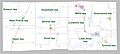
Townships in Poinsett County, Arkansas as of 2010

See also
 In Spanish: Condado de Poinsett para niños
