Cross County, Arkansas facts for kids
Quick facts for kids
Cross County
|
|||
|---|---|---|---|
|
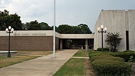
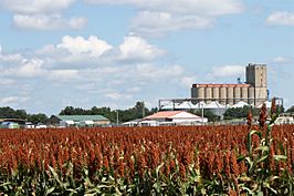
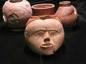
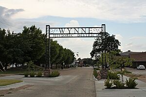
Clockwise from top: Cross County Courthouse, the railroad overpass in Wynne, Lake Austell at Village Creek State Park, a sorghum field with Wynne grain elevator in the background, a preserved Native American mound at Parkin Archaeological State Park, and streetside in the Wynne Commercial Historic District
|
|||
|
|||
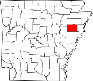
Location within the U.S. state of Arkansas
|
|||
 Arkansas's location within the U.S. |
|||
| Country | |||
| State | |||
| Founded | November 15, 1862 | ||
| Named for | David C. Cross | ||
| Seat | Wynne | ||
| Largest city | Wynne | ||
| Area | |||
| • Total | 622.33 sq mi (1,611.8 km2) | ||
| • Land | 615.85 sq mi (1,595.0 km2) | ||
| • Water | 6.48 sq mi (16.8 km2) 1.0%% | ||
| Population
(2020)
|
|||
| • Total | 16,833 | ||
| • Density | 27.0484/sq mi (10.4434/km2) | ||
| Time zone | UTC−6 (Central) | ||
| • Summer (DST) | UTC−5 (CDT) | ||
| Congressional district | 1st | ||
Cross County is a county in Northeast Arkansas. It is part of the Arkansas Delta region. The county was created on November 15, 1862. It was named after David C. Cross, a local political leader.
Cross County has four towns and cities. Wynne is the largest city and the county seat. The land in the county is mostly flat and good for farming. Farmers grow many different crops here.
A special area called Crowley's Ridge runs through the county. It has hills and forests. This ridge includes part of Wynne and most of Village Creek State Park. This park is an important natural area.
You can find interesting historical sites in Cross County. These include Parkin Archeological State Park, which has ancient Native American mounds. There's also the Johnston Cotton Gin, showing how cotton farming changed. The Northern Ohio School was a special school built for African-American children.
Cross County covers about 622 square miles (1,612 hectares). In 2020, about 16,833 people lived there. Farming is the main way people make a living.
Most students in Cross County go to schools in the Cross County School District or Wynne Public Schools. For college, there is the Wynne campus of East Arkansas Community College. Crossridge Community Hospital in Wynne provides healthcare. The county has access to two major US highways and many state highways. It also has a public airport, Wynne Municipal Airport.
Contents
History of Cross County
Cross County was formed in November 1862. It was made from parts of St. Francis, Crittenden, and Poinsett Counties. The first county seat was a place called Whittsburg.
In 1882, the first railroad was built in Cross County. It was called the Helena & Iron Mountain Railroad. Later, a bigger railroad company bought this line. In 1903, the county seat was moved to Wynne.
Geography and Nature
Cross County is located in the Mississippi Alluvial Plain. This area is known for its rich, fertile soil. In Arkansas, this region is called the Arkansas Delta. It has its own unique history and culture.
A special landform called Crowley's Ridge cuts through the county. It is a line of hills made of a type of soil called loess. These hills are usually covered in forests. Most of Cross County's land (about 68%) is used for farming today.
The western part of the county is mostly flat. It has sandy soils and a high water table. This area is great for farming crops like soybeans and cotton. Some places also raise fish like crawfish and catfish.
Crowley's Ridge is different from the flat Delta. It has hills that can rise up to 500 feet (150 meters). These hills are covered in different types of forests. These forests are similar to those found in the Appalachian Mountains.
The eastern part of Cross County is also flat. It used to have many river channels and floodplains. These areas were drained in the late 1800s for farming. Today, you will see many fields growing soybeans, cotton, corn, and rice.
Water is very important to Cross County. The county is divided into two main water areas by Crowley's Ridge. The eastern side drains into the St. Francis River. The western side drains into the L'Anguille River.
The St. Francis River has always been important. Ancient Native American tribes lived along its banks. Later, European settlers used the river for trade. Important streams in the county include Brushy Creek and Village Creek.
Protected Natural Areas

The biggest protected area is Village Creek State Park. It is located on Crowley's Ridge near Wynne. The park has a large preserved forest. It also offers golf, fishing, horseback riding, and hiking trails. One trail follows an old military road.
Parkin Archeological State Park in Parkin protects an ancient Native American village. This site is very important for understanding history.
The Brushy Creek Wildlife Management Area is a smaller area. It has forests planted by the Arkansas Game and Fish Commission.
People of Cross County
The population of Cross County has changed over the years. Here's how many people have lived there:
| Historical population | |||
|---|---|---|---|
| Census | Pop. | %± | |
| 1870 | 3,915 | — | |
| 1880 | 5,050 | 29.0% | |
| 1890 | 7,693 | 52.3% | |
| 1900 | 11,051 | 43.7% | |
| 1910 | 14,042 | 27.1% | |
| 1920 | 18,579 | 32.3% | |
| 1930 | 25,723 | 38.5% | |
| 1940 | 26,046 | 1.3% | |
| 1950 | 24,757 | −4.9% | |
| 1960 | 19,551 | −21.0% | |
| 1970 | 19,783 | 1.2% | |
| 1980 | 20,434 | 3.3% | |
| 1990 | 19,225 | −5.9% | |
| 2000 | 19,526 | 1.6% | |
| 2010 | 17,870 | −8.5% | |
| 2020 | 16,833 | −5.8% | |
| 2023 (est.) | 16,420 | −8.1% | |
| U.S. Decennial Census 1790–1960 1900–1990 1990–2000 2010 |
|||
2020 Census Information
In 2020, there were 16,833 people living in Cross County. There were 6,653 households and 4,652 families.
| Race | Num. | Perc. |
|---|---|---|
| White | 12,067 | 71.69% |
| Black or African American | 3,651 | 21.69% |
| Native American | 38 | 0.23% |
| Asian | 102 | 0.61% |
| Pacific Islander | 5 | 0.03% |
| Other/Mixed | 618 | 3.67% |
| Hispanic or Latino | 352 | 2.09% |
Education in Cross County
Most adults in Cross County have finished high school. About 83.6% of people over 25 have a high school degree. About 14.4% have a bachelor's degree or higher.
Schools for Kids
Two public school districts serve Cross County. These are the Wynne School District and the Cross County School District. Most students in the county go to schools in these districts. Students graduate from Wynne Senior High School or Cross County High School. Both high schools are approved by the Arkansas Department of Education.
Colleges and Libraries
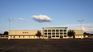
Cross County has one college campus. It is the Wynne Campus of East Arkansas Community College. This is a public community college.
The main library for the area is the Cross County Library in Wynne. It is part of the East Central Arkansas Regional Library system. There is also a branch library in Parkin.
Culture and Daily Life
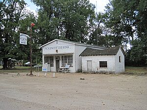
Cross County has many places that help preserve its history and culture. The Cross County Museum teaches visitors about the area's past. The Cross County Historical Society also takes care of the New Hope School.
In Parkin, you can visit Parkin Archeological State Park. This park protects the remains of an ancient Native American village. The Northern Ohio School in Parkin was a special school. It was built for African-American children in the early 1900s.
Wynne became an important business center after the Civil War. Many old buildings in downtown Wynne were built during this time. You can see historic homes and business areas there.
Other interesting places in Cross County include:
- Grace Episcopal Church, built in 1917.
- The Woman's Progressive Club, a social club since 1935.
News and Media
The county has two weekly newspapers. They are the Wynne Progress and the Cross County Times.
Cross County is also served by TV stations from Memphis, Tennessee. These include channels for CBS, NBC, PBS, Fox, ABC, and The CW. The county has two local radio stations, KWYN (92.5 FM) and KWYN (1400 AM).
Communities in Cross County
Towns and Cities
- Cherry Valley
- Hickory Ridge
- Parkin
- Wynne (This is the county seat)
Smaller Communities
- Bay Village
- Birdeye
- Central
- Coldwater
- Colton Crossing
- Duvall
- Ellis Chapel
- Fair Field
- Fair Oaks
- Fitzgerald Crossing
- Flag Lake Crossing
- Fortune
- Gieseck
- Gladden
- Hamlin
- L'Anguille
- Levesque
- McDonald
- McElroy
- Mersman
- Monterey
- Mounds
- Pittinger
- Pleasant Hill
- Princedale
- River Front
- Riverside
- Rose Place
- Smith Chapel
- Smithdale
- Tilton
- Togo
- Twist
- Vanndale
- Wick Mill
- Wilkins
- Wittsburg
- Yarbo Place
Historic Communities
- Aberdeen
- Bellknap
- Budsmith
- Dunn
- Merck
- Saint Francis
- Turney
- Welford
- Wrape
Townships
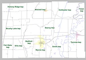
Cross County is divided into different areas called townships:
- Bedford (part of Wynne)
- Birdeye
- Brushy Lake
- Coldwater
- Ellis
- Fair Oaks
- Hickory Ridge (Hickory Ridge)
- Mitchell (Cherry Valley)
- Searcy
- Smith
- Smithdale
- Twist
- Tyronza (Parkin)
- Wynne (most of Wynne)
Transportation and Services
Main Roads
Cross County does not have any Interstate highways. The closest one is Interstate 40 to the south. Two United States highways run through Cross County. U.S. Highway 49 (US 49) goes north and south. U.S. Highway 64 (US 64) goes east and west.
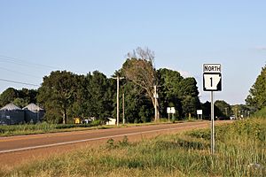
There are also eleven state highways in the county. These roads help people travel around. Arkansas Highway 1 goes through Wynne and connects other towns. Arkansas Highway 42 runs across the northern part of the county. Arkansas Highway 75 goes through the eastern part.
Arkansas Highway 163 starts at Wittsburg and goes north. This road is part of the Crowley's Ridge Parkway. It is a special scenic road.
Utilities and Water
Most of Cross County gets electricity from Entergy Arkansas. Some areas get electricity from Woodruff Electric Cooperative. Telephone service is provided by AT&T. Cable TV is from East Arkansas Video. Natural gas is provided by Centerpoint Energy.
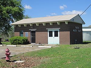
The Arkansas Department of Health makes sure that public water systems are safe. Cross County has seven community water systems. The Cross County Rural Water System serves the most customers. Wynne Water Utilities is also a large water provider. All these systems get their water from underground sources.
See also
 In Spanish: Condado de Cross para niños
 | DeHart Hubbard |
 | Wilma Rudolph |
 | Jesse Owens |
 | Jackie Joyner-Kersee |
 | Major Taylor |


