Hickory Ridge, Arkansas facts for kids
Quick facts for kids
Hickory Ridge, Arkansas
|
|
|---|---|

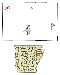
Location of Hickory Ridge in Cross County, Arkansas.
|
|
| Country | United States |
| State | Arkansas |
| County | Cross |
| Incorporated | November 7, 1949 |
| Area | |
| • Total | 0.65 sq mi (1.68 km2) |
| • Land | 0.65 sq mi (1.68 km2) |
| • Water | 0.00 sq mi (0.00 km2) |
| Elevation | 230 ft (70 m) |
| Population
(2020)
|
|
| • Total | 228 |
| • Density | 351.85/sq mi (135.94/km2) |
| Time zone | UTC-6 (Central (CST)) |
| • Summer (DST) | UTC-5 (CDT) |
| ZIP code |
72347
|
| Area code(s) | 870 |
| FIPS code | 05-31900 |
| GNIS feature ID | 2404695 |
Hickory Ridge is a small city in Cross County, Arkansas, in the United States. In 2020, about 228 people lived there. It has always been a farming community, meaning its economy relies on agriculture. The first post office opened in 1875, but the community officially became a city in 1949.
Contents
Exploring Hickory Ridge's Past
A post office in Brushy Lake Township was first named Hickory Ridge in 1875. However, it closed soon after. The area had very few people because the land was too wet for growing cotton.
Growth with the Railway
Around 1882, the Cotton Belt railway built tracks through the settlement. This brought new life to the community. Hickory Ridge began to grow thanks to its timber (wood from trees) and farming. The post office reopened in 1892.
A Difficult Past: Segregation
Historically, the city was divided by race, often along the railroad tracks. Around 1910, the town became a "sundown town". This meant that, through unwritten rules, African Americans were not allowed to live there or stay after dark. The community became entirely white.
Hickory Ridge's Location and Landscape
Hickory Ridge is located in the northwestern part of Cross County. A main road, U.S. Route 49, goes through the city. This road leads north about 37 miles (60 km) to Jonesboro. It goes south about 35 miles (56 km) to Interstate 40 near Brinkley.
Land Area
According to the United States Census Bureau, Hickory Ridge covers a total area of 1.7 square kilometers (0.65 sq mi). All of this area is land.
The Arkansas Delta Environment
Hickory Ridge is part of the Mississippi embayment. This is a flat, fertile area of land known as the Mississippi Alluvial Plain. It was formed by the Mississippi River. In Arkansas, this area is often called the Arkansas Delta.
The western part of Cross County, where Hickory Ridge is, has flat land with silty and sandy soils. These soils were carried by wind and have a high water level underground.
Local Plants and Farming
Some native trees in higher areas include Post oak and loblolly pine. In wetlands (areas with wet soil), you might find overcup oak, water hickory, willow oak, and pin oak.
Today, much of the land is used for row agriculture, mainly for growing soybeans and cotton. Aquaculture is also common. This is like farming fish, such as crawfish, baitfish, and catfish, in ponds.
Population and People of Hickory Ridge
| Historical population | |||
|---|---|---|---|
| Census | Pop. | %± | |
| 1950 | 345 | — | |
| 1960 | 364 | 5.5% | |
| 1970 | 410 | 12.6% | |
| 1980 | 478 | 16.6% | |
| 1990 | 436 | −8.8% | |
| 2000 | 384 | −11.9% | |
| 2010 | 272 | −29.2% | |
| 2020 | 228 | −16.2% | |
| U.S. Decennial Census | |||
In 2000, there were 384 people living in Hickory Ridge. The population density was about 599.6 people per square mile (231.5/km²). Most of the people living in the city were White (99.48%).
The average household had about 2.48 people. The average family had about 3.01 people.
Income and Poverty
In 2000, the typical household income was $22,778. The typical family income was $28,906. About 12.8% of the population lived below the poverty line. This included 10.5% of those under 18 and 29.3% of those 65 or older.
Education in Hickory Ridge
Students in Hickory Ridge attend public schools run by the Cross County School District. They can go all the way through high school and graduate from Cross County High School. The school's mascot is the Thunderbird.
The Cross County school district was created in 1965. It combined the school districts of Cherry Valley, Hickory Ridge, and Vanndale. Hickory Ridge used to have its own elementary school, Hickory Ridge Elementary, as part of this district.
City Services and Connections
Transportation Routes
Hickory Ridge is located where U.S. Route 49 (US 49) and Highway 42 meet. The Union Pacific Railway tracks run very close to US 49 through Hickory Ridge.
Utilities and Services
Several companies provide important services to Hickory Ridge:
- Electricity: Entergy Arkansas is the only company that provides electricity.
- Telephone: AT&T provides telephone services.
- Cable TV: East Arkansas Video offers cable television.
- Natural Gas: Centerpoint Energy provides natural gas.
The Arkansas Department of Health (ADH) makes sure that public water systems are safe. Hickory Ridge Waterworks is a small company that cleans and delivers groundwater (water from underground) to its customers.
See also
 In Spanish: Hickory Ridge (Arkansas) para niños
 | Delilah Pierce |
 | Gordon Parks |
 | Augusta Savage |
 | Charles Ethan Porter |

