
Port Henry, New York facts for kids
Quick facts for kids
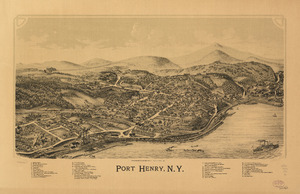
Port Henry, New York
|
|
|---|---|
|
Hamlet and CDP
|
|

Sherman Free Library
|
|

Location in Essex County and the state of New York
|
|
| Country | United States |
| State | New York |
| County | Essex |
| Town | Moriah |
| Settled | 1785 |
| Incorporated | May 1, 1869 |
| Dissolved | March 31, 2017 |
| Area | |
| • Total | 1.73 sq mi (4.48 km2) |
| • Land | 1.39 sq mi (3.60 km2) |
| • Water | 0.34 sq mi (0.88 km2) |
| Elevation | 243 ft (74 m) |
| Population
(2020)
|
|
| • Total | 1,150 |
| • Density | 826.74/sq mi (319.26/km2) |
| Time zone | UTC-5 (Eastern (EST)) |
| • Summer (DST) | UTC-4 (EDT) |
| ZIP code |
12974
|
| Area code(s) | 518 |
| FIPS code | 36-59333 |
| GNIS feature ID | 0960967 |
| Website | http://www.porthenrymoriah.com |
Port Henry is a small community called a hamlet in Essex County, New York, United States. In 2010, about 1,194 people lived there.
This hamlet is located on the eastern side of the town of Moriah. It is about an hour's drive south of Plattsburgh. Port Henry is also about 44 miles (71 km) from Burlington, Vermont, and 115 miles (185 km) north of Albany. It is 113 miles (182 km) south of Montreal, Quebec, in Canada.
Contents
History of Port Henry

Port Henry is on land that the British Crown set aside for soldiers. These soldiers fought in the Seven Years' War, also known as the French and Indian War. A mill was built here in 1765. But other European-American settlers did not arrive until 1785, after the American Revolutionary War.
The Iroquoian-speaking Mohawk and Oswegatchie people lived in the area until after 1800. They were part of the Seven Nations of Canada. Many Iroquois from New York had moved to Canada. This happened because they supported the British during the war.
In the early days, cutting down trees for timber was a big business. There were 20 mills in the area. The first dock was built on Lake Champlain by 1820. This dock helped ship lumber to other places.
Early settlers found iron ore a few miles inland. Getting and processing this iron became a very important industry for about 150 years. A blast furnace was built in Port Henry in 1822. This was one of the first in the United States. Republic Steel also had large operations in the county.
People in the village used Lake Champlain and the Hudson River to move iron and products. They sent them to big markets like Albany and New York City. Later, a railroad connected the village to these markets.
The village of Port Henry was officially created in 1869. By the late 1800s, people caught smelt fish from the lake. They used ice fishing to catch them for restaurants. Several important buildings are listed on the National Register of Historic Places. These include the Delaware & Hudson Railroad Depot and the Sherman Free Library.
On March 31, 2017, the Village of Port Henry was officially dissolved. This happened after people voted on it. The village no longer exists as its own town. Its operations were taken over by the Town of Moriah. Port Henry is still a hamlet within the larger town.
Geography


Port Henry is in the eastern part of Essex County. It is located at 44°2′43″N 73°27′40″W / 44.04528°N 73.46111°W. This hamlet is on the western shore of Lake Champlain. It is also at the northern end of Bulwagga Bay. Port Henry is part of the Adirondack Park.
According to the United States Census Bureau, Port Henry covers about 3.8 square kilometers (1.5 sq mi). About 3.0 square kilometers (1.2 sq mi) is land. The remaining 0.8 square kilometers (0.3 sq mi), or about 20%, is water. Port Henry is located on New York State Route 9N and New York State Route 22. These roads are also called North/South Main Street.
Population Information
| Historical population | |||
|---|---|---|---|
| Census | Pop. | %± | |
| 1880 | 2,494 | — | |
| 1890 | 2,436 | −2.3% | |
| 1900 | 1,751 | −28.1% | |
| 1910 | 2,266 | 29.4% | |
| 1920 | 2,183 | −3.7% | |
| 1930 | 2,040 | −6.6% | |
| 1940 | 1,935 | −5.1% | |
| 1950 | 1,831 | −5.4% | |
| 1960 | 1,767 | −3.5% | |
| 1970 | 1,532 | −13.3% | |
| 1980 | 1,450 | −5.4% | |
| 1990 | 1,263 | −12.9% | |
| 2000 | 1,152 | −8.8% | |
| 2010 | 1,194 | 3.6% | |
| 2020 | 1,150 | −3.7% | |
| U.S. Decennial Census | |||
In 2000, when Port Henry was still a village, there were 1,152 people living there. There were 491 households. Most of the people were White, making up about 97.66% of the population.
About 24.7% of the people were under 18 years old. About 19.9% were 65 years or older. The average age was 40 years. For every 100 females, there were about 94.6 males.

Transportation

Amtrak, which is the national passenger train system, serves Port Henry. The Adirondack train runs daily. It travels between Montreal, Canada, and New York City.
A few miles south of Port Henry, the Champlain Bridge was built in 1929. This bridge connected Crown Point to Vermont. In 2009, the old bridge was taken down. A temporary ferry service helped people cross the lake. A new bridge opened in November 2011 at the same spot.
Education
The area of Port Henry is part of the Moriah Central School District.
Notable People
- Tom Tyler (1903–1954), an actor who starred in Western movies.
- Wallace T. Foote Jr. a US Congressman from the 19th century.
See also
 In Spanish: Port Henry para niños
