Raperswilen facts for kids
Quick facts for kids
Raperswilen
|
||
|---|---|---|
 |
||
|
||
| Country | Switzerland | |
| Canton | Thurgau | |
| District | Kreuzlingen | |
| Area | ||
| • Total | 7.68 km2 (2.97 sq mi) | |
| Elevation | 582 m (1,909 ft) | |
| Population
(Dec 2020 )
|
||
| • Total | 416 | |
| • Density | 54.17/km2 (140.29/sq mi) | |
| Postal code |
8558
|
|
| Localities |
|
|
| Surrounded by | ||
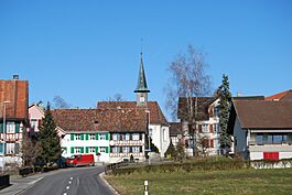
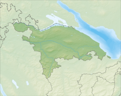
Raperswilen is a small town, also called a municipality, located in the Kreuzlingen District in the canton of Thurgau in Switzerland. It's a peaceful place with a long history and beautiful natural surroundings.
Contents
A Look Back: Raperswilen's History
Long, long ago, before written history, there were two old forts in Raperswilen. One was called Risi, built during the Bronze Age (when people used bronze tools). The other, Schanz, was likely from the Iron Age (when iron tools became common).
The village of Raperswilen was first written about in the year 1227. Back then, it was known as Raperswilar. Some small areas nearby, like Büren and Müllberg, belonged to a court in Klingenberg. Other parts, including Fischbach, Helsighausen, and Raperswilen itself, were part of the Fruthwilen court.
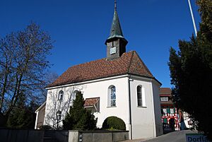
In 1529, a small chapel in Raperswilen was no longer used for religious services. Around 1560, it became a meeting place for local Protestants. From 1562, the pastor from Wigoltingen held services there. Later, from 1661 to 1798, the pastor from Lipperswil also helped. A new church was built in Raperswilen in 1766, but it was still part of the Wigoltingen church area.
An English noble, George Treherne, built Müllberg Castle between 1854 and 1866. In 1905, it was changed into a health spa where people could relax and get fresh air. Sadly, the castle burned down in 1914.
For a long time, Raperswilen's economy relied on growing fruit and farming. Later, people also raised animals for dairy, farmed, and worked in forestry. Today, Raperswilen has some companies that process wood. There are also light auto industry businesses and a mica sand pit. In 2000, more than half of the people living in Raperswilen traveled to other towns for work. By 2005, farming still provided 43% of the jobs in the municipality.
Exploring Raperswilen's Geography
Raperswilen covers an area of about 7.67 square kilometers (2.96 square miles). A large part of this land, about 67.5%, is used for farming. Forests cover another 27.4% of the area. The remaining 5.1% is where buildings and roads are located.
Most of the built-up area is used for industrial buildings. A smaller part is for homes and other buildings, and some is for transportation like roads. All of the forested land is covered with thick forests. On the farms, most of the land is used for growing crops. A smaller part is used for orchards, where fruit trees grow.
The municipality is located in the Kreuzlingen District. It sits in the Seerücken hills, which are a range of hills. Raperswilen includes the main village and smaller hamlets like Büren, Fischbach, Helsighausen, Müllberg, and Sonnenberg.
Who Lives in Raperswilen? Demographics
Raperswilen has a population of about 400 people. In 2008, about 4.5% of the people living there were from other countries. Over ten years, from 1997 to 2007, the population decreased by about 13.6%. Most people in Raperswilen speak German (97.9%). A small number speak French (0.7%) or Portuguese (0.5%).
In 2008, about 48.1% of the population was male and 51.9% was female. Most of the people were Swiss citizens. In 2008, there was 1 birth to Swiss citizens and 4 deaths of Swiss citizens. This means the number of Swiss citizens went down by 3 that year, not counting people moving in or out.
The age groups in Raperswilen in 2009 were:
- Children (0-9 years old): 11.2%
- Teenagers (10-19 years old): 12.7%
- Young adults (20-29 years old): 10.7%
- Adults (30-39 years old): 11.4%
- Adults (40-49 years old): 16.9%
- Adults (50-59 years old): 15.9%
- Seniors (60-69 years old): 10.7%
- Seniors (70-79 years old): 6.0%
- Seniors (80-89 years old): 4.2%
- Seniors (90 and older): 0.2%
In 2000, there were 146 homes in Raperswilen, with about 2.8 people living in each home. Most of the buildings were single-family homes (85.3%). There were also some two-family and three-family buildings.
Many people lived as couples with children (60.1%) or as couples without children (23.0%). Some people lived in single-parent homes (6.6%). In 2008, about 1.23% of homes were empty. In 2007, 2.5 new homes were built for every 1000 residents.
In the 2007 Swiss federal election, the most popular political party was the SVP, which received 67.75% of the votes. Other popular parties included the FDP (7.99%), the CVP (7.4%), and the Green Party (7%). About 56.9% of eligible voters participated in the election.
The table below shows how Raperswilen's population has changed over time:
| year | population |
|---|---|
| 1850 | 446 |
| 1900 | 430 |
| 1950 | 402 |
| 1980 | 287 |
| 1990 | 354 |
| 2000 | 426 |
Raperswilen's Economy
In 2007, Raperswilen had a very low unemployment rate of 0.86%. This means almost everyone who wanted a job had one.
In 2005, many people worked in the primary economic sector, which includes farming and forestry. There were 63 people working in this area across 26 businesses. The secondary sector, which involves manufacturing and construction, employed 51 people in 8 businesses. The tertiary sector, which includes services like shops and offices, had 32 people working in 10 businesses.
In 2000, 304 people lived in Raperswilen and worked. About 39.5% of these residents traveled outside Raperswilen for their jobs. At the same time, 29 people came into Raperswilen to work. There were a total of 213 jobs available in the municipality. Of the people who worked, 5% used public transportation to get to their jobs, and 46.2% drove their own cars.
Religion in Raperswilen
Based on the 2000 census, about 17.4% of the people in Raperswilen were Roman Catholic. A larger group, about 70.4%, belonged to the Swiss Reformed Church. A small number of people belonged to other Christian churches, including the Orthodox Church. There were also a few people who were Islamic. About 4.93% of the population said they did not belong to any church, or were agnostic or atheist.
Education in Raperswilen
In Raperswilen, a good number of adults (between 25 and 64 years old) have completed higher education. About 69.3% of them have finished either non-mandatory upper secondary education or even higher education, like university or a specialized college. This shows a strong focus on learning in the community.
See also
 In Spanish: Raperswilen para niños
 | Aurelia Browder |
 | Nannie Helen Burroughs |
 | Michelle Alexander |


