Rattling Run (Catawissa Creek tributary) facts for kids
Quick facts for kids Rattling Run |
|
|---|---|

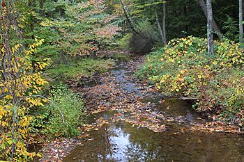
Rattling Run looking downstream near its mouth
|
|
| Physical characteristics | |
| Main source | Southern border of Brandonville in East Union Township, Schuylkill County, Pennsylvania 1,280 to 1,300 feet (390 to 400 m) |
| River mouth | Catawissa Creek in East Union Township, Schuylkill County, Pennsylvania 882 ft (269 m) 40°51′59″N 76°11′41″W / 40.8663°N 76.1948°W |
| Length | 2.4 mi (3.9 km) |
| Basin features | |
| Progression | Catawissa Creek → Susquehanna River → Chesapeake Bay |
| Basin size | 2.28 sq mi (5.9 km2) |
| Tributaries |
|
Rattling Run is a small stream, also called a tributary, that flows into Catawissa Creek in Schuylkill County, Pennsylvania. It's about 2.4 miles (3.9 km) long. This stream is special because it's known as a great place for coldwater fish, especially trout. It's even called "Class A Wild Trout Waters," which means it's a top spot for wild trout.
Contents
The Stream's Journey
Rattling Run starts its journey near a town called Brandonville in East Union Township. It first flows north and a little west. Then, it turns west and slightly south, entering a narrow valley.
After flowing for more than a mile, the stream changes direction again. It heads north-northwest, then north-northeast, and even crosses a road called Pennsylvania Route 339. Finally, it turns west-northwest and soon joins the larger Catawissa Creek. Rattling Run meets Catawissa Creek about 26.32 miles (42.36 km) before Catawissa Creek reaches its own end.
Side Streams
Rattling Run doesn't have any named side streams or "tributaries." However, it does have two smaller, unnamed streams that flow into it. These are known by their official numbers: "Trib 27594 To Rattling Run" and "Trib 27595 To Rattling Run."
Water Quality
The water in Rattling Run is naturally a bit acidic and doesn't have many nutrients. This means it could be affected by acid rain, which is rain that has become more acidic due to pollution.
Scientists have measured the water quality:
- The water's alkalinity (how well it can fight off acid) is 5 milligrams per liter.
- The pH of the stream is 6.6, which is slightly acidic but close to neutral.
- The total hardness of the water is 22 milligrams per liter. This tells us how many minerals are dissolved in the water.
In 1997, measurements were taken near the stream's mouth. The air temperature was 22°C (72°F), and the water temperature was 13.2°C (55.8°F). The specific conductivity of the water was 81 umhos, which shows how well the water conducts electricity, giving clues about what's dissolved in it.
Land and Rocks
The land around Rattling Run is quite interesting. The stream's mouth is about 882 feet (269 meters) above sea level. Where the stream begins, its elevation is even higher, between 1,280 and 1,300 feet (390 and 396 meters) above sea level.
The stream flows over a type of rock called the Mauch Chunk Formation. This rock is made up of different materials like siltstone, sandstone, reddish-gray shale, and conglomerate (which is like a mix of pebbles and sand stuck together). In the southern part of the area, you can also find rocks from the Pottsville Formation. The soil near the lower part of the stream is called Leck Kill soil, while the upper parts have Hazleton soil.
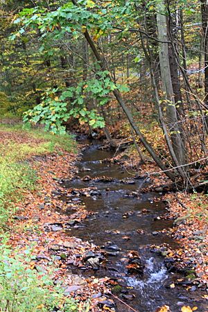
Rattling Run is a small stream, about 3.0 meters (9.8 ft) wide. It flows downhill quite steeply, dropping about 33.0 meters for every kilometer it travels. The valley around the stream is narrow and mostly covered in forests. This means there aren't many places that would flood easily, even during a big "100-year flood."
The Stream's Area
The entire area that drains into Rattling Run is called its watershed. This watershed covers about 2.28 square miles (5.91 km2). Most of this area is in North Union Township, but parts are also in East Union Township. Smaller sections are in Mahanoy Township and West Mahanoy Township.
Some farmland can be found in the Rattling Run watershed. There's also a police station or fire station near where the stream starts. A good portion of the stream runs close to roads: about 25 percent of its length is within 100 meters (330 ft) of a road, and 42 percent is within 300 meters (980 ft). More than half, 56 percent, is within 500 meters (1,600 ft) of a road.
Rattling Run is located in the Shenandoah area, according to the United States Geological Survey maps.
Stream Life
Rattling Run is a very important place for fish. The Pennsylvania Department of Environmental Protection calls it a "High-Quality Coldwater Fishery." This means it's a great habitat for fish that need cold, clean water. The Pennsylvania Fish and Boat Commission also calls it "Class A Wild Trout Waters," which is the highest rating for streams with wild trout.
Three different kinds of fish live in Rattling Run:
- brook trout
- eastern blacknose dace
- sculpins
The stream is home to many wild brook trout. Scientists measure the amount of fish in an area, which they call biomass. For Rattling Run, the biomass of wild brook trout is 56.64 kilograms per hectare. This includes both smaller trout (less than 175 millimeters long) and larger ones (more than 175 millimeters long). The trout found here range in size from 25 to 224 millimeters. There are hundreds of trout per kilometer of stream!
In 1997, a report said that Rattling Run was an excellent place for angling, which means fishing with a rod and line.
 | Delilah Pierce |
 | Gordon Parks |
 | Augusta Savage |
 | Charles Ethan Porter |


