
Rekingen facts for kids
Quick facts for kids
Rekingen
|
||
|---|---|---|
 |
||
|
||

Rekingen
Location in Switzerland

Rekingen
Location in Canton of Aargau
|
||
| Country | Switzerland | |
| Canton | Aargau | |
| District | Zurzach | |
| Area | ||
| • Total | 3.10 km2 (1.20 sq mi) | |
| Elevation | 338 m (1,109 ft) | |
| Population
(December 2005)
|
||
| • Total | 953 | |
| • Density | 307.4/km2 (796.2/sq mi) | |
| Postal code |
5332
|
|
| Surrounded by | Baldingen, Böbikon, Küssaberg (DE-BW), Mellikon, Tegerfelden, Zurzach | |

Rekingen is a village that used to be its own town (called a municipality) in Switzerland. It is located in the Aargau canton, which is like a state in Switzerland. Rekingen is part of the Zurzach district.
On January 1, 2022, Rekingen joined with several other nearby towns. These towns were Bad Zurzach, Baldingen, Böbikon, Kaiserstuhl, Rietheim, Rümikon, and Wislikofen. They all became part of a new, larger municipality called Zurzach.
Contents
History of Rekingen

People have lived in the area around Rekingen for a very long time. In 1956, archaeologists found the remains of an old Roman estate. This was like a large farm or villa from the time when the Roman Empire was in Switzerland. The bricks used to build it came from Roman armies (the 11th and 21st Legions) stationed in a place called Vindonissa.
Later, more digging uncovered graves from the Alamanni people. They were a group of Germanic tribes who lived in this region after the Romans.
The first time Rekingen was written about was in 1261. It was called Rechunch back then. For many years, from 1415 to 1798, Rekingen was under the control of a court in Baden. This court handled serious crimes. Less serious local matters were managed by the Bishop of Constance.
During the Protestant Reformation, a time when many people changed their religious beliefs, most people in Rekingen became Protestant.
In 1678, two priests from Zurzach built a house and a small church called the Metzgerhof. The chapel was later closed as a church in 1878. Since 1980, an old building that used to press grapes for wine has been used as a special chapel. It is used by different Christian groups together, which is called ecumenical. In 1790, the village school separated students based on their religion. But in 1852, it became one school again.
For a long time, most people in Rekingen worked in farming and viticulture, which means growing grapes for wine. In the Middle Ages, there were also three mills and a brick factory.
In 1876, Rekingen got a train station. This connected the village to the main railway line between Koblenz and Winterthur. Over the years, different factories operated in Rekingen. A factory that made lime (a material used in building) was open from 1864 to 1989. There was also a cement plant from 1975 to 1995 and a hardware factory from 1955 to 2001. In 1914, a soda factory called Swiss Sodafabrik opened. Its name changed to Solvay in 1922. This factory was partly in Rekingen and partly in Zurzach.
Geography and Landscape

Rekingen covers an area of about 3.1 square kilometers (about 1.2 square miles). A large part of this area, about 57.4%, is covered by forests. About 13.9% of the land is used for farming.
Buildings and roads take up about 25.5% of the land. This includes industrial buildings, houses, and transportation areas. About 3.9% of the area is made up of rivers or lakes. All the water in the area is flowing water, like streams and rivers.
The village of Rekingen is located in the Zurzach district. It sits along the Rhine river, near the Böbikon valley. Rekingen is a haufendorf village. This means it's an old type of village that grew without a clear plan. Its buildings are often close together around a central area.
Coat of Arms
The coat of arms for Rekingen has a special design. It is split into two parts. The top part is gold and has a black letter "R" on it. The bottom part is blue and shows half of a gold mill wheel.
People and Population

As of 2008, Rekingen had a population of 953 people. About 37.1% of the people living there were foreign nationals. Over ten years, from 1997 to 2007, the number of people living in Rekingen went down by about 4.7%.
Most people in Rekingen speak German, about 84.2% of the population. The second most common language is Albanian, spoken by 5.8% of the people. Italian is the third most common language, spoken by 3.8%.
In 2008, there were slightly more men than women in Rekingen. About 50.6% of the population were male, and 49.4% were female.
The age groups in Rekingen in 2008 were:
- Children (0-9 years old): 9.4%
- Teenagers (10-19 years old): 16.9%
- Young adults (20-29 years old): 11.4%
- Adults (30-39 years old): 11.3%
- Adults (40-49 years old): 18.9%
- Adults (50-59 years old): 15.8%
- Seniors (60-69 years old): 9.3%
- Older seniors (70-79 years old): 4.1%
- Very old seniors (80-89 years old): 2.4%
- Eldest seniors (90 and older): 0.5%
In 2000, there were 362 homes in Rekingen. On average, about 2.7 people lived in each home. In 2008, most homes were single-family houses, making up about 59.4% of all homes and apartments.
The population of Rekingen has changed over time:
| Historical population | ||
|---|---|---|
| Year | Pop. | ±% |
| 1780 | 259 | — |
| 1850 | 348 | +34.4% |
| 1900 | 270 | −22.4% |
| 1950 | 710 | +163.0% |
| 1990 | 877 | +23.5% |
| 2000 | 998 | +13.8% |
Economy and Jobs
In 2007, Rekingen had a low unemployment rate of 1.58%. This means most people who wanted to work had jobs.
Jobs are often grouped into three main types:
- Primary sector: This includes jobs that get raw materials from nature, like farming or forestry. In 2005, 8 people worked in this sector in Rekingen.
- Secondary sector: This involves making things, like in factories. 14 people worked in this sector.
- Tertiary sector: This includes jobs that provide services, like shops, offices, or schools. 227 people worked in this sector.
In 2000, many people who lived in Rekingen worked outside the village. About 86.2% of the residents commuted (traveled) to jobs in other places. Only 36 people came into Rekingen for work.
Most people used private cars to get to work (61.4%). About 13.5% used public transportation like trains or buses.
Religion
According to the 2000 census, people in Rekingen followed different religions:
- About 41.2% were Roman Catholic.
- About 33.8% belonged to the Swiss Reformed Church (a Protestant church).
- A very small number, about 0.20%, belonged to the Christian Catholic Church of Switzerland.
Education
Education is important in Rekingen. About 69.6% of adults (aged 25–64) have completed higher education. This means they finished either non-mandatory upper secondary school or went on to university or a specialized college.
In the 2008/2009 school year, there were 73 students attending primary school in Rekingen. There were also 62 students attending secondary school in the municipality.
Transport
Rekingen has a train station called Rekingen AG railway station. It is served by the Zurich S-Bahn line S36. This train line connects Bülach and Waldshut, making it easy for people to travel to nearby towns.
Images for kids
-
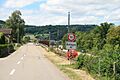
Rekingen village
See also
 In Spanish: Rekingen para niños
