River Alde facts for kids
Quick facts for kids Alde and Ore |
|
|---|---|

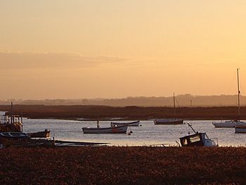
The river at Aldeburgh
|
|
|
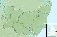
Location of the river mouth within Suffolk
|
|
| Country | England |
| Region | Suffolk |
| Physical characteristics | |
| Main source | Brundish 60 m (200 ft) 52°16′48″N 1°18′17″E / 52.2799°N 1.3048°E |
| 2nd source | Saxstead 57 m (187 ft) 52°15′02″N 1°18′02″E / 52.2505°N 1.3006°E |
| River mouth | North Sea 0 m (0 ft) 52°02′24″N 1°27′39″E / 52.0401°N 1.4607°E |
| Length | 54.4 km (33.8 mi) |
The River Alde and River Ore are two rivers that connect to form one system in Suffolk, England. They flow past well-known places like Snape and Aldeburgh. What's interesting is that the river changes its name along its journey!
The River Alde and River Ore meet each other northwest of Blaxhall. From this meeting point, the combined river is known as the River Alde. It continues past Snape and Aldeburgh. Then, as it gets closer to Orford, it changes its name again to the River Ore. This final section flows by a long shingle spit before emptying into the North Sea.
Both rivers get their names from important towns along their route. The Alde is named after Aldeburgh, and the Ore is named after Orford. This is a special way of naming called "back-formation." It means the town gave its name to the river, not the other way around.
Contents
The River Ore's Journey
The first part of the River Ore flows for about 18 kilometers (11 miles). It starts west of Dennington and then travels south and east. It passes through towns like Framlingham, Parham, and Marlesford. Finally, it meets the River Alde to the northwest of Blaxhall.
The River Alde's Journey
The source (where it begins) of the River Alde is at Brundish, near Laxfield. This area is also close to where the River Blyth starts. Soon after the River Alde joins with the River Ore, it reaches Snape. At Snape, the river becomes tidal, meaning its water level changes with the ocean's tides. It also gets much wider here.
The river then winds its way east past Aldeburgh. After Aldeburgh, it turns south and flows parallel to the coastline. It runs behind a narrow strip of shingle (small, rounded stones).
The Final Stretch: River Ore Again
The River Ore is the name for the final section of the river, which is about 11 kilometers (7 miles) long. This part stretches from just above Orford all the way to the sea. It has one smaller river that flows into it, called the Butley River. You can find Havergate Island where these two rivers meet.
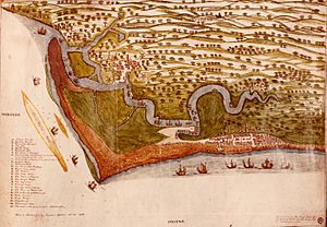
Long ago, the river used to enter the sea closer to Orford. However, over hundreds of years, shingle has built up. This has pushed the river's mouth about five miles (8 km) further south.
A Look Back in Time
During the Tudor period (a time in English history), the river was an important port. Four ships were launched from here to help fight against the Spanish Armada! Today, the river is no longer used as a commercial port for big ships. Instead, it's a popular place for yacht sailing and other water sports.
Nature and Protection
The lower parts of the river flow through marshland and shingle or sand beaches. Most of this land is now owned by the National Trust, a charity that protects special places. This area is known as the "Orford Ness National Nature Reserve."
Before the National Trust took over, this land was a secret military base. During the Cold War, important tests for a special type of radar called Cobra Mist were carried out here. This radar could "see" over the horizon.
The long shingle spit that blocks the river is called Orford Ness. It is now about 10 miles (16 km) long and is also owned by the National Trust. The main area where the Rivers Alde and Ore flow is open countryside. Much of this land is privately owned and used for growing crops.
The parts of the river affected by tides (below Snape Bridge) are very special. They are part of the Suffolk Coast and Heaths Area of Outstanding Natural Beauty. This means the area is protected for its beautiful landscape. It's also a Site of Special Scientific Interest, a Special Area of Conservation, and a Special Protection Area. These titles show how important the area is for wildlife and nature.
An RSPB (Royal Society for the Protection of Birds) reserve, called Boyton Marshes, is located between the River Ore and the Butley River. There's also a charity called the Alde & Ore Association. This group works to "preserve and protect for the public benefit the Alde, Ore and Butley Creek rivers and their banks from Shingle Street to their tidal limits." They help keep the rivers and their surroundings healthy and beautiful for everyone.
The novel What I Was by Meg Rosoff is set on the coastline where the River Ore meets the sea.
Alde Mudflats
There is an area of mudflats that covers about 22 hectares (54 acres) on the southern side of the river, near Iken. This area is managed by the Suffolk Wildlife Trust as their Alde Mudflats nature reserve. To protect the wildlife, people are not allowed to access this land.
 | James Van Der Zee |
 | Alma Thomas |
 | Ellis Wilson |
 | Margaret Taylor-Burroughs |


