Rothwell, Queensland facts for kids
Quick facts for kids RothwellQueensland |
|||||||||||||||
|---|---|---|---|---|---|---|---|---|---|---|---|---|---|---|---|
| Population | 7,538 (2021 census) | ||||||||||||||
| • Density | 746/km2 (1,930/sq mi) | ||||||||||||||
| Postcode(s) | 4022 | ||||||||||||||
| Area | 10.1 km2 (3.9 sq mi) | ||||||||||||||
| Time zone | AEST (UTC+10:00) | ||||||||||||||
| Location |
|
||||||||||||||
| LGA(s) | City of Moreton Bay | ||||||||||||||
| Region | South East Queensland | ||||||||||||||
| State electorate(s) |
|
||||||||||||||
| Federal Division(s) | Petrie | ||||||||||||||
|
|||||||||||||||
Rothwell is a coastal suburb located in the City of Moreton Bay, Queensland, Australia. It is part of the greater Brisbane area. In 2021, about 7,538 people lived in Rothwell.
Contents
Exploring Rothwell's Location
Rothwell is on the western side of the Redcliffe Peninsula. It is about 28 kilometers (17 miles) north-northeast of Brisbane, which is the capital city of Queensland.
The suburb has natural borders. To the north, it meets Deception Bay, which is part of Moreton Bay. To the south and southwest, it is bordered by Saltwater Creek. Part of its eastern border is Nathan Road.
Roads and Railways in Rothwell
Anzac Avenue is a main road that comes into Rothwell from the east, from Kippa-Ring. It then goes west. At a big intersection, Anzac Avenue turns southwest towards Mango Hill. From this same intersection, Deception Bay Road heads northwest towards the suburb of Deception Bay.
The Redcliffe Peninsula railway line also runs through Rothwell. It enters from Kippa-Ring in the east and leaves to Mango Hill in the south. This line connects to the main North Coast railway line at Petrie. Rothwell has its own train station called Rothwell railway station.
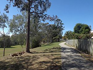
Right next to the railway line, there is a 12.6-kilometer (7.8-mile) path called the Moreton Bay Railway Cyclepath. It's a great place for cycling and walking.
Redcliffe Aerodrome and Local Parks
In the northeast part of Rothwell, you'll find Redcliffe Aerodrome. This airport is owned and managed by the Moreton Bay City Council.
Some areas in Rothwell, especially near Saltwater Creek in the south, can experience flooding. Because of this, some parts of the suburb are not developed. Rothwell Park, located on McGahey Street, is one area that sometimes floods. There have been plans to move the sports fields from this park for several years.
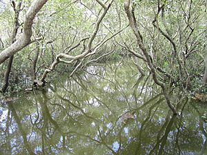
The Nathan Road Wetlands Reserve is a large undeveloped area in the north of Rothwell, next to the Redcliffe Aerodrome. Even though Rothwell is a bayside suburb, there are no roads or paths through these wetlands to reach the bay.
A Look at Rothwell's Past
In the late 1880s, when this area was known as Deception Bay, there was an attempt to sell land called the Isle of Man estate. This land was surrounded by Saltwater Creek. It was advertised as being close to a planned railway line to Redcliffe. However, the land was never sold or built on. Even though it appeared on maps for many years, by 2020, it had returned to being one large, undeveloped piece of land. This might be because Saltwater Creek often floods.
How Rothwell Got Its Name
The suburb of Rothwell is named after Thomas James Rothwell. He was the president of the Royal Automobile Club of Queensland. In 1921, he suggested creating a special memorial drive to Redcliffe. This drive would be lined with trees along the main road, which is now known as Anzac Avenue.
Thomas Rothwell passed away in 1928. To honor his work with Anzac Avenue, a stone monument was unveiled on April 9, 1933, by the Queensland Governor, Sir Leslie Wilson. This monument was first placed at the intersection of Anzac Memorial Avenue and Deception Bay Road. Later, when a roundabout was built there, the monument was moved to nearby Rothwell Park.
Rothwell was officially named as a suburb by the Queensland Place Names Board on July 1, 1970.
Schools and Development
Grace Lutheran College first opened on January 31, 1978, with only 15 students. It started at Grace Lutheran Primary School in Clontarf. In 1980, the college moved to its current location in Rothwell.
Mueller College was founded on January 30, 1990, by the Mueller Community Church.
In 2015, the Moreton Bay Regional Council began a big project to build the Nathan Road Sports Ground in Kippa-Ring. This new sports ground was created to replace the AFL (Australian Rules Football) facility at Rothwell Park, which often flooded. The new facility was completed in 2020.
Who Lives in Rothwell?
In the 2011 census, Rothwell had a population of 6,683 people. About 52.8% were female and 47.2% were male. The average age of people in Rothwell was 36 years old, which was slightly younger than the national average of 37.
Most people living in Rothwell, about 73.5%, were born in Australia. Other common birthplaces included New Zealand (5.8%) and England (5.4%). Most people (87.7%) spoke only English at home. Other languages spoken included Samoan, Afrikaans, Hindi, Vietnamese, and Dutch.
By the 2016 census, Rothwell's population had grown to 7,165 people. In the most recent 2021 census, the population increased further to 7,538 people.
Places of Historical Importance
Rothwell has one site listed for its historical importance:
- Anzac Avenue (the road itself)
Learning in Rothwell
Rothwell is home to two private schools:
- Grace Lutheran College is a private high school for students from Year 7 to Year 12. It is located on Anzac Avenue and Mewes Road. In 2017, the school had 1,361 students.
- Mueller College is a private school that teaches students from Prep (kindergarten) all the way through to Year 12. It is located at 75 Morris Road. In 2017, Mueller College had 1,451 students.
There are no government schools directly in Rothwell. The closest government primary schools are Hercules Road State School in Kippa-Ring and Deception Bay State School in Deception Bay. The nearest government high school is Deception Bay State High School in Deception Bay.
Shopping and Services
Rothwell is mainly a place where people live, but it also has a growing area with shops and businesses. You can find "The Zone" here, which has many different retail stores. There's a Woolworths supermarket near The Zone on Deception Bay Road. A Bunnings Warehouse is also located on Anzac Avenue. For bigger shopping centers and more supermarkets, people often visit nearby Kippa-Ring and Deception Bay.
Sports in Rothwell
If you're into sports, Rothwell has a few local clubs. These include the Redcliffe Cougars softball club and the Redcliffe Tigers AFC, which is an Australian Rules Football club.
 | Precious Adams |
 | Lauren Anderson |
 | Janet Collins |


