
Roy, Utah facts for kids
Quick facts for kids
Roy, Utah
|
|
|---|---|

Roy Municipal Center
|
|

Location in Weber County and the state of Utah
|
|
| Country | United States |
| State | Utah |
| County | Weber |
| Settled | 1873 |
| Incorporated | March 10, 1937 |
| Named for | Roy Peebles |
| Government | |
| • Type | Mayor-council government |
| Area | |
| • Total | 8.14 sq mi (21.07 km2) |
| • Land | 8.13 sq mi (21.07 km2) |
| • Water | 0.00 sq mi (0.00 km2) |
| Elevation | 4,377 ft (1,334 m) |
| Population
(2020)
|
|
| • Total | 39,306 |
| • Estimate
(2023)
|
39,064 |
| • Density | 4,828.75/sq mi (1,865.50/km2) |
| Time zone | UTC-7 (Mountain (MST)) |
| • Summer (DST) | UTC-6 (MDT) |
| ZIP codes |
84067, 84401
|
| Area code(s) | 385, 801 |
| FIPS code | 49-65110 |
| GNIS feature ID | 2411009 |
| Website | Roy City |
Roy is a city in Weber County, Utah, United States. It is located on the west side of Interstate 15. In 2020, about 39,306 people lived in Roy. This was an increase from 36,884 people in 2010.
Roy is part of the larger Ogden−Clearfield Metropolitan Statistical Area. It is often seen as a suburb of the nearby city of Ogden. Roy also has some small businesses.
Contents
Discover the History of Roy
Roy was first settled in 1873 by William Evans Baker, Esther Celestia Cole Baker, and their children. This was 25 years after the city of Ogden was founded. Many communities to the east and south of Roy were already settled by then.
How Roy Got Its Name
Roy was known by different names before it became "Roy." Some of these names were Central City, Sandridge, the Basin, and Lakeview. The city was finally named after a child of a local schoolteacher, Roy C. Peebles, who had passed away. On May 24, 1894, a post office was opened, and the name Roy became official. The City of Roy officially became an incorporated city on March 10, 1937. Joseph William Jensen was the first mayor of Roy. He was elected by commissioners and served for six years.

Roy's Growth During World War II
Roy did not have many businesses until the early 1940s. There was a gas station, a few grocery stores, a cafe, and a lumberyard. However, Roy grew very quickly during World War II. Many workers and military staff from nearby bases lived in Roy. These bases included Hill Air Force Base, the Navy Supply Depot (now called the Freeport Center), and the Defense Supply Depot.
In September 1953, Roy reached an important milestone. It received permission to open Utah's first branch bank. This branch of the Bank of Utah helped other banks open branches in the state. Norton Parker, the son of Mayor Dean Parker, was the first manager of this new bank branch.
Roy's population grew a lot in the 1950s and 1960s. During this time, many new homes were built on the east side of the city. Starting in the 1980s, new homes were built on the west side of Roy. This continued until about 2005.
Getting Around Roy
The city is served by Interstate 15. You can get to Roy using exit 338, which leads to Utah State Route 97 (5600 South). This is one of Roy's main roads. The northern entrance of Hill Air Force Base is also close to this exit. This makes Roy a common place for military members to live.
Public Transportation in Roy
The FrontRunner train has a station in Roy. It opened on April 26, 2008, along with the rest of the northern part of the line. Two sets of train tracks run through the city at 2700 West. These tracks are used by the FrontRunner and Union Pacific Railroad.
Fun Things to Do in Roy
Roy has many activities and places for everyone to enjoy.
Parks in Roy
Roy has several parks where you can play and relax:
- Roy West Park
- Emma Russell Park
- George E. Wahlen Park
- Municipal Park (next to Municipal Elementary)
- Sand Ridge Park
- Foxglen Park
- McCall Park
- Frank Tremea (Roy) Park
- Roger Phil Burnett Meadow Creek Pond
- Memorial Park
Recreation Centers
The Roy City Recreation Complex is located on the campus of Roy High School. It has a swimming pool, basketball courts, a weight room, racquetball courts, and an indoor track. The Roy Aquatic Center is an outdoor swimming area. It has a diving pool, a children's pool, and two slides.
Roy Days Celebration
Roy Days is a special celebration held in the first week of August. During this week, Roy West Park becomes a center for carnival rides and food. Events include a car show and a golf tournament. The celebration ends on Saturday with a 5K run, a parade, and a fireworks show.
Schools in Roy
All schools in Roy are part of the Weber School District. There are six elementary schools, two junior high schools, and one high school.
Students from Lakeview Elementary, Municipal Elementary, and Roy Elementary attend Roy Junior High. Students from North Park Elementary, Valley View Elementary, and Midland Elementary usually go to Sand Ridge Junior High. However, some students from Midland Elementary go to Roy Junior High. All students, including those from West Haven Elementary, attend Roy High School. Roy High School is a Region 6A high school.
Roy's Location and Climate
Roy covers about 7.6 square miles (19.7 square kilometers) of land. To the west of Roy is Hooper. To the north is West Haven. To the east are Riverdale and Ogden. The cities of Clinton and Sunset in Davis County border Roy to the south.
Weather in Roy
Roy is in an area called the Wasatch Front. This area has different temperatures throughout the year and is generally dry. April or May is usually the wettest month, and July is the driest. Yearly temperatures usually reach between 95 and 99 degrees Fahrenheit (35 to 37 degrees Celsius). The lowest yearly temperatures are around 0 to 15 degrees Fahrenheit (-17 to -9 degrees Celsius).
People of Roy
In 2020, there were 39,306 people living in Roy. The city had about 4,823 people per square mile.
Diversity in Roy
Most people in Roy are White. There are also people from other backgrounds, including African American, Native American, Asian, and Pacific Islander. Many people in Roy are also of Hispanic or Latino heritage.
Age and Households
About 29.3% of the population in Roy is under 18 years old. Most people, about 59.3%, are between 18 and 64 years old. About 11.4% of the population is 65 years or older. The average age in Roy is 31.8 years.
There are about 12,944 households in Roy. Most of these, about 75.8%, are families. The average household size is 3.04 people. Many households, about 41.5%, have children under 18. Most homes in Roy, about 81.2%, are owned by the people who live in them.
Education in Roy
Out of adults 25 years or older in Roy:
- About 6.3% have not finished high school.
- About 36.9% have a high school diploma.
- About 38.2% have some college education or an associate degree.
- About 13.7% have a bachelor's degree.
- About 4.8% have a graduate or professional degree.
Famous People from Roy
- Gina Barberi: A radio DJ and co-host of the "Radio from Hell" show on KXRK 96.3FM in Salt Lake City.
- Sabra Johnson: The winner of season 3 of So You Think You Can Dance. She lived in Roy before moving to New York City.
- Jim McMahon: A famous quarterback who led the Chicago Bears to win Super Bowl XX.
- Randal Quarles: A former Under Secretary of the Treasury and Executive Director of the International Monetary Fund.
- Bill Schuffenhauer: A three-time Olympian and silver medalist in bobsled with the United States Olympics team.
- L'Wren Scott: A fashion designer and partner of Mick Jagger.
Images for kids
-
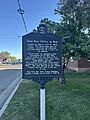
A plaque describing the nature of the first post office in Roy City, Utah.
See also
 In Spanish: Roy (Utah) para niños
