Sasebo facts for kids
Quick facts for kids
Sasebo
佐世保市
|
|||||||||||
|---|---|---|---|---|---|---|---|---|---|---|---|
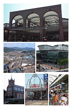
Sasebo Station, Huis Ten Bosch, Arkas Sasebo, Kuroshima Church, Sasebo Yonkacho, Yosakoi Sasebo Matsuri
|
|||||||||||
|
|||||||||||
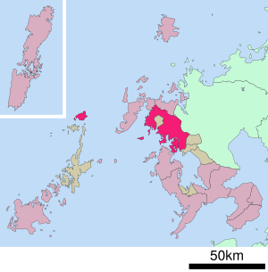
Location of Sasebo in Nagasaki Prefecture
|
|||||||||||
| Country | Japan | ||||||||||
| Region | Kyushu | ||||||||||
| Prefecture | Nagasaki | ||||||||||
| Area | |||||||||||
| • Total | 426.01 km2 (164.48 sq mi) | ||||||||||
| Population
(April 1, 2024)
|
|||||||||||
| • Total | 230,873 | ||||||||||
| • Density | 541.943/km2 (1,403.625/sq mi) | ||||||||||
| Time zone | UTC+09:00 (JST) | ||||||||||
| City hall address | 1–10 Hachiman, Sasebo-shi, Nagasaki-ken 857-8585 | ||||||||||
| Climate | Cfa | ||||||||||
|
|||||||||||
Sasebo (佐世保市, Sasebo-shi) is an important city in Nagasaki Prefecture, Japan. It is the second-largest city in the prefecture, right after its capital, Nagasaki. As of April 1, 2024, Sasebo had about 230,873 people living in 102,670 homes. The city covers an area of about 426 square kilometers.
Contents
Exploring Sasebo's Location
Sasebo is located in the northwestern part of Kyushu, a large island in Japan. It sits in the northern part of Nagasaki Prefecture. The city stretches from the base to the middle and southern parts of the Kitamatsuura Peninsula. It is about 50 kilometers north of Nagasaki City.
The western, southwestern, and southern parts of Sasebo face the sea. To the east, it shares a border with Saga Prefecture. The city also includes Ukujima, an island at the northern end of the Goto Islands. Sasebo has many hills, similar to Nagasaki City, but not as steep. Because mountains are close to the city center, bicycles are not commonly used for getting around. Some areas of Sasebo are part of the beautiful Saikai National Park.
Nearby Towns and Cities
Sasebo is surrounded by several other towns and cities.
- In Nagasaki Prefecture, it borders:
* Hasami * Hirado * Kawatana * Matsuura * Ojika * Saikai * Saza
- In Saga Prefecture, it borders:
* Imari * Arita
Sasebo's Weather
Sasebo has a humid subtropical climate. This means it has hot, humid summers and cool winters. The weather is similar to places like Norfolk, Virginia, in the United States.
The rainy season in Sasebo usually lasts from early June to mid-July. During winter, there might be light snowfall and some freezing temperatures. It rains quite a lot throughout the year, but less in winter.
People of Sasebo
Based on the Japanese census data, Sasebo had 243,223 people living there in 2020. The city has been counting its population since 1920.
| Historical population | ||||||||||||||||||||||||||||||||||||||||||||||||||||||||||||||||||||||
|---|---|---|---|---|---|---|---|---|---|---|---|---|---|---|---|---|---|---|---|---|---|---|---|---|---|---|---|---|---|---|---|---|---|---|---|---|---|---|---|---|---|---|---|---|---|---|---|---|---|---|---|---|---|---|---|---|---|---|---|---|---|---|---|---|---|---|---|---|---|---|
|
|
|||||||||||||||||||||||||||||||||||||||||||||||||||||||||||||||||||||
| Sasebo population statistics | ||||||||||||||||||||||||||||||||||||||||||||||||||||||||||||||||||||||
Sasebo's Past
The area where Sasebo is today was once part of an old province called Hizen Province. It was a small fishing village until the Meiji period began.
Admiral Tōgō Heihachirō of the Imperial Japanese Navy chose Sasebo as a navy base location. He picked it because it had a safe, deep harbor. It was also close to China and Korea, and there were coal fields nearby. The Sasebo Naval District was started in 1886. It became a very important port for the Japanese navy during the First Sino-Japanese War and the Russo-Japanese War.
Sasebo remained a major naval base until the end of World War II. The navy also built the Sasebo Naval Arsenal there. This included large shipyards and repair facilities.
After World War II, parts of the base were taken over by the United States Navy. This became U.S. Fleet Activities Sasebo. Some parts of the base are shared with the Japan Self-Defense Forces. This includes the JMSDF. The main base for the JGSDF's Western Army Infantry Regiment is also in Sasebo.
The village of Sasebo officially became a city on April 1, 1902. The city grew by adding nearby villages and towns over the years. In 1945, Sasebo had 206,000 people. The city was badly damaged by United States bombing on June 29, 1945, during World War II. Almost half of the city (48%) was destroyed. Sasebo was even considered as a target for the atomic bomb to end the war.
Sasebo continued to grow by merging with more towns. On April 1, 2016, Sasebo was named a "core city." This gave it more local control over its own affairs.
- On April 1, 2005, the towns of Sechibaru and Yoshii joined Sasebo.
- On March 31, 2006, the towns of Kosaza and Uku joined Sasebo.
- On March 31, 2010, the towns of Emukae and Shikamachi joined Sasebo.
Sasebo's Economy
Shipbuilding and related heavy industries are still very important to Sasebo's economy. Next to the naval base is the shipyard of Sasebo Heavy Industries Co., Ltd.
The Port of Sasebo has a busy fishing fleet. Many oyster and pearl farms are also found around the Kujū-ku Islands. The Mikawachi area of Sasebo is known for its pottery. This pottery making tradition is over 400 years old.
Learning in Sasebo
Sasebo has many schools for children and young adults.
- The city government runs 42 public elementary schools.
- There are 25 public junior high schools.
- Two schools combine elementary and junior high levels.
- The prefecture operates nine public high schools.
- There are also two schools for students with special needs.
- Sasebo has one national high school and five private high schools.
- For higher education, there is the private Nagasaki International University and Nagasaki Junior College.
Getting Around Sasebo
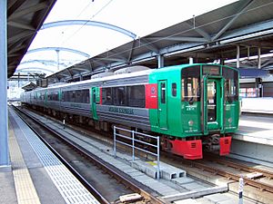
.
Sasebo has a good transportation system, including trains and highways.
Train Lines
* Stations: Mikawachi - Haiki - Daitō - Hiu - Sasebo
* Stations: Huis Ten Bosch - Haenosaki
* Stations: Suetachibana - Emukae-Shikamachi - Takaiwa - Inotsuki - Senryūgataki - Yoshii - Kōda - Seihō-Koukou-Mae - Saza - Koura - Masaru - Tanagata - Ainoura - Daigaku - Kami-Ainoura - Motoyama - Nakazato - Kaize - Nonaka - Hidariishi - Senpukuji - Yamanota - Kita-Sasebo - Naka-Sasebo - Sasebo-Chūō - Sasebo
Major Highways
 Nishi-Kyūshū Expressway
 National Route 35
 National Route 202
 National Route 204
 National Route 205
 National Route 384
 National Route 498
Friendship Cities
Sasebo has special relationships with cities around the world. These are called sister cities or friendship cities.
 Albuquerque, New Mexico, United States
 Coffs Harbour, New South Wales, Australia
 Kokonoe, Ōita, Japan
 Paju, South Korea
 Shenyang, Liaoning, China (friendship city)
 Xiamen, Fujian, China
Fun Places to Visit in Sasebo
Sasebo has many interesting places to explore:
- Fukui cave: A National Historic Site.
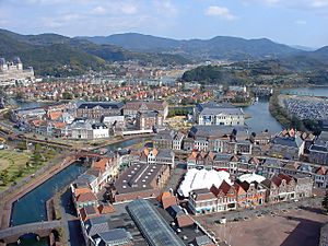
- Huis Ten Bosch (theme park): A theme park inspired by a Dutch trading post.
- Japan Maritime Self-Defense Force Museum: Learn about Japan's navy.
- Kōzakihana: The westernmost point on the island of Kyushu.
- Kujū-ku Islands: A group of beautiful islands.
- Miuramachi Catholic Church: A large church built in 1930. It is a symbol of Sasebo and is opposite the main train station. Sasebo is the only Japanese city that uses a Christian church image on its official seal or flag.
- Saikai Pearl Sea Resort: A great place to see pearls.
- Sasebo City Museum Shimanose Art Center: Explore art and history.
- Sasebo Zoological Park and Botanical Garden: See animals and plants.
- Senpukuji Cave: Another interesting cave to visit.
- Tenkaihō: A spot with amazing views.
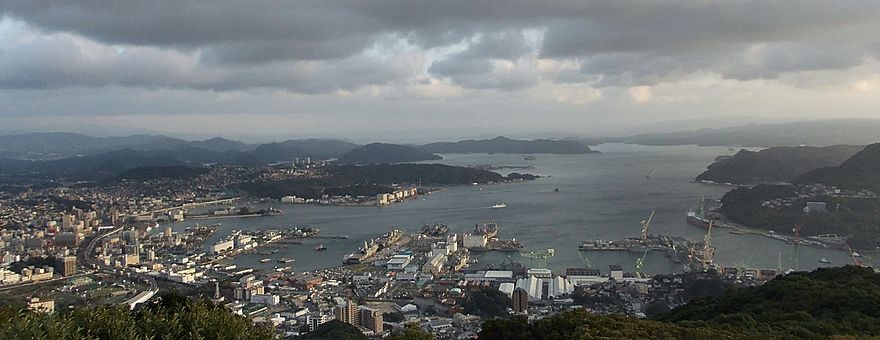
Sasebo's City View
See also
 In Spanish: Sasebo para niños


