
Sharon, New Hampshire facts for kids
Quick facts for kids
Sharon, New Hampshire
|
||
|---|---|---|
|
Town
|
||

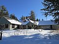
1832 Schoolhouse
|
||
|
||

Location in Hillsborough County, New Hampshire
|
||
| Country | United States | |
| State | New Hampshire | |
| County | Hillsborough | |
| Incorporated | 1791 | |
| Area | ||
| • Total | 15.7 sq mi (40.6 km2) | |
| • Land | 15.7 sq mi (40.6 km2) | |
| • Water | 0 sq mi (0.0 km2) | |
| Elevation | 1,179 ft (359 m) | |
| Population
(2020)
|
||
| • Total | 359 | |
| • Density | 23/sq mi (8.9/km2) | |
| Time zone | UTC−5 (Eastern) | |
| • Summer (DST) | UTC−4 (Eastern) | |
| ZIP code |
03458
|
|
| Area code(s) | 603 | |
| FIPS code | 33-68820 | |
| GNIS feature ID | 0873719 | |

Sharon is a small town located in Hillsborough County, New Hampshire, USA. In 2020, about 359 people lived there. For many years, Sharon was known for the Sharon Arts Center, a place that supported art, but it is now closed.
Contents
History of Sharon
Sharon was first settled in 1738. It was part of a larger area called "Peterborough Slip." This area also included the town of Temple until 1768.
In 1777, the people of Sharon asked to become part of Peterborough. However, their request was not approved. The town was known as "Sliptown" for a while. Then, in 1791, it officially became a town and was named Sharon. It got its name from Sharon, Connecticut, where many of the first settlers came from.
The land in Sharon is not flat; it has many hills and mountains. In 1823, about 400 people lived in Sharon. By 1859, the population had dropped to 229. At that time, the town had three sawmills. But most people in Sharon worked as farmers.
Geography and Nature
Sharon covers about 40.6 square kilometers (about 15.7 square miles) of land. There is no water area within the town limits. Several small streams flow through Sharon. These streams are branches of the Contoocook River. They start near the southeastern part of the town.
Temple Mountain forms the eastern edge of Sharon for several miles. The highest point in Sharon is Holt Peak. It is located on Temple Mountain and is about 2,045 feet (623 meters) above sea level.
Neighboring Towns
Sharon is surrounded by several other towns:
- Peterborough (to the north)
- Temple (to the east)
- New Ipswich (to the southeast)
- Rindge (to the southwest)
- Jaffrey (to the west)
Population Changes
| Historical population | |||
|---|---|---|---|
| Census | Pop. | %± | |
| 1790 | 259 | — | |
| 1800 | 428 | 65.3% | |
| 1810 | 446 | 4.2% | |
| 1820 | 391 | −12.3% | |
| 1830 | 271 | −30.7% | |
| 1840 | 251 | −7.4% | |
| 1850 | 226 | −10.0% | |
| 1860 | 250 | 10.6% | |
| 1870 | 182 | −27.2% | |
| 1880 | 203 | 11.5% | |
| 1890 | 137 | −32.5% | |
| 1900 | 122 | −10.9% | |
| 1910 | 71 | −41.8% | |
| 1920 | 21 | −70.4% | |
| 1930 | 38 | 81.0% | |
| 1940 | 61 | 60.5% | |
| 1950 | 62 | 1.6% | |
| 1960 | 78 | 25.8% | |
| 1970 | 136 | 74.4% | |
| 1980 | 184 | 35.3% | |
| 1990 | 299 | 62.5% | |
| 2000 | 360 | 20.4% | |
| 2010 | 352 | −2.2% | |
| 2020 | 359 | 2.0% | |
| U.S. Decennial Census | |||
The population of Sharon has changed a lot over the years. In 1790, there were 259 people. The population grew to 446 in 1810. Then it slowly decreased for many years, reaching a low of 21 people in 1920. Since then, the population has grown again. In 2020, 359 people lived in Sharon.
In 2000, there were 360 people living in Sharon. Most of the people were White (about 97%). A small number of people were from other racial backgrounds. About 25% of households had children under 18. Most households were married couples living together. The average age of people in Sharon was 41 years old.
Famous People from Sharon
- P. J. O'Rourke (1947–2022), a writer known for his funny political comments.
- Erazim Kohák (1933–2020), an educator, philosopher, and writer.
- Gustavus Swan (1787–1860), a politician, judge, and banker.
Images for kids
-
(Closed) Sharon Arts Center

See also
 In Spanish: Sharon (Nuevo Hampshire) para niños
