Sharp County, Arkansas facts for kids
Quick facts for kids
Sharp County
|
|
|---|---|

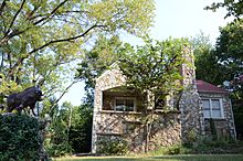
Sherman Bates House in Hardy, Arkansas.
|
|

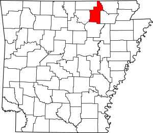
Location within the U.S. state of Arkansas
|
|
 Arkansas's location within the U.S. |
|
| Country | |
| State | |
| Founded | July 18, 1868 |
| Named for | Ephraim Sharp |
| Seat | Ash Flat |
| Largest city | Cherokee Village |
| Area | |
| • Total | 606 sq mi (1,570 km2) |
| • Land | 604 sq mi (1,560 km2) |
| • Water | 2.0 sq mi (5 km2) 0.3%% |
| Population
(2020)
|
|
| • Total | 17,271 |
| • Density | 28.500/sq mi (11.004/km2) |
| Time zone | UTC−6 (Central) |
| • Summer (DST) | UTC−5 (CDT) |
| Congressional district | 1st |
Sharp County is a place in the state of Arkansas, USA. It's like a big neighborhood with its own government. In 2020, about 17,271 people lived there. The main town, or county seat, is Ash Flat. Sharp County was created on July 18, 1868. It was named after Ephraim Sharp, who was a lawmaker in the area.
Contents
About Sharp County's Land
Sharp County covers a total area of about 606 square miles. Most of this area, about 604 square miles, is land. Only a small part, about 2 square miles, is water. This means only 0.3% of the county is covered by water.
Main Roads in Sharp County
Many important roads run through Sharp County, helping people travel around. These include:
Neighboring Counties
Sharp County shares its borders with several other counties. These are:
- Oregon County, Missouri (to the north)
- Randolph County (to the northeast)
- Lawrence County (to the southeast)
- Independence County (to the south)
- Izard County (to the southwest)
- Fulton County (to the northwest)
People of Sharp County
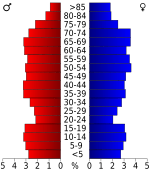
The number of people living in Sharp County has changed a lot over the years. Here's how the population has grown and shrunk:
| Historical population | |||
|---|---|---|---|
| Census | Pop. | %± | |
| 1870 | 5,400 | — | |
| 1880 | 9,047 | 67.5% | |
| 1890 | 10,418 | 15.2% | |
| 1900 | 12,199 | 17.1% | |
| 1910 | 11,688 | −4.2% | |
| 1920 | 11,132 | −4.8% | |
| 1930 | 10,715 | −3.7% | |
| 1940 | 11,497 | 7.3% | |
| 1950 | 8,999 | −21.7% | |
| 1960 | 6,319 | −29.8% | |
| 1970 | 8,233 | 30.3% | |
| 1980 | 14,607 | 77.4% | |
| 1990 | 14,109 | −3.4% | |
| 2000 | 17,119 | 21.3% | |
| 2010 | 17,264 | 0.8% | |
| 2020 | 17,271 | 0.0% | |
| 2023 (est.) | 17,968 | 4.1% | |
| U.S. Decennial Census 1790–1960 1900–1990 1990–2000 2010 |
|||
Who Lives in Sharp County?
In 2020, there were 17,271 people living in Sharp County. These people lived in 7,447 households, and 4,420 of these were families.
Here's a quick look at the different groups of people living in Sharp County in 2020:
| Group | Number | Percentage |
|---|---|---|
| White (not Hispanic) | 15,729 | 91.07% |
| Black or African American (not Hispanic) | 114 | 0.66% |
| Native American | 121 | 0.7% |
| Asian | 57 | 0.33% |
| Pacific Islander | 20 | 0.12% |
| Other or Mixed Race | 868 | 5.03% |
| Hispanic or Latino | 362 | 2.1% |
Towns and Communities
Sharp County has several towns and smaller communities where people live.
Cities in Sharp County
- Ash Flat (This is the county seat, where the main county offices are)
- Cave City
- Cherokee Village
- Hardy
- Highland
- Horseshoe Bend
Towns in Sharp County
Smaller Communities (Unincorporated)
These are smaller places that are not officially cities or towns:
Townships
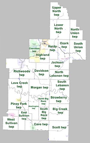
Counties are often divided into smaller areas called townships. Here are the townships in Sharp County: Townships in Arkansas are the divisions of a county. Each township includes unincorporated areas; some may have incorporated cities or towns within part of their boundaries. Arkansas townships have limited purposes in modern times. However, the United States Census does list Arkansas population based on townships (sometimes referred to as "county subdivisions" or "minor civil divisions"). Townships are also of value for historical purposes in terms of genealogical research. Each town or city is within one or more townships in an Arkansas county based on census maps and publications. The townships of Sharp County are listed below; listed in parentheses are the cities, towns, and/or census-designated places that are fully or partially inside the township.
- Big Creek
- Cave (includes Cave City)
- Cherokee (includes most of Cherokee Village, and a small part of Highland)
- Davidson
- East Sullivan
- Hardy (includes most of Hardy)
- Highland (includes most of Highland)
- Jackson (includes Williford)
- Lave Creek
- Lower North
- Morgan
- North Big Rock
- North Lebanon
- Ozark
- Piney Fork (includes Evening Shade)
- Richwoods (includes part of Ash Flat, and a small part of Horseshoe Bend)
- Scott
- South Big Rock
- South Union
- Strawberry
- Upper North
- Washington
- West Sullivan (includes most of Sideny)
Sharp County was once featured on a TV show called Independent Lens. The show talked about an event in 1906 where all of its Black residents were asked to leave the county.
See also
 In Spanish: Condado de Sharp para niños
 | Audre Lorde |
 | John Berry Meachum |
 | Ferdinand Lee Barnett |


