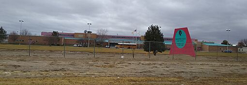
Shiprock, New Mexico facts for kids
Quick facts for kids
Shiprock, New Mexico
|
|
|---|---|
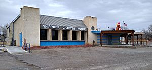
Shiprock Chapter House
|
|
| Nickname(s):
Naat’áanii Nééz
|
|
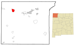
Location of Shiprock, New Mexico
|
|
| Country | United States |
| State | New Mexico |
| County | San Juan |
| Area | |
| • Total | 13.71 sq mi (35.50 km2) |
| • Land | 13.51 sq mi (34.99 km2) |
| • Water | 0.19 sq mi (0.50 km2) |
| Elevation | 4,954 ft (1,510 m) |
| Population
(2020)
|
|
| • Total | 7,718 |
| • Density | 571.24/sq mi (220.56/km2) |
| Time zone | UTC-7 (Mountain (MST)) |
| • Summer (DST) | UTC-6 (MDT) |
| ZIP codes |
87420, 87461
|
| Area code(s) | 505 |
| FIPS code | 35–72770 |
| GNIS feature ID | 2408729 |
Shiprock (Navajo: Naatʼáanii Nééz) is a community located on the Navajo Nation reservation in San Juan County, New Mexico, United States. It is called an "unincorporated community" because it doesn't have its own local government like a city or town. It is also a "census-designated place" (CDP), which means the U.S. Census Bureau counts it as a specific area for statistics. In 2020, about 7,718 people lived here.
The community gets its name from the famous Shiprock rock formation nearby. Since 1903, the Navajo people have called the town Naat’áanii Nééz. This Navajo name means "tall leader." It was named after William T. Shelton, who was a superintendent for the San Juan Indian Agency and helped settle the area for the United States government.
Shiprock is home to Diné College, which is a four-year college. It used to be called Navajo Community College. This college is controlled by the Navajo tribe and has seven other campuses across the Navajo Nation. Shiprock also has a Chapter House for the Navajo people. A Chapter House is like a local community center where important meetings and events happen. The town also has a Bureau of Indian Affairs (BIA) agency and the Northern Navajo Medical Center, which is a hospital run by the Indian Health Service.
The town is an important meeting point for roads. Many trucks and tourists pass through Shiprock. Visitors often travel to nearby places like the Four Corners Monument, Mesa Verde, the Shiprock rock formation, and the Grand Canyon. Shiprock is located where U.S. Route 64 and U.S. Route 491 (which used to be U.S. Route 666) cross. Every October, the community hosts the annual Northern Navajo Fair. Since 1984, Shiprock has also been the host of the Shiprock Marathon and Relay race.
Contents
History of Shiprock
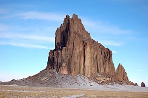
Shiprock was started on September 11, 1903. It was founded by William Taylor Shelton, who worked for the Bureau of Indian Affairs (BIA). The BIA is a U.S. government agency that works with Native American tribes. Shelton was sent to the northern Navajo area to open an Indian agency and a boarding school.
He started the Shiprock Indian School and an administrative office. He had a small team of three white and three Navajo employees. The Shiprock Indian Boarding School stayed open until the early 1980s, when the system of American Indian boarding schools began to close down.
The land where Shiprock was founded originally belonged to Tséheya Begay. Early reports from Shelton show that Navajo people had been using irrigation to farm the land for many years. There were many farms that got water from about 25 ditches between Shiprock and Farmington.
Under Shelton, the agency helped to make the irrigation system bigger. They also started a dairy farm as part of their farming programs. A sawmill near Sanostee and a coal mine in the Hogback area were also developed. The first buildings in Shiprock were made of logs and adobe. But after a big flood in 1912, new buildings were made with brick. Shelton was known for being strict, but he was generally respected for his work. He helped add the Utah-Colorado extension to the main Navajo Reservation.
Geography and Climate
According to the United States Census Bureau, the Shiprock area covers about 16.2 square miles (42 square kilometers). Most of this area, about 15.9 square miles (41.2 square kilometers), is land. The rest, about 0.3 square miles (0.8 square kilometers), is water.
Shiprock's Weather
| Climate data for Shiprock, New Mexico | |||||||||||||
|---|---|---|---|---|---|---|---|---|---|---|---|---|---|
| Month | Jan | Feb | Mar | Apr | May | Jun | Jul | Aug | Sep | Oct | Nov | Dec | Year |
| Mean daily maximum °F (°C) | 46.4 (8.0) |
53.1 (11.7) |
63.8 (17.7) |
71.8 (22.1) |
82.4 (28.0) |
91.8 (33.2) |
96.4 (35.8) |
92.9 (33.8) |
85.6 (29.8) |
72.6 (22.6) |
58.2 (14.6) |
46.3 (7.9) |
71.8 (22.1) |
| Daily mean °F (°C) | 32.8 (0.4) |
38.7 (3.7) |
46.6 (8.1) |
53.9 (12.2) |
64.2 (17.9) |
72.9 (22.7) |
79.0 (26.1) |
76.4 (24.7) |
68.1 (20.1) |
55.2 (12.9) |
42.9 (6.1) |
32.4 (0.2) |
55.3 (12.9) |
| Mean daily minimum °F (°C) | 19.1 (−7.2) |
24.4 (−4.2) |
29.4 (−1.4) |
36.0 (2.2) |
46.1 (7.8) |
54.0 (12.2) |
61.7 (16.5) |
59.8 (15.4) |
50.6 (10.3) |
37.9 (3.3) |
27.6 (−2.4) |
18.6 (−7.4) |
38.8 (3.8) |
| Average precipitation inches (mm) | 0.72 (18) |
0.73 (19) |
0.54 (14) |
0.43 (11) |
0.50 (13) |
0.22 (5.6) |
0.82 (21) |
1.24 (31) |
0.88 (22) |
0.76 (19) |
0.67 (17) |
0.70 (18) |
8.21 (208.6) |
| Average snowfall inches (cm) | 1.5 (3.8) |
0.6 (1.5) |
0.6 (1.5) |
0.0 (0.0) |
0.0 (0.0) |
0.0 (0.0) |
0.0 (0.0) |
0.0 (0.0) |
0.0 (0.0) |
0.0 (0.0) |
0.2 (0.51) |
1.0 (2.5) |
3.9 (9.81) |
| Source: WRCC 1981-2010 normals, snow for 1926-2005 | |||||||||||||
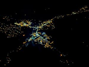
Population of Shiprock
| Historical population | |||
|---|---|---|---|
| Census | Pop. | %± | |
| 2000 | 8,156 | — | |
| 2010 | 8,295 | 1.7% | |
| 2020 | 7,718 | −7.0% | |
| U.S. Decennial Census | |||
In 2000, there were 8,156 people living in Shiprock. By 2010, the population grew slightly to 8,295. In the most recent census in 2020, the population was 7,718 people.
Most of the people living in Shiprock are Native American, making up about 96.74% of the population in 2000. About 2.17% were White. A small number of people were from other racial backgrounds.
In 2000, about 52.2% of homes had children under 18 living there. The average household had about 3.73 people. The average family had about 4.06 people. The median age in Shiprock was 25 years old. This means half the people were younger than 25, and half were older. About 38.6% of the population was under 18 years old.
Education in Shiprock
The Central Consolidated School District serves Shiprock and other nearby communities. Shiprock has several schools:
- Shiprock High School
- Career Prep High School
- Tsé Bit'a'í Middle School
- Mesa Elementary School
- Nizhoni Elementary School
- Eva B. Stokely Elementary School
Shiprock Associated Schools, Inc. also operates two schools: Atsá Biyáázh Community School and Shiprock Northwest High School (for grades 7 to 12). These schools are connected with the Bureau of Indian Education (BIE).
Shiprock in Media
Film Locations
Shiprock has been featured or mentioned in a few films:
- The 1987 movie Made in U.S.A., directed by Ken Friedman, partly refers to Shiprock.
- The 2017 documentary Mayors of Shiprock focuses on a group of young Native American people. It shows how they are working to make positive changes in their community.
Notable People from Shiprock
Many interesting people have connections to Shiprock:
- Joyce Begay-Foss: A Navajo weaver, educator, and museum worker, born in Shiprock.
- Eugenia Charles-Newton: A Diné tribal councilor.
- Amber Midthunder: A Sioux actress known for her role as Naru in the movie Prey, born in Shiprock.
- Orville Tsinnie (1943–2017): A Navajo silversmith and jeweler.
See also
 In Spanish: Shiprock (Nuevo México) para niños


