Silver Bay, Minnesota facts for kids
Quick facts for kids
Silver Bay
|
|
|---|---|

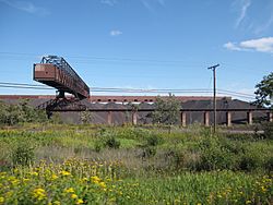
Taconite Plant in Silver Bay
|
|

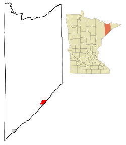
Location of the city of Silver Bay
within Lake County, Minnesota |
|
| Country | United States |
| State | Minnesota |
| County | Lake |
| Area | |
| • Total | 8.06 sq mi (20.88 km2) |
| • Land | 7.63 sq mi (19.76 km2) |
| • Water | 0.43 sq mi (1.12 km2) |
| Elevation | 764 ft (233 m) |
| Population
(2020)
|
|
| • Total | 1,857 |
| • Estimate
(2021)
|
1,858 |
| • Density | 243.45/sq mi (93.99/km2) |
| Time zone | UTC-6 (CST) |
| • Summer (DST) | UTC-5 (CDT) |
| ZIP code |
55614
|
| Area code(s) | 218 |
| FIPS code | 27-60250 |
| GNIS feature ID | 0658258 |
Silver Bay is a city located in Lake County, Minnesota, in the United States. In 2020, about 1,857 people lived there.
Silver Bay is a popular spot for tourists because it's close to beautiful places. These include Tettegouche State Park and the famous Split Rock Lighthouse. The city is also a port on Lake Superior. It's known for handling iron ore and has facilities for processing taconite, which is a type of iron ore.
The North Shore National Scenic Drive, a beautiful road, goes right through the city.
Contents
History of Silver Bay
The city of Silver Bay started on May 1, 1954. Before that, it was a housing project called Beaver Bay. The city was built by a company to process taconite. This taconite was mined in Babbitt, Minnesota, about sixty miles away, and then shipped to Silver Bay by train.
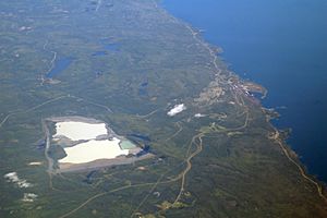
In the 1960s, Silver Bay became well-known because a company called Reserve Corporation was putting taconite waste into Lake Superior. In 1972, they were told to stop. After a long legal process, a new place to store the waste was built inland in 1977. This new site was about 7 miles away and was often called “Mile Post 7.”
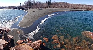
In 2015, Black Beach opened to the public. This beach has dark sand because of the taconite waste. The city of Silver Bay and the state's DNR worked with the mining company to open the beaches to everyone. Black Beach Park has three beaches and a campground run by the city.
Geography and Nature
Silver Bay covers about 8.36 square miles (21.65 square kilometers). Most of this area is land, with a small part being water.
The city is located on the North Shore of Lake Superior. It's about halfway between Duluth and Grand Marais.
Many natural attractions are close by. These include Tettegouche State Park, the Baptism River, and the impressive Palisade Head rock formation.
Silver Bay offers many outdoor activities. You can find summer hiking trails, winter cross-country skiing, and maintained snowmobile trails. There are also several parks, a hockey arena, and four baseball/softball fields in the city.
People of Silver Bay
Population Changes Over Time
| Historical population | |||
|---|---|---|---|
| Census | Pop. | %± | |
| 1960 | 3,723 | — | |
| 1970 | 3,504 | −5.9% | |
| 1980 | 2,917 | −16.8% | |
| 1990 | 1,894 | −35.1% | |
| 2000 | 2,068 | 9.2% | |
| 2010 | 1,887 | −8.8% | |
| 2020 | 1,857 | −1.6% | |
| 2021 (est.) | 1,858 | −1.5% | |
| U.S. Decennial Census 2020 Census |
|||
In 2010, about 1,887 people lived in Silver Bay. Most of the people living there were White (97.9%). A small number were from other racial backgrounds.
There were 836 households in the city. About 22.8% of these households had children under 18 living with them. Many households (53.3%) were married couples living together.
The average age of people in Silver Bay was about 50.1 years old. About 18.4% of the residents were under 18 years old.
City Services and Roads
Transportation in Silver Bay
Silver Bay used to have its own airport, the Silver Bay Municipal Airport. However, it closed on June 7, 2018.
The main roads in Silver Bay include Outer Drive (which is County Road 5), Penn Boulevard, and Minnesota Highway 61. These roads help people get around the city and connect to other areas.
See also
 In Spanish: Silver Bay (Minnesota) para niños
 | Claudette Colvin |
 | Myrlie Evers-Williams |
 | Alberta Odell Jones |


