Silver Star Mountain (Okanogan County, Washington) facts for kids
Quick facts for kids Silver Star Mountain |
|
|---|---|

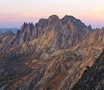
Silver Star Mountain at sunset seen from Kangaroo Ridge
|
|
| Highest point | |
| Elevation | 8,876 ft (2,705 m) |
| Prominence | 2,436 ft (742 m) |
| Geography | |
| Location | Okanogan County, Washington |
| Parent range | Methow Mountains North Cascades Cascade Range |
| Topo map | USGS Silver Star Mountain |
| Type of rock | Granite |
| Climbing | |
| First ascent | Lage Wernstedt, 1926 |
| Easiest route | South Route |
Silver Star Mountain is a tall mountain in Okanogan County, Washington. It stands 8,876-foot (2,705-metre) high! This mountain is part of the Methow Mountains, which are a smaller group within the larger Cascade Range. Silver Star is a very noticeable mountain near Washington Pass. You can easily see it from the North Cascades Highway. A person named Lage Wernstedt was the first to climb it in 1926.
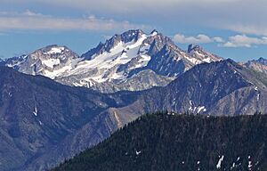
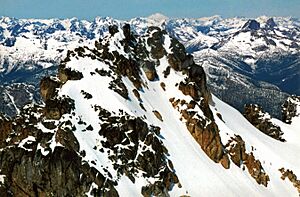
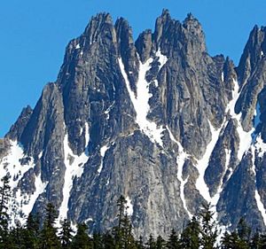
The top part of Silver Star Mountain has a long ridge with pointy rock towers called the Wine Spires. These spires lead up to the main peak. Other ridges, like Vasiliki Ridge and Snagtooth Ridge, stretch out from the mountain. From Highway 20 on the west side, the mountain looks like a very steep, jagged wall. There's a glacier on the north side that reaches almost to the top. The easiest way to climb Silver Star is by going up this glacier from the north, following Silver Star Creek.
Silver Star Mountain is also important for water. Rain and melting snow from the mountain flow into Early Winters Creek. This creek then joins the Methow River, which eventually flows into the Columbia River.
Contents
Climbing Silver Star Mountain
People climb Silver Star Mountain using different paths, called "routes." Some routes are easier, while others are very challenging. The mountain has two main peaks: the East Summit and the West Summit.
Routes to the East Summit
- Silver Star Glacier route
- East ridge and spur route
- Southeast Face and East ridge route
Routes to the West Summit
- Southwest Buttress route
- West Buttress route
- Northeast Ridge route
- Gato Negro route
- Silver Star Glacier route
How Silver Star Mountain Formed
The North Cascades mountains, where Silver Star is located, have very rugged shapes. You can see sharp peaks, long ridges, and deep valleys carved by glaciers. These amazing shapes and big changes in height happened because of geological events over millions of years.
The Cascade Mountains started forming a very long time ago. This happened when the North American Plate slowly moved over the Pacific Plate. This movement caused volcanoes to erupt. Also, small pieces of the Earth's crust, called terranes, joined together to create the North Cascades about 50 million years ago. Silver Star Mountain is made of granite, just like many other peaks in the Washington Pass area.
About two million years ago, during the Pleistocene period, huge sheets of ice called glaciers moved across the land. They carved out the "U"-shaped valleys you see today. The combination of the land pushing up (uplift) and cracks in the Earth (faulting), along with the glaciers, created the tall peaks and deep valleys of the North Cascades.
Weather and Climate

Silver Star Mountain is in a "marine west coast" climate zone. This means it gets a lot of moisture from the Pacific Ocean. Most weather systems travel from the Pacific Ocean towards the Cascade Range. As these weather systems hit the tall Cascade Mountains, they are forced to rise. This causes them to drop their moisture as rain or snow onto the mountains. This process is called Orographic lift.
Because of this, the west side of the North Cascades gets a lot of rain and snow, especially in winter. The snow helps keep the Silver Star Glacier on the north side of the mountain from melting away. In winter, it's often cloudy. But in summer, high-pressure systems over the Pacific Ocean often bring clear skies. The snow here tends to be wet and heavy, which can lead to a high risk of avalanches. In fact, the North Cascades Highway has one of the highest numbers of avalanche paths per mile in the United States!
 | Frances Mary Albrier |
 | Whitney Young |
 | Muhammad Ali |


