
Snagtooth Ridge facts for kids
Quick facts for kids Snagtooth Ridge |
|
|---|---|

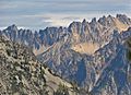
Snagtooth Ridge from North Cascades Highway
|
|
| Highest point | |
| Elevation | 8,330 ft (2,540 m) |
| Prominence | 570 ft (170 m) |
| Geography | |

Snagtooth Ridge
Location in Washington (state)

Snagtooth Ridge
Location in the United States
|
|
| Parent range | North Cascades |
| Topo map | USGS Silver Star Mountain |
| Climbing | |
| First ascent | 1946 Fred Beckey |
| Easiest route | Scrambling |
Snagtooth Ridge is a cool, jagged mountain ridge in Washington state. It's found in Okanogan County and is part of the Methow Mountains. These mountains are a smaller part of the bigger North Cascades range. Snagtooth Ridge sits between Silver Star Mountain and Kangaroo Ridge. The land around it is managed by the Okanogan National Forest.
The highest point on Snagtooth Ridge is called Big Snagtooth. It stands tall at 8,330 feet. Other parts of the ridge have fun names like Willow Tooth, Cedar Tooth, and Dog Tooth. The very first time someone climbed Big Snagtooth was on September 29, 1946. This amazing climb was done by Fred Beckey, Jerry O'Neil, and Charles Welsh. Water from rain and melting snow flows off the ridge into streams that join the Methow River.
Contents
What's the Weather Like on Snagtooth Ridge?
Weather systems from the Pacific Ocean usually move northeast. When they reach the Cascade Mountains, the tall peaks force the air upwards. This makes the air cool down and drop its moisture. This moisture falls as rain or snowfall onto the mountains. This process is called orographic lift.
Because of this, the western side of the North Cascades gets a lot of rain and snow. This is especially true in winter. Winters are often cloudy, but summers are usually sunny. This is because high-pressure systems build up over the Pacific Ocean. The snow here tends to be wet and heavy. This means there's a high risk of avalanches, which are dangerous slides of snow.
How Was Snagtooth Ridge Formed?
The North Cascades area has some really rugged land. You can see sharp peaks, long ridges, and deep valleys carved by glaciers. These amazing shapes were created by geological events that happened millions of years ago. These events also caused big changes in height across the mountains. This led to different climates and types of plants in various areas.
The Cascade Mountains started forming millions of years ago. This was during the late Eocene Epoch. At that time, the North American Plate was slowly moving over the Pacific Plate. This caused a lot of volcanic activity. Also, small pieces of the Earth's crust, called terranes, came together. This helped create the North Cascades about 50 million years ago.
About two million years ago, during the Pleistocene period, glaciers moved across the land many times. As they moved, they scraped and shaped the landscape. They left behind piles of rock and debris. The "U"-shaped valleys you see today were carved out by these glaciers. The combination of land being pushed up (uplift) and cracks forming in the Earth (faulting), along with glaciation, created the tall peaks and deep valleys of the North Cascades.
Gallery
-
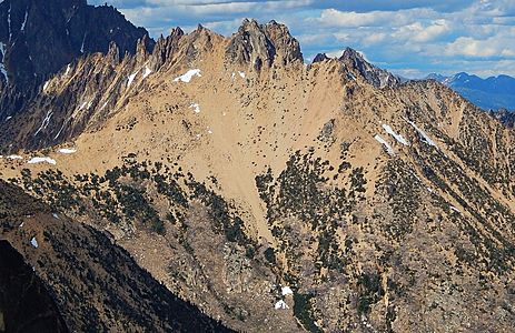
Snagtooth Ridge seen from Kangaroo Ridge
-
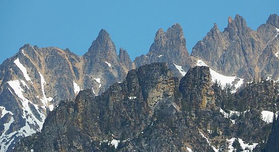
Snagtooth Ridge with Dog Tooth, Red Tooth, Cedar Tooth
-
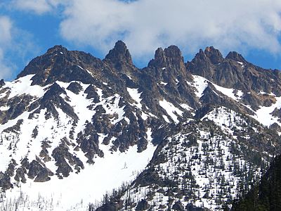
Snagtooth Ridge
-
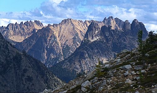
Snagtooth Ridge (left) from Maple Pass trail


Images for kids
-
Snagtooth Ridge from Maple Pass trail

