
South Branch Newport Creek facts for kids

The South Branch Newport Creek is a small stream in Luzerne County, Pennsylvania. It flows into a larger stream called Newport Creek. This creek is about 3.6 miles (5.8 kilometers) long. Sadly, the water in the entire creek area is considered "impaired" by the Pennsylvania Department of Environmental Protection. This means the water isn't as clean or healthy as it should be. One reason for this is that there has been a lot of mining in the area around the creek.
Contents
Where the Creek Flows

The South Branch Newport Creek starts in areas where strip mining used to happen. These areas are near a community called Wanamie in Newport Township. The very beginning of the creek is north of Penobscot Mountain.
The creek first flows towards the east. Then, it slowly turns north, just west of the town of Alden. Finally, it reaches the western part of Nanticoke. Here, it joins the main Newport Creek.
Smaller Streams Joining In
The South Branch Newport Creek has one named stream that flows into it, called Reservoir Creek. It also has another smaller stream that doesn't have a specific name.
Water Quality of the Creek
The water in South Branch Newport Creek has different substances in it, like iron, manganese, and aluminum. These are metals that can get into the water, especially from mining areas. The amount of these metals changes as the creek flows downstream. For example, the amount of iron, manganese, and aluminum generally increases as the creek moves away from its start.
The creek also has acidity, which means the water is more acidic than it should be. This is also often linked to mining. The acidity levels are quite high, especially in some parts of the creek. On the other hand, the water also has some alkalinity, which helps to balance the acidity, but it's not enough to make the water completely healthy.
There is also a lot of sediment (like dirt and small rocks) that flows into the creek. A big part of this sediment comes from farm fields and pastures. Forests, stream banks, and even old coal mines also add sediment to the water.
The amount of water flowing in the South Branch Newport Creek changes along its path. It starts with a small flow and gets bigger as more water from rain and other sources joins it.
Land and Climate Around the Creek
The South Branch Newport Creek is located in a geographical area called the Ridge-and-Valley Appalachians. This means the land has many long, parallel ridges and valleys, which are part of the larger Appalachian Mountains. The southern part of the creek's area is on a place called Little Wilkes-Barre Mountain.
Most of the rocks in the creek's area belong to certain types, like the Llwellyn Formation. The soil in the area is also of different types. These rock and soil types affect how water flows and what minerals get into the creek.
There isn't a lot of "drift" (loose rock and soil left by glaciers) along the banks of this creek, unlike the main Newport Creek.
The area around the creek gets a good amount of rain each year, about 43.5 inches (110.5 centimeters). A small part of this rain runs off into the creek.
The Creek's Watershed
The area of land that drains into South Branch Newport Creek is called its watershed. This watershed covers about 5.05 square miles (13.1 square kilometers).
Most of the land in the watershed is covered by forests (58 percent). About 28 percent of the land has been developed with buildings and roads. Another 13 percent is used for farming. Only a small part (1 percent) is used for other things.
Most of the watershed is in Newport Township and Nanticoke. However, a small part of the southwestern edge is on the border between Newport Township and Slocum Township.
The developed areas, like towns, are mostly in the middle of the watershed around Wanamie and in the northeast part in Nanticoke. Forests are found almost everywhere else. Farmland is mostly in the central part, and areas that have been disturbed, like old mining sites, are mostly in the western part.
You can get to the beginning of the South Branch Newport Creek by using State Route 3004.
In the late 1800s, there used to be a swamp at the very start of the South Branch Newport Creek.
History of the Creek
In 1874, there was a big release of quicksand at a mining shaft called Alden, which was located on South Branch Newport Creek. Also, in the early 1900s, several coal mines used to release their wastewater directly into the South Branch Newport Creek. This is one of the reasons why the creek's water quality is still affected today.
Images for kids
-

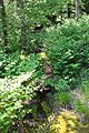
South Branch Newport Creek looking downstream
-
South Branch Newport Creek looking upstream
