Steiglitz, Queensland facts for kids
Quick facts for kids SteiglitzGold Coast, Queensland |
|||||||||||||||
|---|---|---|---|---|---|---|---|---|---|---|---|---|---|---|---|

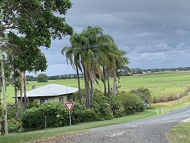
Looking south down Cabbage Tree Point Road over houses and cane fields across Steiglitz with a storm approaching, January 2022
|
|||||||||||||||
| Population | 682 (2021 census) | ||||||||||||||
| • Density | 59.82/km2 (154.9/sq mi) | ||||||||||||||
| Postcode(s) | 4207 | ||||||||||||||
| Area | 11.4 km2 (4.4 sq mi) | ||||||||||||||
| Time zone | AEST (UTC+10:00) | ||||||||||||||
| Location |
|
||||||||||||||
| LGA(s) | City of Gold Coast | ||||||||||||||
| State electorate(s) | Coomera | ||||||||||||||
| Federal Division(s) | Fadden | ||||||||||||||
|
|||||||||||||||
Steiglitz is a small town located near the coast in Queensland, Australia. It is part of the City of Gold Coast. In 2021 census, about 682 people lived in Steiglitz.
Contents
Where is Steiglitz?
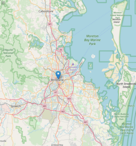
Steiglitz is on the eastern side of Moreton Bay, which is a large bay. To the south, you'll find Jacobs Well. To the west and north, it borders Woongoolba.
A special part of Steiglitz is Cabbage Tree Point. This is a piece of land that sticks out into Moreton Bay. The town of Steiglitz is actually located at Cabbage Tree Point. Because of this, people often call the town "Cabbage Tree Point." The name comes from the cabbage tree palms that used to grow a lot in this area.
A Look at Steiglitz's Past
The name Steiglitz comes from Stegelitz, a town in Germany. This was the hometown of the Kleinschmidt family, who were early settlers here.
In the late 1800s, the area between the Pimpama River and the Logan River was known as Pimpama Island. This "island" included modern-day Steiglitz, Jacobs Well, Norwell, and Woongoolba. It was called an island because many swamps and lagoons would surround it during the wet season. Even though this made it a bit tricky to get around, it was great land for growing sugar cane!
German Settlers and Early Churches
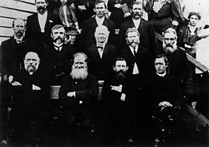
German families started settling in this area in the 1870s. They were Lutheran and held church services in their homes at first. In 1882, they built their first church. The church you see today was built in 1908 and was updated in 1930.
The Rocky Point Sugar Mill
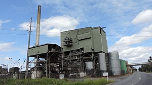
The Rocky Point Sugar Mill was started in 1878 by Carl Heinrich Heck. It's located on Mill Road, right between Woongoolba and Steiglitz. This mill is one of the oldest sugar mills in Australia! It's still owned by the Heck Group, a family company that has been running it for five generations. Other sugar mills used to be in the area, but they closed down. Rocky Point Sugar Mill grew to take over their work.
The Sugar Mill Tramway
On August 16, 1924, a special tramway for the Rocky Point Sugar Mill was opened. This tramway helped move harvested sugar cane to the mill. It was very useful because the land was often swampy, making transport difficult. The tramway mostly ran along the side of roads, which were built on higher ground. However, they still had to build a long raised path (called a causeway) to cross a swamp.
The tramway used a small steam train from England. It had 100 wagons to carry the cane. People hoped the tramway would be extended to connect to other railway lines or the Steiglitz wharf, but this didn't happen. It was only used for moving sugar cane.
The tramway often flooded, causing the trains to go off the tracks. It was also hard to keep the line working during World War II. After the war, more people started using trucks and other vehicles. So, the tramway closed in 1951. Even though the locomotive was sold, the rails and wagons were still used to move cane around the mill. The old locomotive later became a display at different places before finally returning to the mill. In 2013, it was given to the Beenleigh Historical Village.
Modern Power at the Mill
In 2001 and 2002, the Rocky Point Sugar Mill added a special plant that makes electricity. This plant uses renewable energy sources and creates a lot of power. This makes Rocky Point one of the most energy-efficient sugar mills in Australia!
Population Changes
The number of people living in Steiglitz has changed over the years:
- In 2011 census, there were 441 people.
- In 2016 census, the population grew to 705 people.
- In 2021 census, the population was 682 people.
What Steiglitz Offers
Steiglitz has some important places and services for its residents.
Local Facilities
- Bethlehem Lutheran Church: This church is located at 1281 Stapylton Jacobs Well Road. Right next door, at 1279 Stapylton Jacobs Well Road, is the Bethlehem Preschool and Kindergarten.
- Woongoolba Bowls Club: This is a sports and community club at 324 Cabbage Tree Point Road. The Gold Coast City Council also runs a mobile library service that visits this club every two weeks.
- Marinas: Steiglitz is home to two marinas:
- Horizon Shores Marina at 80 Cabbage Tree Point Road.
- Rudy Maas Marina at 82 Cabbage Tree Point Road.
- Boat Ramp: There's a boat ramp at Charlie Hammel Park, at the very end of Cabbage Tree Point Road. It's managed by the Gold Coast City Council.
Parks and Reserves
Steiglitz has several parks and natural areas where people can enjoy the outdoors:
- Behm Creek Reserve
- Cabbage Tree Point Conservation Park
- Charlie Hammel Park
- Floodgate Area
- Lake Royal Palms Park
- Rocky Point Reserve
- Short Cut Road Reserve
- Sugar Mill Reserve
Education
Steiglitz does not have its own schools. Children usually go to Woongoolba State School in nearby Woongoolba for primary school. For high school, the closest government school is Ormeau Woods State High School in Ormeau.
 | Georgia Louise Harris Brown |
 | Julian Abele |
 | Norma Merrick Sklarek |
 | William Sidney Pittman |


