Woongoolba, Queensland facts for kids
Quick facts for kids WoongoolbaGold Coast, Queensland |
|||||||||||||||
|---|---|---|---|---|---|---|---|---|---|---|---|---|---|---|---|
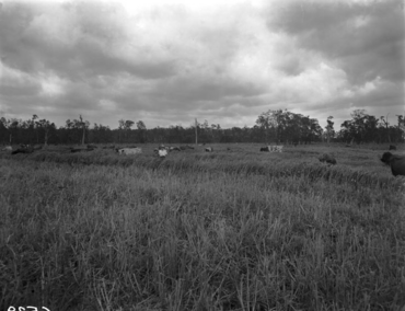
Cattle grazing, Woongoolba, 1956
|
|||||||||||||||
| Population | 282 (2021 census) | ||||||||||||||
| • Density | 8.677/km2 (22.47/sq mi) | ||||||||||||||
| Postcode(s) | 4207 | ||||||||||||||
| Area | 32.5 km2 (12.5 sq mi) | ||||||||||||||
| Time zone | AEST (UTC+10:00) | ||||||||||||||
| Location |
|
||||||||||||||
| LGA(s) | City of Gold Coast | ||||||||||||||
| State electorate(s) | Coomera | ||||||||||||||
| Federal Division(s) | Fadden | ||||||||||||||
|
|||||||||||||||
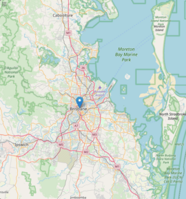
Woongoolba is a small, quiet place located by the coast in the northern part of the Gold Coast in Australia. It's a rural area, meaning it has lots of open spaces and farms. In 2021, about 282 people called Woongoolba home.
Contents
Exploring Woongoolba's Landscape
Woongoolba is surrounded by water! To the north, you'll find the Logan River. To the north-east, it meets the big Moreton Bay.
Unique Coastal Features
A special spot here is Little Rocky Point, a piece of land that sticks out into Moreton Bay.
Most of Woongoolba is very flat, less than 10 meters above sea level. But there are a few slightly higher places:
- Marks Hill, which is about 20 meters high, near the Logan River.
- The area right behind Little Rocky Point.
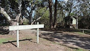
- Cecil Zipf Park along the coast.
What Grows and Lives Here?
The land in Woongoolba is mostly used for growing sugarcane. However, in the north-east, people farm seafood like prawns. Some parts of this area are also marshlands, which are wet, undeveloped areas.
A Journey Through Woongoolba's History
In the late 1800s, the area between the Pimpama River and the Logan River was known as Pimpama Island. This "island" included places like Jacobs Well, Norwell, Steiglitz, and Woongoolba. It was called an island because swamps and lagoons would cut it off during the rainy season. This wet land was actually great for growing sugarcane.
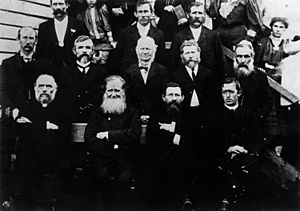
The name Woongoolba is thought to be an Aboriginal word for the geebung tree. Many German immigrants settled in this area between 1864 and 1900.
Schools and Sweet Success
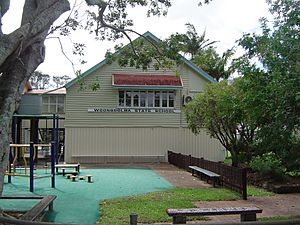
The Pimpama Island Provisional School first opened on April 17, 1876, with 13 students. It became Woongoolba State School in 1930. The school has grown over the years with new classrooms and a library added.
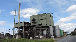
The Rocky Point Sugar Mill started in 1878. It's one of Australia's oldest sugar mills and is still owned by the Heck Group family. While other sugar mills in the area have closed, Rocky Point has expanded to keep up with demand.
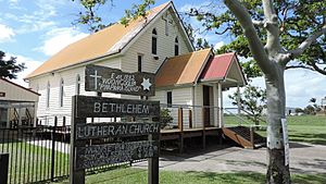
The first Bethlehem Lutheran church was built in 1882. The church building you see today was built in 1908.
In 1917, the Pimpama Island Public Hall was opened. Later, an old school building from Norwell was moved to the site to make the hall bigger.
Challenges for Prawn Farmers
In 2016, prawn farms in Woongoolba faced a big problem: an outbreak of white spot virus. This disease was found in imported prawns. It's believed that fishermen used these imported prawns as bait in the Logan River, which then spread the disease to local prawn farms. This caused a lot of trouble for the prawn industry.
A Historic Home Moves On
In 2019, a historic family home called "Friedensheim" (which means "House of Peace") was moved from Woongoolba. It was carefully divided into three pieces and relocated to the Beenleigh Historical Village, a museum where old buildings are preserved. The house was built in 1914 for the Heck family, who owned the sugar mill. It was restored and reopened at the museum in 2021.
Who Lives in Woongoolba?
The number of people living in Woongoolba has changed a bit over the years:
- In 2011, there were 460 people.
- In 2016, the population was 280 people.
- In 2021, it was 282 people.
Learning in Woongoolba
Woongoolba State School is a primary school for students from Prep to Year 6. It's located at 1219 Jacobs Well Road. In 2018, about 224 students attended the school.
There are no high schools directly in Woongoolba. Students usually go to Ormeau Woods State High School in Ormeau or Beenleigh State High School in Beenleigh.
Places to Visit and Things to Do
The Gold Coast City Council has a mobile library that visits Woongoolba State School every two weeks.
You can find Bethlehem Lutheran Church at 1281 Stapylton Jacobs Well Road.
The Woongoolba Public Hall, also known as the Pimpama Island & Districts Community Centre, is at 1226 Stapylton Jacobs Well Road.
Parks and Outdoor Fun
Cecil Zipf Park at Little Rocky Point is a great place to visit. You can get there by a special road through the mangroves. The park offers amazing views of Moreton Bay, a place for dogs to run off-leash, BBQs, and toilets. The beach below the park is also good for fishing, especially for bream.
There are several other parks in Woongoolba where you can enjoy the outdoors:
- Behm Creek Reserve
- Loves Road Weir
- New Norwell Rd Reserve
- Norwell Reserve
- Pimpama Island Recreational Reserve
- Rocky Point Reserve
- Sandy Creek Park
 | William Lucy |
 | Charles Hayes |
 | Cleveland Robinson |


