Stuart, Queensland facts for kids
Quick facts for kids StuartTownsville, Queensland |
|||||||||||||||
|---|---|---|---|---|---|---|---|---|---|---|---|---|---|---|---|
| Population | 1,576 (2021 census) | ||||||||||||||
| • Density | 29.57/km2 (76.6/sq mi) | ||||||||||||||
| Postcode(s) | 4811 | ||||||||||||||
| Area | 53.3 km2 (20.6 sq mi) | ||||||||||||||
| Time zone | AEST (UTC+10:00) | ||||||||||||||
| Location |
|
||||||||||||||
| LGA(s) | City of Townsville | ||||||||||||||
| State electorate(s) | Mundingburra | ||||||||||||||
| Federal Division(s) | |||||||||||||||
|
|||||||||||||||
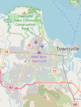
Stuart is a coastal suburb in Townsville, Queensland, Australia. It is mostly a rural area. In 2021, about 1,576 people lived there.
Contents
Exploring Stuart's Location
Stuart is located right next to the Coral Sea on its north-east side. This means it has a coastline.
Roads and Railways
A railway line, called the North Coast railway line, runs along Stuart's western side. Stuart has its own railway station.
Important roads like the Bruce Highway and Flinders Highway go through Stuart. Other roads, such as Townsville Connection Road and Townsville Port Road, also connect to the area.
Land Use in Stuart
Most of Stuart is undeveloped land. This means it's not built up with many houses or shops. The developed parts are mainly used for large buildings and factories. There are only a few homes in Stuart.
The Partington Area
Inside Stuart, there is a small area called Partington. It got its name from an old railway stop. This stop was named after Joseph Partington, who used to make bricks in the area.
A Look Back at Stuart's History
The name "Stuart" comes from its railway station. The station was first called Ayr Junction in 1902. Later, in 1938, it became Stewarts Creek. Finally, in 1939, it was named Stuart railway station. People believe the name "Stewart" was a mistake. The area was likely meant to be named after Clarendon Stuart, an important surveyor from 1865.
Early Schools in Stuart
Stewart's Creek Provisional School opened on May 18, 1891. It became Stewart's Creek State School in 1901. In 1939, its name changed to Stuart State School. Even though it had over 80 students, the school closed on December 31, 2013. The school was located at 10 Dwyer Street.
Stuart's Role in World War II
During December 1942, in World War II, two classrooms at Stuart State School were used by the Australian Army. They became a main communication center for Army signals in North Queensland. Later, this unit moved to a strong concrete bunker in Roseneath.
How Many People Live in Stuart?
The number of people living in Stuart has grown over the years:
- In 2011, Stuart had 1,051 people.
- In 2016, the population grew to 1,386 people.
- By 2021, Stuart had 1,576 people living there.
Important Historic Places
Stuart has several places that are protected because of their history. These are called heritage-listed sites:
- Stewart's Creek Gaol: These are historic buildings inside the Townsville Correction Centre. You can find them off Dwyer Street.
- Operations and Signals Bunker, Stuart: This was a former Army bunker. It is now located off Stuart Drive in Wulguru.
- St Brigid's Church, Stuart: This church is located at 523 Stuart Drive.
What Stuart Offers
Stuart is home to several important facilities and industries.
Key Facilities
- Townsville Correctional Centre: This is a large prison facility.
- Stuart landfill and waste transfer station: This is where rubbish is managed and sorted.
Major Industries
- Mount Stuart Power Station: This is a power plant that generates electricity.
- Sun Metals Zinc Refinery: This is a factory that processes zinc.
Learning Opportunities Near Stuart
There are no schools directly within Stuart itself. However, students can attend schools in nearby suburbs.
Primary Schools
The closest primary schools are:
- Townsville South State School in South Townsville (to the north-west).
- Oonooba State School in Idalia (to the west).
- Wulguru State School in Wulguru (to the south-west).
Secondary Schools
The nearest high school is William Ross State High School in Annandale (to the west).
 | Shirley Ann Jackson |
 | Garett Morgan |
 | J. Ernest Wilkins Jr. |
 | Elijah McCoy |


