
Sumner, Maine facts for kids
Quick facts for kids
Sumner, Maine
|
|
|---|---|

West Sumner c. 1910
|
|

Sumner, Maine
Location in Maine

Sumner, Maine
Location in the United States
|
|
| Country | United States |
| State | Maine |
| County | Oxford |
| Incorporated | 1798 |
| Area | |
| • Total | 44.87 sq mi (116.21 km2) |
| • Land | 44.27 sq mi (114.66 km2) |
| • Water | 0.60 sq mi (1.55 km2) |
| Elevation | 479 ft (146 m) |
| Population
(2020)
|
|
| • Total | 994 |
| • Density | 23/sq mi (8.7/km2) |
| Time zone | UTC-5 (Eastern (EST)) |
| • Summer (DST) | UTC-4 (EDT) |
| ZIP Codes | |
| Area code(s) | 207 |
| FIPS code | 23-75035 |
| GNIS feature ID | 0582755 |
Sumner is a town located in Oxford County, Maine, United States. It is part of the larger Lewiston-Auburn, Maine area. In 2020, the population of Sumner was 994 people. The town includes smaller communities known as West Sumner and East Sumner.
Contents
History of Sumner
Sumner was first settled in 1783 by Noah Bosworth, who came from Plympton, Massachusetts. It was originally called West Butterfield Plantation. Many of the early settlers were soldiers who had fought in the American Revolution.
The town officially became "Sumner" on June 13, 1798. It was named after Increase Sumner, who was the governor of Massachusetts at that time.
Early Occupations and Growth
Even though the land was a bit hilly, farming became the main job for people in Sumner. The two branches of the Nezinscot River were important because they provided water power for many mills.
By 1859, when 1,151 people lived there, Sumner had several types of mills. These included three sawmills for cutting wood and two gristmills for grinding grain. There were also mills that made shingles and a factory for starch. A special mill cleaned clover seeds, which were used as food for cattle. There was even a powder mill. In 1878, the Rumford Falls and Buckfield Railroad opened a station near East Sumner, making travel and trade easier.
Geography of Sumner
According to the United States Census Bureau, the town of Sumner covers a total area of about 44.87 square miles (116.21 km²). Most of this area, about 44.27 square miles (114.66 km²), is land. The remaining 0.60 square miles (1.55 km²) is water.
The town's water comes from the east and west branches of the Nezinscot River. Sumner shares its borders with several other towns: Peru to the north, Hartford to the east, Buckfield to the south, and Paris and Woodstock to the west.
State roads Route 140 and Route 219 help people travel in and out of Sumner.
Population of Sumner
| Historical population | |||
|---|---|---|---|
| Census | Pop. | %± | |
| 1800 | 330 | — | |
| 1810 | 611 | 85.2% | |
| 1820 | 1,055 | 72.7% | |
| 1830 | 1,098 | 4.1% | |
| 1840 | 1,269 | 15.6% | |
| 1850 | 1,151 | −9.3% | |
| 1860 | 1,154 | 0.3% | |
| 1870 | 1,170 | 1.4% | |
| 1880 | 1,014 | −13.3% | |
| 1890 | 901 | −11.1% | |
| 1900 | 802 | −11.0% | |
| 1910 | 762 | −5.0% | |
| 1920 | 670 | −12.1% | |
| 1930 | 867 | 29.4% | |
| 1940 | 541 | −37.6% | |
| 1950 | 526 | −2.8% | |
| 1960 | 481 | −8.6% | |
| 1970 | 525 | 9.1% | |
| 1980 | 613 | 16.8% | |
| 1990 | 761 | 24.1% | |
| 2000 | 854 | 12.2% | |
| 2010 | 939 | 10.0% | |
| 2020 | 994 | 5.9% | |
| U.S. Decennial Census | |||
2010 Census Information
In 2010, there were 939 people living in Sumner. These people lived in 383 households, and 266 of these were families. The town had about 21.2 people per square mile. There were 565 housing units in total.
Most of the people in Sumner were White (97.4%). A small number were African American (0.4%), Native American (0.5%), or Asian (0.3%). About 2.0% of the population identified as Hispanic or Latino.
In terms of households, 26.9% had children under 18 living with them. Most households (59.3%) were married couples. The average household had 2.45 people, and the average family had 2.85 people.
The average age of people in Sumner was 45.5 years. About 20.7% of residents were under 18 years old.
Notable People from Sumner
- Samuel F. Hersey – He was a US congressman and a successful lumber businessman.
Images for kids
-
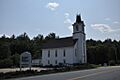
Congregational Church of East Sumner

See also
 In Spanish: Sumner (Maine) para niños
