Texas Irrigation Canals facts for kids
Canals are like special waterways built by people to move water from one place to another. In Texas, there are many of these canals, especially in the Rio Grande Valley and along the Gulf Coast. They are super important because they bring water to dry areas, helping farmers grow crops.
Contents
Canals in the Rio Grande Valley
El Paso Area Canals
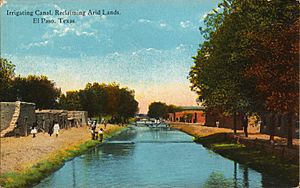
One big canal system in Texas is near El Paso. It starts at the American Dam on the border where Texas, New Mexico, and Mexico meet. This dam sends water into the American Canal on the U.S. side. The canal flows through El Paso. Farther down, it splits into smaller canals, like the Franklin Canal. These smaller canals water a large part of the upper Rio Grande valley. The US Bureau of Reclamation manages this network. Key canals here are the Riverside Canal (El Paso), American Canal, and Franklin Canal. Mexico has a similar canal system starting in Ciudad Juárez.
Eagle Pass Canals
Plans for canals in Eagle Pass began way back in 1885. A rancher named Patrick W. Thompson first drew up the ideas. Construction started in 1889 but stopped because there wasn't enough money. Work didn't restart until 1926. The canal system finally began working in 1932. By the early 1970s, the main canal was about 108 kilometers (67 miles) long. Some of the first crops grown here were onions and figs.
Lower Rio Grande Valley Canals
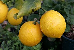
Another huge canal system is in the very southern tip of Texas, in the lower Rio Grande valley. This area has 25 water districts across three counties. The warm, tropical weather here is perfect for growing many foods. Farmers grow citrus fruits, watermelons, and lots of other fruits and vegetables. This part of Texas is the main place where the state grows crops like citrus.
Texas Colorado River Canals
There's another large canal system along the Colorado River in Texas. This river is different from the one that flows through the Grand Canyon. This canal network is about 1,770 kilometers (1,100 miles) long. The Lower Colorado River Authority (LCRA) manages it. It brings water to farms in an area that doesn't get much rain. Texas grows about 7% of the nation's rice, and most of it comes from farms along this Colorado River. Nine pumping stations move water into these canals. The network waters about 370 square kilometers (91,500 acres) in Colorado, Matagorda, and Wharton Counties.
Phantom Lake Canal
The Phantom Lake Canal is in West Texas. It helps water vineyards, orchards, and other crops. Any extra water in this canal flows into Lake Balmorhea.
Balmorhea Canals
The Balmorhea canal system gets its water from San Solomon Springs. It carries this water to nearby farms for irrigation. The water leaves the San Solomon Springs swimming pool in Balmorhea State Park. It starts as one big canal and then splits into smaller ones after leaving the park.
East Texas Canals
Canals in East Texas help deliver water to farms. Many of these canals are east of Houston and west of Beaumont. People sometimes confuse them with drainage ditches. You can usually tell a canal by a few things:
- The water level is often high, sometimes even above the ground.
- They are usually straight with some turns, unlike natural streams.
- They might have special gates called locks or valves to control the water flow.
Even though many canals are in quiet areas, you can see them from I-10 in some spots. Other major roads that cross canals include US 90, US 69, US 96, and US 287 around Beaumont.
Gulf Coast Water Authority
The Gulf Coast Water Authority runs several canals. The American Canal and Briscoe Canal systems were first built to water rice and sugar cane farms. These farms are in Brazoria, Fort Bend, and Galveston counties.
Lower Neches Valley Authority
A big part of the canals in Southeast Texas are owned and run by the Lower Neches Valley Authority (LNVA). The LNVA was created in 1933. It manages water in Hardin, Jefferson, Tyler, eastern Chambers, and Liberty counties. The LNVA system has 640 kilometers (400 miles) of canals. These canals cover an area of about 1,813 square kilometers (700 square miles). They deliver fresh water to cities, industries, and over 100 farms. Water is taken from the lower Neches River and Pine Island Bayou. Twenty-one large pumps can move over 3.7 billion liters (1 billion gallons) of water each day.
A special barrier was built across the Neches River between 2000 and 2003. This barrier stops saltwater from getting into the fresh water during dry times when the river flow is low. This helps keep the water clean for farms and cities.
Sabine River Authority
The Sabine River Authority runs the John W. Simmons Gulf Coast Canal System. This system provides water for farms, factories, and cities. It includes 120 kilometers (75 miles) of canals. They start at the Sabine River near Orange, Texas. Pumps here can deliver more than 1.3 billion liters (360 million gallons) of water every day.
 | Madam C. J. Walker |
 | Janet Emerson Bashen |
 | Annie Turnbo Malone |
 | Maggie L. Walker |


