Torsa facts for kids
| Gaelic name | Torsa |
|---|---|
| Norse name | Possibly Þorirsey |
| Meaning of name | Thorir's island |
| OS grid reference | NM762130 |
| Coordinates | 56°16′N 5°37′W / 56.26°N 5.62°W |
| Physical geography | |
| Island group | Slate Islands |
| Area | 113 ha (280 acres) |
| Area rank | 143 |
| Highest elevation | 62 m (203 ft) |
| Administration | |
| Sovereign state | United Kingdom |
| Country | Scotland |
| Council area | Argyll and Bute |
| Demographics | |
| Population | 0 |
Torsa (sometimes called Torsay) is a small island in Argyll and Bute, Scotland. It is one of the Slate Islands. Torsa lies east of Luing and south of Seil. It is a tidal island, which means you can walk to it at low tide. People lived on Torsa until the 1960s. Now, there is only one house, which is used for holidays.
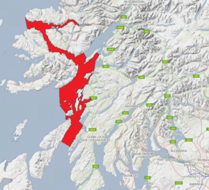
The island is made of slate rock. But unlike its nearby islands, the slate here has never been mined. Torsa's name comes from the Old Norse language. A famous old building on the island is the ruined Caisteal nan Con. This castle was once owned by Clan Campbell. The waters around Torsa are full of amazing sea life. They are protected by the Loch Sunart to the Sound of Jura Marine Protected Area.
Contents
Exploring Torsa's Geography
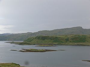
Torsa is located just off the east coast of Luing island. A rough path from Luing leads to a narrow stretch of water. You can cross this water at low tide to reach Torsa. This area is called Torsa Beag, meaning "Little Torsa." It is always connected to the main island by a thin strip of land.
The Island's Features
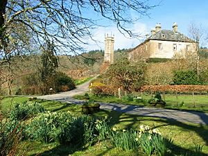
The Torsa farmhouse is nearby. People lived there until the 1960s. Now, it is a holiday home. The island covers about 113 hectares (279 acres). Most of it is on a raised beach, between 10 and 60 meters above sea level. There is a shallow place for boats at Ardinamir. It has a narrow entrance with rocks that appear at low tide. Torsa does not have a pier. Visitors usually use a small dinghy to get to the island.
Torsa is quite fertile compared to its larger neighbors. It has good land for cattle. Almost all of its surface can be farmed.
Small Islands Around Torsa
There are several small islands off Torsa's west side. These include Eilean Fraoch, which means "Heather Island." Glas Eilean means "Grey-green Island." Another is Sgeir a' Bodaich. The northern tip of Torsa is a peninsula called Eilean na h-Eaglaise. This name means "island of the church."
Torsa's Rocks and Land
Most of Torsa is made of a type of rock called Easdale Slate. However, this slate has never been dug up for sale. Around the middle of the island, there is a raised beach. This area has soil and rocks left behind by the sea after the last ice age. Torsa Beag was formed by a very old type of rock called a metamorphic intrusion. This happened during the Neoproterozoic era.
What Torsa's Name Means
The name Torsa, sometimes spelled Torsay, comes from the Old Norse language. It means "Thorir's island" or possibly "Thor's Island." Thorir and Thor were common names. An old record from 848 mentions a Viking king whose heir, Thórir, brought an army to Ireland. Just south of Ardinamir on Luing, there is Bàgh Lachlainn. This means "Lachlan's Bay." The name Lachlan comes from an 11th-century word. It described someone of Norse (Viking) origin.
A Look at Torsa's History
From about the 500s to the 700s AD, a group called the Cenél Loairn controlled the area. This region included the Slate Islands. It was part of the kingdom of Dál Riata. By the late 700s, the area became a place of fighting. The Celtic rulers of mainland Argyll fought against new Norse settlers.
Norse Influence and Scottish Rule
Even though there are not many written records from this time, Norse names for places show their influence. This suggests the islands became part of the Kingdom of the Isles. The Clan MacDougall was powerful in the area. They answered to the Scottish crown for their mainland lands. But they answered to the Kings of Norway for their island lands. This changed in 1266 with the Treaty of Perth. This treaty gave the Hebrides islands to the Kingdom of Scotland.
The Dogs' Castle
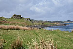
Caisteal nan Con means "the Dogs' Castle." It is a ruined tower house on a rocky hill on the northeast shore. In the late Middle Ages, Clan Campbell owned it. Later, the MacDougalls of Rarey owned it. Finally, Clan MacLean owned it. The castle was built in a strong defensive spot. It was on a steep rocky cliff overlooking the sea on three sides.
The main tower was about 13.7 meters by 8.8 meters. A lower area, called a bailey, was closer to the sea. It had a small round tower. In the 1970s, experts reported that the buildings were very ruined. They were covered in grass. But large parts of the outer walls of the tower house and bailey still stood. A small rocky inlet nearby might have been used for boats. The name "Dogs' Castle" might mean it was a hunting lodge. But Torsa is too small for much hunting. It is more likely that the name came from a nickname for Clan MacLean. Their enemies called them Clann Illeathain nan Con.
Changes in Land Ownership
By the late 1600s, the Dukes of Argyll owned most of the land. They started renting land based on who paid the most. This was different from the old way of helping their clan members. Nearby islands like Seil, Luing, and Shuna saw many people forced to leave their homes. This was part of the Highland clearances. Torsa likely had the same fate. The Slate Islands then became part of the Netherlorn estates. These were owned by the Breadalbane family, a branch of Clan Campbell. They managed their lands from Ardmaddy Castle on the mainland.

Population Changes
At the start of the 1800s, eleven families lived on Torsa. They used a traditional farming system called run rig. In the mid-1800s, the population was 9 people. There were 5 females and 4 males. By 1909, the island had only one farm. The 1961 census was the last time anyone was recorded living there permanently. Only one person lived there at that time.
During the 1900s, most of the Breadalbane land on the Slate islands was sold. It was divided into smaller farms and individual houses. Torsa is still part of the Ardmaddy Estate today. However, the Struthers family now owns it.
In 1928, a stone spindle whorl was found on the island's central plateau. Its age is not known.
Wildlife on Torsa
You can find red deer, roe deer, and foxes on Torsa. Sometimes, you can see otters and seals along the shoreline. Local boat trips offer chances to see whales and dolphins and basking sharks. The island is near the eastern edge of the Firth of Lorn Marine Special Area of Conservation. The waters around all the Slate Islands are part of the Loch Sunart to the Sound of Jura Marine Protected Area.
See also
 In Spanish: Torsa para niños
 | Aurelia Browder |
 | Nannie Helen Burroughs |
 | Michelle Alexander |


