Tricouni Peak (Washington) facts for kids
Quick facts for kids Tricouni Peak |
|
|---|---|

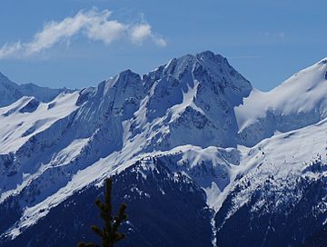
Tricouni Peak seen from Ruby Mountain
|
|
| Highest point | |
| Elevation | 8,102 ft (2,469 m) |
| Prominence | 862 ft (263 m) |
| Geography | |
| Location | North Cascades National Park, Washington, U.S. |
| Parent range | North Cascades Cascade Range |
| Topo map | USGS Forbidden Peak |
| Type of rock | Eldorado Orthogneiss |
| Climbing | |
| First ascent | 1951 Les Carlson, Elwyn Elerding, Jeanne Elerding |
| Easiest route | Glacier travel, rock scrambling |
Tricouni Peak is a tall mountain, about 8,102-foot (2,469-metre) high. You can find it in Skagit County, Washington state. It's part of the beautiful North Cascades National Park. The peak sits north of the North Klawatti Glacier and southeast of the Borealis Glacier.
Its closest taller neighbor is Primus Peak, just 0.54 mi (0.87 km) to the west. Rain and melting snow from Tricouni flow into Thunder Creek. The mountain gets its name from 'tricouni' – special metal spikes that climbers used on their boots to grip ice. Getting to the top of Tricouni Peak means crossing a glacier, which is a big sheet of ice.
Mountain Weather
Tricouni Peak is in a place with a 'marine west coast' climate. This means it's near the ocean, which affects its weather. Most of the weather here comes from the Pacific Ocean. Big weather systems move from the ocean towards the Cascade Mountains.
When these weather systems hit the tall North Cascades, they are pushed upwards. This causes them to drop their moisture as rain or snow onto the mountains. This process is called orographic lift. Because of this, the west side of the North Cascades gets a lot of rain and snow, especially in winter.
During winter, it's usually cloudy. But in summer, high-pressure systems over the Pacific Ocean often bring clear skies. Since the ocean influences the weather, the snow tends to be wet and heavy. This can lead to a high risk of avalanches.
How the Mountains Formed
The North Cascades have some very rugged land. You can see sharp peaks, tall spires, long ridges, and deep valleys carved by glaciers. These amazing shapes and big changes in height were created by geological events that happened millions of years ago. These events also led to the different climates you find across the Cascade Range.
The Cascade Mountains started forming millions of years ago, during the late Eocene Epoch. At that time, the North American Plate was slowly moving over the Pacific Plate. This movement caused many volcanic eruptions. Also, small pieces of the Earth's crust, called terranes, came together to form the North Cascades about 50 million years ago.
During the Pleistocene period, which was over two million years ago, glaciers grew and shrank many times. As they moved, they scraped and shaped the land, leaving behind piles of rock. The river valleys you see today often have a "U" shape. This shape was created by these ancient glaciers. The combination of land being pushed up (uplift) and cracks forming in the Earth (faulting), along with the work of glaciers, has created the tall peaks and deep valleys of the North Cascades area.
 | Anna J. Cooper |
 | Mary McLeod Bethune |
 | Lillie Mae Bradford |


