
Turpan facts for kids
Quick facts for kids
Turpan
Turfan
|
|
|---|---|
|
Prefecture-level city
|
|

Jiaohe Ruins
|
|

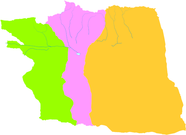
Turpan (red) in Xinjiang (orange)
|
|

Turpan
Location in Xinjiang

Turpan
Location in China
|
|
| Country | People's Republic of China |
| Region | Xinjiang |
| County-level divisions | 3 |
| Prefecture seat | Gaochang District |
| Area | |
| • Prefecture-level city | 69,759 km2 (26,934 sq mi) |
| • Urban | 13,650 km2 (5,270 sq mi) |
| Lowest elevation
(Ayding Lake)
|
−154 m (−505.2 ft) |
| Population
(2020)
|
|
| • Prefecture-level city | 693,988 |
| • Density | 9.94837/km2 (25.76615/sq mi) |
| • Urban | 317,443 |
| • Urban density | 23.256/km2 (60.232/sq mi) |
| Demographics | |
| • Major ethnic groups |
|
| GDP | |
| • Prefecture-level city | CN¥ 31.0 billion US$ 4.7 billion |
| • Per capita | CN¥ 49,279 US$ 7,180 |
| Time zone | UTC+8 (China Standard) |
| ISO 3166 code | CN-XJ-04 |
| Climate | BWk |
| Website | Turpan Prefecture-level city Government |
| Turpan | |||||||||||
|---|---|---|---|---|---|---|---|---|---|---|---|
| Chinese name | |||||||||||
| Simplified Chinese | 吐鲁番 | ||||||||||
| Traditional Chinese | 吐魯番 | ||||||||||
|
|||||||||||
| Uyghur name | |||||||||||
| Uyghur | تورپان | ||||||||||
|
|||||||||||
Turpan (Uyghur: تۇرپان), also known as Turfan (Chinese: 吐鲁番), is a city in the eastern part of Xinjiang, China. It covers about 69,759 square kilometers and had a population of 693,988 in 2020. Turpan has always been an important place. Its main city has moved over time, from Yar-Khoto to Qocho (Gaochang) and now to modern Turpan.
Contents
- Understanding the Names of Turpan
- A Glimpse into Turpan's Past
- Turpan's Geography and Climate
- People and Culture in Turpan
- Turpan's Economy and Agriculture
- Getting Around Turpan
- Places to Visit in Turpan
- Notable People from Turpan
- See also
Understanding the Names of Turpan
Many places in the Tarim Basin have different names. This is because people speaking Chinese, Turkic, Mongolian, and Persian languages lived there. Turpan is one of these places. The name "Turfan" is older than "Turpan." It became widely used after the time of the Mongol Empire.
A Glimpse into Turpan's Past
Turpan has always been a key spot because of its rich oasis. This oasis gets water from an old canal system called karez. It was also a vital trading hub along the famous Silk Road. Other kingdoms like Korla and Yanqi were also in this region.
Early Inhabitants of Turpan
Long ago, people speaking Tocharian languages lived in Turpan. These languages are part of the Indo-European family. The Jushi Kingdom ruled the area first. Then, the Chinese Han dynasty took control in 107 BC. The city was often fought over by the Han dynasty and its enemy, the Xiongnu Empire. Sometimes, it was even independent for short periods.
Turpan After the Han Dynasty
After the Han dynasty ended in 220 AD, the Turpan region became mostly independent. However, it still paid tribute to various Chinese dynasties. Until the 5th century AD, the capital was Jiaohe. Many Han Chinese and Sogdians moved to Turpan during this time. The oldest Chinese writing found in Turpan dates back to 273 AD.
In 327 AD, a Chinese military area called Gaochang Commandery was set up in Turpan. Chinese settlers from other parts of China also moved here. Gaochang was ruled by several Chinese dynasties.
The Gaochang Kingdom
,_Khocho,_Nestorian_Temple,_683-770_AD,_wall_painting_-_Ethnological_Museum,_Berlin_-_DSC01741.JPG)
In 460 AD, the Rouran Khaganate from Mongolia took over Gaochang. They appointed a Chinese man, Kan Bozhou, as king. Gaochang became a separate kingdom under their rule. Later, the Gaoche kingdom took over. Then, the Göktürks became powerful, and the Qu dynasty of Gaochang became their allies.
The culture in Gaochang started to look more like that of the Tang dynasty. Qu Wentai, the King of Gaochang, was a big supporter of the famous Tang traveler Xuanzang.
The Tang Dynasty Takes Control

The Tang dynasty of China took control of the Turpan area in 640 AD. For the next 300 years, the Tibetan Empire, the Tang dynasty, and the Turks fought for control of the Tarim Basin. Turpan was renamed Xi Prefecture by the Tang dynasty. It was already a busy trade center on the Silk Road with many inns for travelers. The city was so influenced by Chinese culture that its name in the Sogdian language meant "Chinatown."
Many documents from this time have been found in Turpan. For example, a contract from 639 AD shows a Sogdian girl being sold to a Chinese man. This shows how people from different cultures interacted.
The Tang dynasty became weaker after the An Lushan Rebellion. The Tibetans then took control of Turpan in 792 AD.


Interesting finds from Turpan include 7th or 8th-century dumplings and wontons!
Uyghur Rule in Turpan
In 803 AD, the Uyghurs of the Uyghur Khaganate took Turpan from the Tibetans. However, the Uyghur Khaganate was later destroyed in 840 AD. This caused many Uyghurs to move from Mongolia to Gansu and Central Asia, including Turpan.
The Idikut Kingdom

The Uyghurs created a kingdom in the Turpan region. Its capital was in Gaochang, also known as Kara-Khoja. This kingdom, called the Uyghuria Idikut state or Kara-Khoja Kingdom, lasted from 856 to 1389 AD. The Uyghurs were first Manichaean but later became Buddhists. They helped build the cave temples in the Bezeklik Caves. This kingdom later became a vassal state of the Kara-Khitans and then of the Mongol Empire.
German Turpan Expeditions
At the beginning of the 20th century (1902-1914), German scientists explored Turpan. These were called the German Turfan expeditions. They found many ancient paintings and art pieces. These treasures were taken to the Museum of Asian Art in Berlin. Sadly, many of these artifacts were destroyed or stolen during World War II.
Turpan Fragments
Many old documents have been found in Turpan. These include writings in Uyghur, Persian, Sogdian, and Syriac. These are known as the Turpan fragments. There are over 40,000 pieces of manuscripts in 16 different languages. They are kept at the Berlin State Library.
These writings cover Buddhist, Christian-Nestorian, Manichaean, and everyday topics. About 8,000 of them are old Turkic Buddhist texts. Christian texts are mostly in Syriac and Sogdian. Manichaean texts are in Middle Persian, Parthian, Sogdian, and Uyghur. Important parts of the Gospel of Mani and the Arzhang (Book of Pictures) were found here.
Most Buddhist texts are fragments. They include Indian Sanskrit texts and Uyghur texts translated from Sanskrit, Tocharian, and Chinese.
Turpan Becomes Islamic
The local Buddhist people in Turpan gradually converted to Islam. This process was finished in the second half of the 15th century. After converting, the descendants of the Buddhist Uyghurs forgot their old history. They mistakenly thought that "infidel Kalmuks" (Dzungars) built the Buddhist monuments in their area.
Turpan in the 15th and 16th Centuries

In 1414, a Chinese diplomat named Chen Cheng described Buddhist images and temples in Turpan. In 1420, a traveler from Herat to Beijing, Ghiyāth al-dīn Naqqāsh, reported that many people in Turpan were "infidels." He visited a large temple with a statue of Shakyamuni. Some accounts even said many Turpanians "worshipped the cross."

The ruler of Turpan, Yunus Khan, united his region in 1472. Around this time, a conflict started with Ming China. Turpan wanted to send more "tribute missions" to China. These missions allowed them to get valuable gifts and trade a lot. However, the Chinese found these missions too expensive.
Yunus Khan was unhappy with China's rules on missions. So, in 1473, he went to war against China and captured Hami. His son, Ahmad Alaq, later took Hami again in 1493. China responded by stopping trade with Turpan. This made things very hard for Turpan. Ahmad's son, Mansur, continued these conflicts. He tried to attack China in 1524 but was defeated.
Turpan in the 18th and 19th Centuries
The Imin mosque in Turpan was built in 1779.
Francis Younghusband visited Turpan in 1887. He described two walled towns: a Chinese one with about 5,000 people and a Turk town with 12,000 to 15,000 people. The Turk town had strong walls and gates. Wheat, cotton, poppies, melons, and grapes were grown in the fields around the city.
Turpan grapes were very famous. A Russian explorer, Grigory Grum-Grshimailo, thought the local raisins might be "the best in the world." He also noted special buildings used for drying them. Mongols, Chinese, and Chantos all lived in Turpan during this time.
Turpan in the 20th and 21st Centuries
In 1931, a rebellion started in the region. This happened after a Chinese commander tried to force a local girl to marry him. The Chinese army attacked Muslims, which made many local groups join the rebels.
On August 19, 1981, Deng Xiaoping, a leader of China, visited Turpan. On March 31, 1995, Turpan and Dunhuang became sister cities.
Turpan's Geography and Climate

Turpan is about 150 kilometers southeast of Ürümqi, the capital of Xinjiang. It sits in a mountain basin, on the north side of the Turpan Depression. The city is about 30 meters above sea level. There is a small volcano near Turpan that is said to have erupted in 1120.
Turpan's Subdivisions
Turpan is divided into one district and two counties:
| Map | ||||||||
|---|---|---|---|---|---|---|---|---|
Gaochang
Shanshan
County Toksun
County |
||||||||
| # | Name | Chinese characters | Hanyu Pinyin | Uyghur (UEY) | Uyghur Latin (ULY) | Population (2020 Census) |
Area (km2) | Density (/km2) |
| 1 | Gaochang District | 高昌区 | Gāochāng Qū | قاراھوجا رايونى | Qarahoja Rayoni | 317,443 | 13,651 | 23.25 |
| 2 | Shanshan County | 鄯善县 | Shànshàn Xiàn | پىچان ناھىيىسى | Pichan Nahiyisi | 242,310 | 39,547 | 6.13 |
| 3 | Toksun County | توكسۇن ناھىيىسى | Toqsun Xiàn | توقسۇن ناھىيىسى | Toqsun Nahiyisi | 134,235 | 16,561 | 8.11 |
Turpan's Weather Patterns
Turpan has a very dry continental climate (BWk). Summers are extremely hot, and winters are very cold. Spring and autumn are very short. It gets very little rain, only about 15.7 mm per year. The average temperature changes a lot between seasons. It's about -6.7°C in January and 33.1°C in July. The yearly average is 15.7°C.
Turpan gets a lot of sunshine, about 2,912 hours each year. The highest temperature recorded was 49.1°C, and the lowest was -28.9°C. Even with the extreme heat and dryness in summer, Turpan's old irrigation system helps grow lots of high-quality fruit.
| Climate data for Turpan, elevation 39 m (128 ft), (1991–2020 normals) | |||||||||||||
|---|---|---|---|---|---|---|---|---|---|---|---|---|---|
| Month | Jan | Feb | Mar | Apr | May | Jun | Jul | Aug | Sep | Oct | Nov | Dec | Year |
| Record high °C (°F) | 8.5 (47.3) |
19.5 (67.1) |
31.7 (89.1) |
40.5 (104.9) |
43.6 (110.5) |
47.6 (117.7) |
49.1 (120.4) |
47.8 (118.0) |
43.4 (110.1) |
34.3 (93.7) |
23.0 (73.4) |
9.6 (49.3) |
49.1 (120.4) |
| Mean daily maximum °C (°F) | −2.3 (27.9) |
7.0 (44.6) |
17.9 (64.2) |
27.8 (82.0) |
33.9 (93.0) |
38.8 (101.8) |
40.5 (104.9) |
39.0 (102.2) |
32.6 (90.7) |
22.5 (72.5) |
10.3 (50.5) |
−0.4 (31.3) |
22.3 (72.1) |
| Daily mean °C (°F) | −6.7 (19.9) |
1.3 (34.3) |
11.6 (52.9) |
20.7 (69.3) |
26.6 (79.9) |
31.6 (88.9) |
33.1 (91.6) |
31.2 (88.2) |
24.6 (76.3) |
14.5 (58.1) |
4.4 (39.9) |
−4.4 (24.1) |
15.7 (60.3) |
| Mean daily minimum °C (°F) | −10.3 (13.5) |
−3.5 (25.7) |
5.9 (42.6) |
14.2 (57.6) |
19.8 (67.6) |
24.7 (76.5) |
26.5 (79.7) |
24.6 (76.3) |
18.4 (65.1) |
9.1 (48.4) |
0.3 (32.5) |
−7.6 (18.3) |
10.2 (50.3) |
| Record low °C (°F) | −28.9 (−20.0) |
−24.5 (−12.1) |
−10.4 (13.3) |
−1.8 (28.8) |
4.7 (40.5) |
11.5 (52.7) |
15.5 (59.9) |
11.6 (52.9) |
1.3 (34.3) |
−5.7 (21.7) |
−17.8 (0.0) |
−26.1 (−15.0) |
−28.9 (−20.0) |
| Average precipitation mm (inches) | 0.9 (0.04) |
0.5 (0.02) |
0.7 (0.03) |
0.9 (0.04) |
1.0 (0.04) |
2.6 (0.10) |
2.0 (0.08) |
2.0 (0.08) |
1.4 (0.06) |
1.2 (0.05) |
0.6 (0.02) |
0.9 (0.04) |
14.7 (0.6) |
| Average precipitation days (≥ 0.1 mm) | 1.0 | 0.3 | 0.3 | 0.7 | 1.1 | 2.0 | 2.3 | 1.9 | 0.9 | 0.8 | 0.5 | 1.1 | 12.9 |
| Average snowy days | 2.5 | 0.9 | 0 | 0 | 0 | 0 | 0 | 0 | 0 | 0 | 0.2 | 2.6 | 6.2 |
| Average relative humidity (%) | 56 | 40 | 25 | 23 | 25 | 27 | 30 | 31 | 35 | 45 | 50 | 56 | 37 |
| Mean monthly sunshine hours | 121.8 | 172.0 | 234.2 | 263.7 | 308.4 | 301.6 | 303.3 | 299.6 | 273.5 | 238.6 | 163.7 | 108.2 | 2,788.6 |
| Percent possible sunshine | 41 | 57 | 62 | 65 | 67 | 66 | 66 | 71 | 74 | 71 | 57 | 39 | 61 |
| Source 1: China Meteorological Administration | |||||||||||||
| Source 2: | |||||||||||||
| Climate data for Turpan (Dongkan Station), elevation −49 m (−161 ft), (1991–2020 normals) | |||||||||||||
|---|---|---|---|---|---|---|---|---|---|---|---|---|---|
| Month | Jan | Feb | Mar | Apr | May | Jun | Jul | Aug | Sep | Oct | Nov | Dec | Year |
| Mean daily maximum °C (°F) | −1.9 (28.6) |
7.6 (45.7) |
18.6 (65.5) |
28.5 (83.3) |
34.5 (94.1) |
39.3 (102.7) |
40.8 (105.4) |
39.3 (102.7) |
33.2 (91.8) |
23.2 (73.8) |
10.9 (51.6) |
0.0 (32.0) |
22.8 (73.1) |
| Daily mean °C (°F) | −8.0 (17.6) |
0.5 (32.9) |
11.1 (52.0) |
20.7 (69.3) |
26.8 (80.2) |
31.9 (89.4) |
33.3 (91.9) |
31.4 (88.5) |
24.8 (76.6) |
14.8 (58.6) |
3.8 (38.8) |
−5.7 (21.7) |
15.5 (59.8) |
| Mean daily minimum °C (°F) | −12.8 (9.0) |
−5.5 (22.1) |
4.5 (40.1) |
13.8 (56.8) |
19.7 (67.5) |
24.9 (76.8) |
26.6 (79.9) |
24.7 (76.5) |
18.3 (64.9) |
8.6 (47.5) |
−1.3 (29.7) |
−9.9 (14.2) |
9.3 (48.8) |
| Average precipitation mm (inches) | 0.8 (0.03) |
0.4 (0.02) |
0.6 (0.02) |
1.0 (0.04) |
1.0 (0.04) |
2.5 (0.10) |
2.0 (0.08) |
1.9 (0.07) |
1.3 (0.05) |
0.9 (0.04) |
0.4 (0.02) |
0.6 (0.02) |
13.4 (0.53) |
| Average precipitation days (≥ 0.1 mm) | 1.0 | 0.3 | 0.3 | 0.8 | 1.0 | 2.1 | 2.4 | 2.1 | 1.0 | 0.6 | 0.4 | 0.8 | 12.8 |
| Average snowy days | 2.2 | 0.6 | 0 | 0 | 0 | 0 | 0 | 0 | 0 | 0 | 0.1 | 2.0 | 4.9 |
| Average relative humidity (%) | 56 | 41 | 26 | 24 | 25 | 28 | 32 | 33 | 34 | 41 | 48 | 57 | 37 |
| Mean monthly sunshine hours | 161.9 | 193.2 | 246.9 | 267.1 | 307.9 | 304.8 | 306.1 | 302.3 | 282.0 | 254.7 | 186.0 | 140.0 | 2,952.9 |
| Percent possible sunshine | 55 | 64 | 66 | 66 | 67 | 67 | 67 | 71 | 77 | 76 | 65 | 50 | 66 |
| Source: China Meteorological Administration | |||||||||||||
People and Culture in Turpan
In 2015, Turpan had a population of 651,853 people. Islam is the main religion. Here's a look at the different ethnic groups:
| 2000 | 2015 | 2018 | |||||||||||||||||||||||||||||||||||||||||||||||||||||||||||||||||||||||||||||||||||||||||||||||||||||||||
|---|---|---|---|---|---|---|---|---|---|---|---|---|---|---|---|---|---|---|---|---|---|---|---|---|---|---|---|---|---|---|---|---|---|---|---|---|---|---|---|---|---|---|---|---|---|---|---|---|---|---|---|---|---|---|---|---|---|---|---|---|---|---|---|---|---|---|---|---|---|---|---|---|---|---|---|---|---|---|---|---|---|---|---|---|---|---|---|---|---|---|---|---|---|---|---|---|---|---|---|---|---|---|---|---|---|---|---|
|
|
|
|||||||||||||||||||||||||||||||||||||||||||||||||||||||||||||||||||||||||||||||||||||||||||||||||||||||||
Language and Local Features
The Uyghur dialect spoken in Turpan has some Chinese words in it. Some people believe that Uyghurs in Turpan have more Han Chinese features because of marriages between Han Chinese and Uyghurs in the past.
Turpan's Economy and Agriculture

Turpan's economy is mostly based on farming. They grow vegetables, cotton, and especially grapes. Turpan is China's biggest area for producing raisins. The local government strongly supports grape farming. They help with raisin distribution, offer loans for growing grapes, and provide free training for farmers. Turpan also holds an annual Grape Festival.
Getting Around Turpan


Turpan has good transportation links. The Lanzhou–Xinjiang High-Speed Railway serves the Turpan North Railway Station. The Turpan Railway Station is a meeting point for two regular train lines: the Lanzhou-Xinjiang and the Southern Xinjiang Railways.
China National Highway 312 also passes through Turpan. The Tulufan Jiaohe Airport is close to the Turpan North Railway Station.
Places to Visit in Turpan
Turpan is home to one of several caves linked to the famous Christian and Muslim story of the Seven Sleepers.
Notable People from Turpan
- Mahmut Muhiti
- Emin Khoja
|
See also
 In Spanish: Turfán para niños
