Twizel facts for kids
Quick facts for kids
Twizel
|
|
|---|---|
 |
|
| Country | New Zealand |
| Region | Canterbury |
| Territorial authority | Mackenzie District |
| Ward | Pukaki Ward |
| Community | Twizel Community |
| Founded | 1968 |
| Electorates |
|
| Area | |
| • Total | 15.54 km2 (6.00 sq mi) |
| Elevation | 470 m (1,540 ft) |
| Population
(June 2023)
|
|
| • Total | 1,850 |
| • Density | 119.0/km2 (308.3/sq mi) |
| Time zone | UTC+12 (NZST) |
| • Summer (DST) | UTC+13 (NZDT) |
| Postcode(s) |
7901
|
| Area code(s) | 03 |
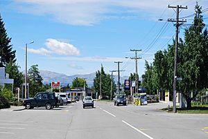
Twizel (pronounced 'twy-zel') is the biggest town in the Mackenzie District of New Zealand. It's located in the Canterbury Region on the South Island.
The town was started in 1968. It was built to house workers for a big project. This project was the Upper Waitaki Hydroelectric Scheme. This scheme created electricity using water power.
Today, Twizel is a busy town for tourists and local services. Many people visit the area for holidays. During the summer, the number of people in Twizel almost triples!
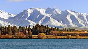
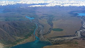
Nearby Lake Ruataniwha is a popular spot. People go there for rowing, sailing, and water skiing. Twizel is about 37 km east of Lake Ōhau village. It's also 30 km north of Omarama and 60 km south of Lake Tekapo.
Contents
How Twizel Began: A Town Built for Power
Twizel was built in 1968 from scratch. It was created to support the huge Hydroelectricity Scheme. This scheme was in the Upper Waitaki area.
What was the Hydroelectricity Scheme?
The scheme was a massive construction project. It included 50 km of canals and two dams. There were also four powerhouses built. These powerhouses were Tekapo B, Ohau A, B, and C. The project also created Lake Ruataniwha. All this work produced 848 megawatts of electricity.
At its busiest in the 1970s, Twizel had about 6,000 people living there.
How was Twizel Designed?
The town was planned in a special way, like a 'Scandinavian' design. It had winding roads and paths for walking. This made it easier and quicker to walk than to drive.
Shops, the school, and parks were in the middle of town. Homes were built around this central area. Different types of houses were available. Smaller ones were for workers. 'Staff houses' were for teachers and other professionals. The largest homes were for engineers and high-ranking residents.
Why was Twizel Meant to be Temporary?
Twizel was first meant to be a temporary town. It was planned to be removed once the hydroelectric project finished. Because of this, many things were built to be temporary.
For example, roads had a special flat 'W' shape. This meant they didn't need curbs or separate footpaths. Also, most phone lines were above ground. This saved the effort of burying them. Many houses were built in factories. They were designed to be moved easily. Some houses were even brought from another town, Otematata. Later, some were moved to Clyde for another project.
However, in 1983, the hydroelectric project was ending. The people living in Twizel fought to save their town. They succeeded, and Twizel became a permanent place.
Twizel's Population: Who Lives Here?
Twizel is a small urban area. It covers about 15.54 square kilometers. As of 2018, its population was around 1,455 people.
The population has grown quite a bit. In 2006, there were 1,041 people. By 2018, it had increased by 39.8%. The average age in Twizel in 2018 was 46.5 years. About 14.6% of the people were under 15 years old.
Most people in Twizel are of European background (87.6%). About 9.1% identify as Māori. Many people (54.2%) said they had no religion. About 34.2% were Christian.
Fun Things to Do in Twizel
Twizel is a great place for visitors. It offers many activities, especially outdoors.
Fishing: Catch a Big One!
Twizel is famous for fishing. You can fish in mountain streams and lakes. These include Lakes Ruataniwha and Ōhau. The hydroelectric canals are also popular.
The canals have salmon farms. This means there's lots of food for wild salmon and trout. Many huge fish have been caught here. Trout weighing over 4.5 kilograms are common. In October 2020, a trout caught in the Ōhau canal weighed 20.1 kg. This was a world record! Twizel also has an annual Salmon & Wine Festival in February.
Rowing: On Lake Ruataniwha
Lake Ruataniwha is perfect for water sports. People enjoy sailing and water skiing there. Many big rowing events happen on the lake. These include the Maadi Cup and the New Zealand Rowing Championships. The Twizel Rowing Club is based here. Its members compete in all age groups.
Skiing: Winter Fun Nearby
In winter, tourists come for skiing. The nearby Ōhau Skifield and the Round Hill Ski Area are popular. The Twizel Snow Club helps local kids. They learn skills and train for skiing and snowboarding competitions.
Walking and Hiking: Explore the Outdoors
The Twizel River Trail is a 24-kilometer walk. It goes around the edge of Twizel. Other nearby walks include:
- The Ben Ohau Wetland track (15 minutes long).
- The Darts Bush Stream track (four hours long).
You can also climb Ben Ohau mountain. The track starts 23 km outside Twizel.
Biking: Cycle the Alps to Ocean Trail
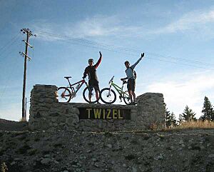
Twizel is on the Alps to Ocean Cycle Trail. This is a long biking route.
- Stage 2: Lake Tekapo to Twizel
* This part is 54 km long. * Riders go past the Tekapo A power station. * They cycle along the Tekapo Canal. * Then, they go around Lake Pukaki and across the Pukaki Flats to Twizel.
- Stage 3: Twizel to Lake Ōhau Lodge
* This section is 38 km long. * Riders follow canal roads to Lake Ōhau. * Then, it becomes an off-road trail along the lake. * This part is easy and has little traffic. * You'll see the Pukaki and Ohau canals. You'll also get views of Ben Ohau and Maori Swamp.
Another biking trail is the Dusky Trail. It's 23 km long and easy to ride. It goes through the Ruataniwha Conservation Park. The views along this trail are amazing!
Twizel also hosts the annual Twizel to Timaru Cycle Classic race. This race is 151 km long.
Astronomy: Stargazing in a Dark Sky Reserve
The sky around Twizel is very clear, dry, and dark. This makes it perfect for looking at stars. Many astronomers come to Twizel and the surrounding area. There are already places for 'astro-tourism' in Lake Tekapo and Omarama. Two new observatories are being built in Twizel and at Mount Cook Village.
Since 2012, Twizel has been part of the Aoraki Mackenzie International Dark-Sky Reserve. This is one of only sixteen such reserves in the world. It's recognized by the International Dark-Sky Association.
Twizel's Weather: What's the Climate Like?
Twizel has an oceanic climate. This means summers are usually mild and dry. Winters are cold and frosty. Snow often falls in Twizel during several months of the year. Twizel is often the coldest town in New Zealand in winter.
| Climate data for Twizel (Pukaki Airport), elevation 461 m (1,512 ft), (1991–2020 normals, extremes 1972–present) | |||||||||||||
|---|---|---|---|---|---|---|---|---|---|---|---|---|---|
| Month | Jan | Feb | Mar | Apr | May | Jun | Jul | Aug | Sep | Oct | Nov | Dec | Year |
| Record high °C (°F) | 35.7 (96.3) |
34.3 (93.7) |
31.0 (87.8) |
27.3 (81.1) |
25.1 (77.2) |
18.0 (64.4) |
18.5 (65.3) |
20.2 (68.4) |
24.5 (76.1) |
28.0 (82.4) |
30.4 (86.7) |
33.3 (91.9) |
35.7 (96.3) |
| Mean daily maximum °C (°F) | 24.6 (76.3) |
24.6 (76.3) |
21.5 (70.7) |
16.7 (62.1) |
12.1 (53.8) |
7.1 (44.8) |
7.2 (45.0) |
10.6 (51.1) |
14.7 (58.5) |
17.6 (63.7) |
19.9 (67.8) |
22.7 (72.9) |
16.6 (61.9) |
| Daily mean °C (°F) | 16.6 (61.9) |
16.2 (61.2) |
13.5 (56.3) |
9.5 (49.1) |
6.1 (43.0) |
2.0 (35.6) |
1.8 (35.2) |
4.3 (39.7) |
7.4 (45.3) |
10.1 (50.2) |
12.3 (54.1) |
14.9 (58.8) |
9.6 (49.2) |
| Mean daily minimum °C (°F) | 8.6 (47.5) |
7.8 (46.0) |
5.6 (42.1) |
2.4 (36.3) |
0.1 (32.2) |
−3.1 (26.4) |
−3.5 (25.7) |
−2.0 (28.4) |
0.1 (32.2) |
2.6 (36.7) |
4.8 (40.6) |
7.1 (44.8) |
2.5 (36.6) |
| Record low °C (°F) | −1.1 (30.0) |
−3.5 (25.7) |
−4.2 (24.4) |
−7.0 (19.4) |
−10.5 (13.1) |
−19.8 (−3.6) |
−14.7 (5.5) |
−9.1 (15.6) |
−8.5 (16.7) |
−4.9 (23.2) |
−4.7 (23.5) |
−2.4 (27.7) |
−19.8 (−3.6) |
| Average rainfall mm (inches) | 55.0 (2.17) |
55.0 (2.17) |
50.2 (1.98) |
65.8 (2.59) |
57.3 (2.26) |
46.3 (1.82) |
48.9 (1.93) |
51.4 (2.02) |
45.4 (1.79) |
55.4 (2.18) |
64.4 (2.54) |
63.2 (2.49) |
658.3 (25.94) |
| Source: NIWA | |||||||||||||
Getting Around Twizel
Roads and Buses
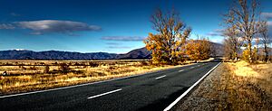
Twizel is right next to State Highway 8. This is the main road that serves the town. You can also get to Twizel by bus. InterCity coaches offer regular services. They connect Twizel to Christchurch and Queenstown. The Cook Connection bus also links Twizel to Mount Cook village.
Airport
Twizel has an airport nearby called Pukaki Airport.
Twizel's Local Government
Twizel is part of the Waitaki electorate. This means people in Twizel vote for a Member of Parliament (MP) for this area. The current MP is Miles Anderson from the National Party.
The local government for Twizel is the Mackenzie District Council. Twizel also has its own Community Board. This board has four elected members and one council member.
Places to Visit in Twizel
Swimming Pool: Cool Off in Summer
The Twizel Community Pool is located on Market Place. It's next to the Twizel Events Centre. This outdoor pool complex has three pools:
- A 33-meter pool for swimming laps, with a slide.
- A smaller pool for children.
- A pool for toddlers.
The pools open in late November each year. There are plans to heat the pools. Many people in the community wanted warmer water.
Golf Course: Play a Round
The Ben Ohau golf club is in Twizel. It's a nine-hole golf course.
Shops: Find What You Need
Twizel's shops are mostly around the Market Place. This area is for pedestrians only. There are two Four Square supermarkets in Twizel. Twizel is also known for having New Zealand's smallest bookstore!
Library: Read and Learn
The Twizel Community Library is on Mount Cook Street. It's just off Market Place. The library is open Monday to Friday and on Saturday mornings.
Twizel Events Centre: A Place for Community
The Twizel Events Centre was built in 2001. It's in the middle of town at Market Place. The centre has a sports hall, a community room with a kitchen, and a theatre hall.
Church: All Saints Church
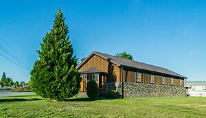
All Saints Church is at 52 Mackenzie Drive. It's a cooperating parish church. This means different Christian groups use it for their services.
Education: Twizel Area School
Twizel has one school, the Twizel Area School. It teaches students from Year 1 to Year 13 (ages 5 to 18). Twizel Primary School and Twizel High School started in 1970. They joined together in 1986 to form the Twizel Area School. It's a co-educational school, meaning both boys and girls attend.
In 2020, the New Zealand government announced a $21 million rebuild for the school. This will replace the old classrooms.
 | Charles R. Drew |
 | Benjamin Banneker |
 | Jane C. Wright |
 | Roger Arliner Young |


