Tysons, Virginia facts for kids
Quick facts for kids
Tysons
|
|
|---|---|
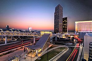
Skyline of Tysons from Tysons station at sunset
|
|
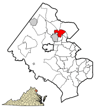
Location of Tysons in Fairfax County, Virginia. Inset: Location of Fairfax County in Virginia
|
|
![Boundaries of Tysons in Fairfax County, Virginia as of 2003[update]](/images/thumb/a/a7/TysonsCornerCDPmap.gif/250px-TysonsCornerCDPmap.gif)
Boundaries of Tysons in Fairfax County, Virginia as of 2003[update]
|
|
| Country | United States |
| State | Virginia |
| County | Fairfax |
| Area | |
| • Total | 4.27 sq mi (11.1 km2) |
| • Land | 4.26 sq mi (11.0 km2) |
| • Water | 0.01 sq mi (0.026 km2) |
| Elevation | 486 ft (148 m) |
| Population
(2020)
|
|
| • Total | 26,374 |
| • Estimate
(2023)
|
28,022 |
| • Density | 6,177/sq mi (2,385/km2) |
| Time zone | UTC−5 (Eastern (EST)) |
| • Summer (DST) | UTC−4 (EDT) |
| FIPS code | 51-79952 |
| GNIS feature ID | 1496341 |
Tysons, also known as Tysons Corner, is a busy area in Fairfax County, Virginia, United States. It's located where two main roads, SR 123 (Chain Bridge Road) and SR 7 (Leesburg Pike), meet. Tysons is part of the larger Washington metropolitan area and sits between the towns of McLean and Vienna.
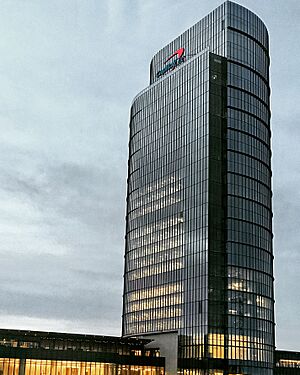
This area is famous for its two huge shopping malls, Tysons Corner Center and Tysons Galleria. Many big companies also have their main offices here. Some of these include Capital One, Freddie Mac, and Hilton Worldwide. Tysons is a major business hub for Fairfax County. It's often called an "edge city" because it's a large commercial area outside a traditional city center. In 2020, about 26,374 people lived here.
Contents
History of Tysons
Early Days: 19th Century Origins
Tysons was first known as Peach Grove. After the Civil War, it became "Tysons Crossroads." This name came from William Tyson, who bought land here. He also served as the postmaster for the local post office from 1854 to 1866.
Growth in the 20th Century
As late as the 1950s, Tysons was a quiet, rural spot. It had a few small shops and a fruit stand run by the Tyson family. But in 1963, things changed a lot. New roads were built, connecting VA Route 7 and VA Route 123.
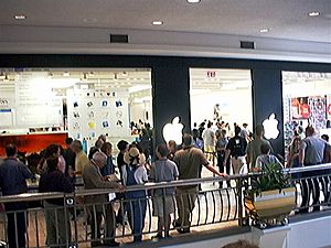
In 1962, plans were approved for the Tysons Corner Shopping Center. This mall, now called Tysons Corner Center, opened on July 25, 1968. Developers said it was the largest enclosed mall in the world at the time!
Tysons Today: 21st Century Development
In the early 2000s, many technology companies moved to Northern Virginia. This led to lots of new office buildings and hotels in Tysons. Tysons grew much faster than other areas nearby. It became a central business area for Fairfax County. Even though it's only 1% of the county's land, it has a quarter of all office space and an eighth of all retail stores.
Because of all the cars, Tysons used to have a lot of traffic. So, in 2008, local leaders approved a 40-year plan to make Tysons more like a city. This plan focused on building around the new Washington Metro Silver Line train stops. Billions of dollars were planned for new transportation projects. This included building the Silver Line and creating a new street layout.
New developments like Arbor Row and Scotts Run Station South were approved. These projects include many new office buildings, homes, hotels, and shops. They are designed to make Tysons a more walkable, urban place.
In 2012, the area officially changed its name from "Tysons Corner" to just "Tysons." This change happened as the new Metro Silver Line was about to open. It also showed that the area was changing from a "corner" to a full-fledged urban center. Tysons is now a great example of an "edge city." It continues to grow and attract businesses.
Geography of Tysons
Tysons is located in Northern Virginia. It sits about 11 miles (18 km) west of downtown Washington, D.C.. The area is part of the Piedmont region. The highest natural point in Fairfax County is in Tysons, at 520 feet (158 meters) above sea level.
Tysons is surrounded by other communities. These include McLean to the north, Vienna to the southwest, and Wolf Trap to the west.
People and Population
Tysons is unique because many people commute into it for work during the day. It has a daytime population of over 100,000 workers. At night, fewer than 20,000 people live there. Planners hope that in the future, Tysons will have 200,000 jobs and 100,000 residents.
2020 Census Information
According to the 2020 census, Tysons had 26,374 people living there.
- About 48.86% of residents were White.
- About 32.40% were Asian.
- About 6.39% were African American.
- About 8.63% of the population was Hispanic or Latino.
The average age of people in Tysons was 36.1 years old. Many people here speak a language other than English at home (48.3%). Also, 41.5% of residents were born outside the United States.
The average income for a household in Tysons was $129,468. Most adults (80.6%) have a college degree or higher. Only a small percentage (6.8%) of the population lives below the poverty line.
Economy and Businesses
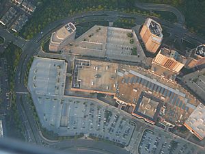
Tysons is the main business center for Fairfax County. It has a huge amount of office and retail space. In 2008, it had 46 million square feet (4.3 million m2) of commercial space. This makes it a great example of an edge city.
Many well-known companies have their main offices in Tysons. These include Alarm.com, Appian Corporation, Booz Allen Hamilton, Capital One, Freddie Mac, Hilton Worldwide, and MicroStrategy. Even though some use a McLean or Vienna address, their offices are in Tysons.
Tysons is home to Tysons Corner Center, which is the largest shopping mall in Virginia and the Baltimore-Washington area. It also has two fancy shopping centers, Tysons Galleria and Fairfax Square. These malls attract about 55,000 shoppers every weekday!
Tysons also has a strong technology industry. In 2007, about 1,200 technology companies were based here. The cost of living in Tysons is quite high, meaning things like housing are more expensive than the U.S. average.
Education in Tysons
Schools for Kids and Teens
Fairfax County Public Schools (FCPS) runs the public schools in Tysons. There are five FCPS elementary schools in the area: Freedom Hill, Westbriar, Spring Hill, Westgate, and Joyce Kilmer Middle School. For high school, students usually go to nearby schools like George C. Marshall High School, James Madison High School, Langley High School, or McLean High School.
Local Libraries
The Fairfax County Public Library system has a branch nearby called the Tysons-Pimmit Regional Library. It's located in Pimmit Hills.
Getting Around Tysons
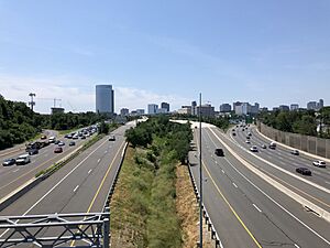
Tysons has several major roads running through it. Interstate 495, also known as the Capital Beltway, goes through eastern Tysons. Virginia State Route 267, the Dulles Toll Road, runs along the northern edge. Two other important roads, Virginia State Route 7 and Virginia State Route 123, cross in the center of Tysons.
Because so many people work and shop in Tysons, it used to have a lot of traffic jams. To help with this, new public transportation was added. On July 26, 2014, the Washington Metro opened its Silver Line in Tysons.
The Metro Silver Line has four stations in Tysons: McLean, Tysons, Greensboro, and Spring Hill. This train line connects Tysons to places like Reston, Washington Dulles International Airport, and Ashburn to the west. It also connects to Arlington, Washington, D.C., and Maryland to the east.
In 2017, construction began on the Jones Branch Connector. This new half-mile road crosses Interstate 495. It helps connect different parts of Tysons and makes it easier for cars to get around. The bridge opened in 2018, and the whole project finished in 2020.
See also
 In Spanish: Tysons Corner para niños


