Unterlunkhofen facts for kids
Quick facts for kids
Unterlunkhofen
|
||
|---|---|---|
 |
||
|
||
| Country | Switzerland | |
| Canton | Aargau | |
| District | Bremgarten | |
| Area | ||
| • Total | 4.49 km2 (1.73 sq mi) | |
| Elevation | 401 m (1,316 ft) | |
| Population
(Dec 2020 )
|
||
| • Total | 1,499 | |
| • Density | 333.9/km2 (864.7/sq mi) | |
| Postal code |
8918
|
|
| Surrounded by | Arni, Hermetschwil-Staffeln, Oberlunkhofen, Oberwil-Lieli, Rottenschwil, Zufikon | |
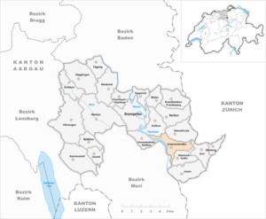
Unterlunkhofen is a small town, also known as a municipality, located in the Bremgarten district of the canton of Aargau in Switzerland. It's a place with a long and interesting history!
Contents
Uncovering Unterlunkhofen's Past
People have lived in the area around Unterlunkhofen for a very long time, even before Christianity.
- Stone Age Discoveries: Archeologists have found proof of a settlement in the Geisshof area from the Neolithic Age, which was around 2700-2400 BC. This period is also called the New Stone Age.
- Iron Age Secrets: Even more important discoveries come from the early Iron Age (about 800-450 BC). This includes the Bärhau burial site, which is the largest of its kind in Switzerland! You can learn more about it below.
- Roman Life: The area also had a Roman era villa (a large country house). In 1890, a Roman wall with fancy marble and a beautiful six-color mosaic floor was found.
From Ancient Tribes to Modern Switzerland
The Alemanni people settled here around the 7th century. The name Lunkhofen used to include several areas like Oberlunkhofen, Unterlunkhofen, Jonen, and Arni-Islisberg. It was first written down as Lunchunft in the 9th century.
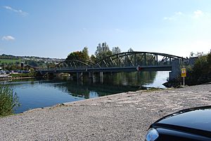
A ferry across the Reuss River was a key part of the main road connecting Zürich and Bern until the 16th century. The land was owned by Murbach Abbey, then given to the Habsburgs in 1259, and later sold to Rudolf I of Germany in 1291.
Unterlunkhofen stayed under Habsburg control until 1414. After the region of Aargau was taken over in 1415, Lunkhofen became part of Zürich until 1798. Finally, in 1803, it became part of the new canton of Aargau.
Exploring Unterlunkhofen's Geography
Unterlunkhofen covers an area of about 4.5 square kilometers (about 1.7 square miles).
- More than half of the land (51.6%) is used for farming.
- About a quarter (26.6%) is covered by forests.
- A smaller part (8.5%) has buildings or roads.
- The rest (13.4%) is made up of natural features like rivers.
Understanding the Coat of Arms
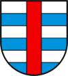
The blazon (description) of Unterlunkhofen's municipal coat of arms is: Barry of Six Argent and Azure and overall a Pale Gules. This coat of arms was officially adopted in 1929. It is based on the coat of arms of Hugo of Lunkhofen, which was recorded way back in 1255.
Who Lives in Unterlunkhofen?
Unterlunkhofen has a population of around 1,262 people (as of 2022).
- Over the past 10 years, the population has grown by about 23%.
- Most people (94.6%) speak German. Italian and English are the next most common languages.
- About 10.2% of the people living here are from other countries.
Age and Homes
In Unterlunkhofen, the population includes:
- About 11.2% are children aged 0-9 years old.
- About 12.5% are teenagers aged 10-19.
- The adult population is spread across different age groups, with a good mix of young adults, middle-aged people, and seniors.
Most homes in Unterlunkhofen have 3 or 4 people living in them. The average household has about 2.61 people. Many homes are single-family houses.
Politics and Education
In the 2007 federal election, the most popular political party was the SVP. When it comes to education, about 86.4% of adults (aged 25-64) have completed either high school or gone on to higher education, like a university. In the 2008/2009 school year, there were 99 students attending primary school in the municipality.
Population Growth Over Time
Here's how the population of Unterlunkhofen has changed over the years:
- 1975: 399 people
- 1980: 415 people
- 1990: 758 people
- 2000: 1235 people
Important Historical Sites
The Bärhau site is very important and is listed as a Swiss heritage site of national significance.
- It's an Iron Age burial site with 63 graves, making it the largest of its kind in Switzerland.
- The Bärhau was found and explored between 1865 and 1900.
- Each burial mound, called a tumulus, is about 1.2 meters (4 feet) high and about 12 meters (39 feet) wide. They are located close together.
- Inside the graves, archeologists found human skeletons along with items like bronze jewelry, tools, and small weapons.
- These finds are now kept in the National Museum in Zurich and the Vindonissa museum in Brugg.
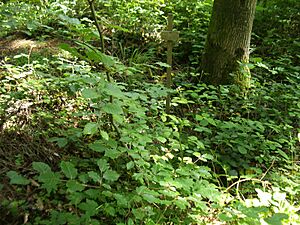
- Today, these ancient Celtic burial mounds are in a forest, so they can be a bit hard to spot.
How Unterlunkhofen Works
In 2007, Unterlunkhofen had a low unemployment rate of 1.25%.
- Many people work in the primary economic sector, which includes farming.
- Others work in the secondary sector, which involves manufacturing and construction.
- The tertiary sector includes jobs in services, like shops and offices.
Many people who live in Unterlunkhofen travel outside the municipality for work. About 16.9% use public transportation, and 60.2% use a private car to get to their jobs.
Religion in Unterlunkhofen
According to the 2000 census:
- About 51.8% of the population were Roman Catholic.
- About 30.7% belonged to the Swiss Reformed Church.
See also
 In Spanish: Unterlunkhofen para niños
 | Misty Copeland |
 | Raven Wilkinson |
 | Debra Austin |
 | Aesha Ash |


