Upper Brookfield, Queensland facts for kids
Quick facts for kids Upper BrookfieldBrisbane, Queensland |
|||||||||||||||
|---|---|---|---|---|---|---|---|---|---|---|---|---|---|---|---|

The Upper Brookfield Community Hall
|
|||||||||||||||
| Population | 857 (2021 census) | ||||||||||||||
| • Density | 23.48/km2 (60.8/sq mi) | ||||||||||||||
| Postcode(s) | 4069 | ||||||||||||||
| Area | 36.5 km2 (14.1 sq mi) | ||||||||||||||
| Time zone | AEST (UTC+10:00) | ||||||||||||||
| Location | 22.5 km (14 mi) W of Brisbane CBD | ||||||||||||||
| LGA(s) | City of Brisbane (Pullenvale Ward) |
||||||||||||||
| State electorate(s) | Moggill | ||||||||||||||
| Federal Division(s) | Ryan | ||||||||||||||
|
|||||||||||||||
Upper Brookfield is a lovely suburb located in the western part of Brisbane, Queensland, Australia. It's a bit further out from the city center, giving it a more rural feel. In 2021, about 857 people called Upper Brookfield home.
Contents
Exploring Upper Brookfield's Location
Upper Brookfield is a hilly, countryside suburb. It has many large properties with lots of land. It is about 22.5 kilometers (14 miles) by road west of the main Brisbane city center.
Marshalls Flat
In the middle of the suburb, you'll find a flat area called Marshalls Flat. It sits next to Moggill Creek. This area was named after Arthur John (Jack) Marshall and Kathleen Bell Marshall. They owned and farmed these flats from 1944 to 1976.
A Look Back at Upper Brookfield's History
Upper Brookfield gets its name from its nearby suburb, Brookfield. People started using the name around 1910. However, it wasn't officially named and given its boundaries until August 11, 1975.
Early Farms and Land Sales
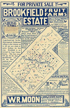
In 1914, some land was sold in the Upper Brookfield area. It was called the Brookfield Fruit Farms Estate. There were 23 blocks of land, perfect for growing fruits like bananas and pineapples, and also vegetables. The land was described as "virgin scrub," meaning it was untouched nature.
Upper Brookfield State School's Journey
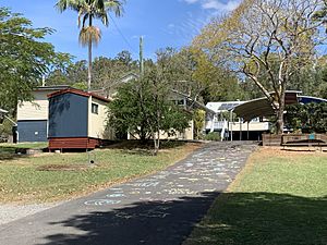
Upper Brookfield State School first opened its doors in 1916. It was also known as Brookfield Upper State School. However, it closed in 1921 because not enough students were attending. Luckily, it reopened in 1923 and has been helping kids learn ever since!
Building the Community Hall
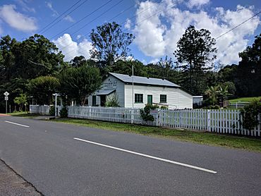
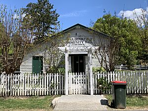
In March 1933, a local resident decided to raise money for a public hall. Fred Meilandt generously offered to donate the land. Other people gave timber and money to help. A group of volunteers started clearing the land on June 24, 1933. Construction of the hall began in September 1933, showing how the community worked together.
The Story of a Local Church
A Methodist church opened in Upper Brookfield on November 29, 1952. Before this, the local church group had met in different places for 17 years. The church was next to the public hall at 508 Upper Brookfield Road. In 1977, the Methodist Church joined with others to form the Uniting Church in Australia. So, it became the Upper Brookfield Uniting Church. It closed in November 2001. In April 2003, the church building was moved to Moreton Bay College in Manly West. It is now used as their Centenary Chapel.
Who Lives in Upper Brookfield?
The number of people living in Upper Brookfield has grown over the years.
- In 2011, there were 655 people.
- By 2016, the population had increased to 785 people.
- In 2021, the population reached 857 people.
Most people living in Upper Brookfield were born in Australia. However, many also come from countries like England, South Africa, and New Zealand, making it a diverse community. English is the main language spoken at home.
Special Places: Heritage Listings
Upper Brookfield has some places that are important to its history. These are called heritage-listed sites. One such site is the Gold Creek Reservoir at 693A Gold Creek Road.
Learning in Upper Brookfield
Upper Brookfield State School is a government primary school for students from Prep (the first year of school) to Year 6. It is located at 496 Upper Brookfield Road. In 2018, the school had 54 students.
There isn't a high school in Upper Brookfield itself. The closest high school for older students is Kenmore State High School in Kenmore, which is to the south-east.
Community Amenities
The Upper Brookfield Community Hall is an important gathering place for locals. It is located at 506 Upper Brookfield Road. It's a place where people can come together for events and activities.
 | Audre Lorde |
 | John Berry Meachum |
 | Ferdinand Lee Barnett |


