Walton Hill facts for kids
Quick facts for kids Walton Hill |
|
|---|---|

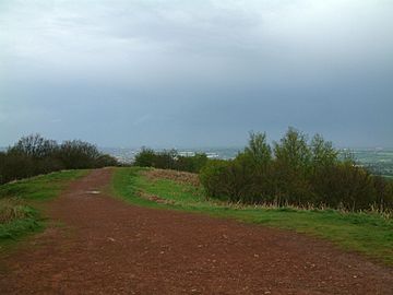
The path along the summit ridge of Walton Hill
|
|
| Highest point | |
| Elevation | 316 metres (1,037 ft) |
| Prominence | 207 metres (679 ft) |
| Parent peak | The Wrekin |
| Listing | Marilyn |
| Geography | |
| Location | Worcestershire, England |
| OS grid | SO942797 |
| Topo map | OS Landranger 139 |
Walton Hill is a special place in northern Worcestershire, England. It stands 316 metres (1,037 ft) tall, making it the highest point in the Clent Hills. From its top, you can see for miles around! It's the tallest spot for about 21 miles (34 km) in every direction. This means you get amazing views of the countryside.
The very top of Walton Hill is covered in open grassland and heathland. This land used to be "common land," meaning local people could use it. In 1959, this beautiful area was given to the National Trust. The National Trust is a charity that helps protect important places in England. They also received the woodlands on the side of the hill, making sure they are looked after for everyone to enjoy.
Contents
Amazing Views from Walton Hill
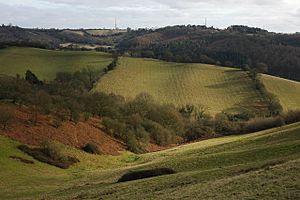
Walton Hill is known for its incredible views. When you stand on the summit, you can see many other hills in the distance. Looking south-west, you might spot the Clee Hills, The Wrekin, and the Malvern Hills.
On a really clear day, your view can stretch even further!
- You might see the Cotswolds about 30 miles (48 km) to the south.
- The Peak District in the north is about 40 miles (64 km) away.
- To the west, the Shropshire Hills are about 20 miles (32 km) distant.
- You can even see the Black Mountains in Wales, which are about 55 miles (89 km) to the south-west.
Walton Hill offers these wide views because it's located right in the middle of England. It's far enough from other big hills that nothing blocks your sight.
Exploring Walton Hill: How to Get There
You can walk up Walton Hill from many different directions. It's a popular spot for hikers and nature lovers.
Starting Your Walk
The most common way to start your walk is from a car park located north-east of the summit. This car park is easy to find from the A456 road. You can turn off onto Hagley Wood Lane or Uffmoor Lane. Both of these lanes lead to a junction near High Harcourt Farm. From there, a lane goes around Walton Hill, ending near the Hollybush public house on the A491 road.
Other Walking Paths
There are other ways to reach the top of Walton Hill:
- You can access the hill from a long, brick-paved driveway leading to Walton Hill Farm.
- Near Sling Common, you can find a footpath that goes through private farmland. This path follows a ridge and leads to Walton Hill Farm, where you enter the National Trust land on the summit.
- A special path for horses, called a bridle path, runs from Calcot Hill Farm along the southern side of Walton Hill. This path goes all the way to a small group of houses called Walton Pool.
- From Walton Pool, two more bridle paths follow ridges up the hill. They meet to form the main path on the south-western side of Walton Hill.
- Another footpath starts near St. Leonard's church in Clent village and connects to one of the bridle paths from Walton Pool.
- You can also start a walk from the small village of Clatterbach, near the Vine Inn. This path takes you directly to the north-western side of Walton Hill.
Walk Lengths and Steepness
The northern car park is about 260 metres (850 ft) above sea level. Other starting points are a little lower, around 250 metres (820 ft). The path from the northern car park is the shortest and steepest way to the top. However, there's also an easier trail that winds gently around the hill.
The route from Calcot Hill is just over a mile long (about two kilometres). Most of the other paths are about a mile (about one and a half kilometres) to reach the summit. No matter which way you choose, getting to the top of Walton Hill is a rewarding adventure!
 | Audre Lorde |
 | John Berry Meachum |
 | Ferdinand Lee Barnett |


