
Washington County, Nebraska facts for kids
Quick facts for kids
Washington County
|
|
|---|---|

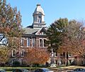
Washington County Courthouse in Blair
|
|

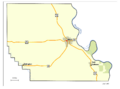
Location within the U.S. state of Nebraska
|
|
 Nebraska's location within the U.S. |
|
| Country | |
| State | |
| Founded | 1854 (created) 1855 (reorganized) |
| Named for | George Washington |
| Seat | Blair |
| Largest city | Blair |
| Area | |
| • Total | 393 sq mi (1,020 km2) |
| • Land | 390 sq mi (1,000 km2) |
| • Water | 3.2 sq mi (8 km2) 0.8%% |
| Population
(2020)
|
|
| • Total | 20,865 |
| • Estimate
(2023)
|
21,152 |
| • Density | 53.09/sq mi (20.499/km2) |
| Time zone | UTC−6 (Central) |
| • Summer (DST) | UTC−5 (CDT) |
| Congressional district | 1st |
Washington County is a county in the state of Nebraska in the United States. A county is like a smaller area within a state. As of 2020, about 20,865 people lived here. The main town, or county seat, is Blair. Washington County is part of the larger Omaha-Council Bluffs area. When you see Nebraska license plates, cars from Washington County often have the number 29. This is because it had the 29th largest number of registered vehicles when the system started in 1922.
Contents
History of Washington County
Washington County is in eastern Nebraska, right next to the Missouri River. European explorers first visited this area around 1739. These were French explorers named Pierre Antoine and Paul Mallet. They were on a trip to trap animals for their fur.
Early Explorers and Forts
In 1804, famous explorers Lewis and Clark came through. They met with Native American chiefs near where Fort Calhoun is today. They told the chiefs about the new United States government. Because of this meeting, Fort Atkinson was built in 1819. It was a very important outpost in the middle of the country until 1827.
County Formation and Growth
The first permanent settlement in Washington County started in 1854. In the same year, Washington County became one of the first eight counties in Nebraska. It was officially set up again in 1855. The county seat, which is the main town for government, has moved a few times. It was first in Fort Calhoun, then DeSoto, and since 1869, it has been in Blair.
Past Power and Missile Sites
South of Blair, there used to be a power plant called the Fort Calhoun Nuclear Generating Station. It was the smallest nuclear power plant in North America. It closed down in 2016. Also, an old Atlas missile launch site was located east of Arlington. It was part of Offutt Air Force Base but was stopped being used in the 1960s.
Geography of Washington County
Washington County is on the eastern side of Nebraska. Its eastern border is the Missouri River, which separates Nebraska from Iowa. The Elkhorn River flows along the county's southwest edge. The Little Papillon River flows through the middle of the county. Most of the land in the county is used for farming.
Land and Water Areas
The county covers about 393 square miles (1,018 square kilometers). Most of this, about 390 square miles (1,010 square kilometers), is land. The rest, about 3.2 square miles (8.3 square kilometers), is water. This makes Washington County the fifth smallest county in Nebraska by land area.
Neighboring Counties
Washington County shares borders with these other counties:
- Burt County to the north
- Harrison County, Iowa to the northeast
- Pottawattamie County, Iowa to the southeast
- Douglas County to the south
- Dodge County to the west
Special Protected Areas
There are several special areas in Washington County that are protected for nature or history:
- Boyer Chute National Wildlife Refuge
- DeSoto National Wildlife Refuge (part of it)
- Fort Atkinson State Historical Park
- Neale Woods Nature Center (part of it)
Population in Washington County
| Historical population | |||
|---|---|---|---|
| Census | Pop. | %± | |
| 1860 | 1,249 | — | |
| 1870 | 4,452 | 256.4% | |
| 1880 | 8,631 | 93.9% | |
| 1890 | 11,869 | 37.5% | |
| 1900 | 13,086 | 10.3% | |
| 1910 | 12,738 | −2.7% | |
| 1920 | 12,180 | −4.4% | |
| 1930 | 12,095 | −0.7% | |
| 1940 | 11,578 | −4.3% | |
| 1950 | 11,511 | −0.6% | |
| 1960 | 12,103 | 5.1% | |
| 1970 | 13,310 | 10.0% | |
| 1980 | 15,508 | 16.5% | |
| 1990 | 16,607 | 7.1% | |
| 2000 | 18,780 | 13.1% | |
| 2010 | 20,234 | 7.7% | |
| 2020 | 20,865 | 3.1% | |
| 2023 (est.) | 21,152 | 4.5% | |
| US Decennial Census 1790-1960 1900-1990 1990-2000 2010 |
|||
According to the 2020 United States Census, there were 20,865 people living in Washington County. Most people, about 96.3%, identified as White. About 3.3% of the population identified as Hispanic or Latino.
In 2000, there were 18,780 people. The average household had about 2.63 people. Many families had children under 18 living with them. The median age in the county was 37 years old.
Transportation in Washington County
Washington County has several important roads and a few airports.
Main Roads
These are the major highways that go through Washington County:
 U.S. Highway 30
 U.S. Highway 75
 Nebraska Highway 31
 Nebraska Highway 91
 Nebraska Highway 133
Airports and Airstrips
The county has the Blair Municipal Airport. There are also a few smaller, privately owned grass airstrips, like the Orum Aerodrome. For medical emergencies, there is a helipad at the Memorial Community Hospital in Blair.
Communities in Washington County

Washington County has several different types of communities, from larger cities to smaller villages and unincorporated areas.
Cities
- Blair (This is the county seat)
- Fort Calhoun
Villages
Census-Designated Place
Unincorporated Communities
These are smaller places that are not officially organized as cities or villages:
Precincts
Precincts are smaller divisions within the county, often used for voting:
- Fort Calhoun
- Richland
- Herman
- Township 6
- Arlington
Images for kids
-
Washington County Courthouse in Blair
-
Map of Washington County
See also
 In Spanish: Condado de Washington (Nebraska) para niños
