West Delhi (district) facts for kids
Quick facts for kids
West Delhi
|
|
|---|---|
| Country | |
| State | Delhi |
| Headquarters | Rajouri Garden |
| Government | |
| • Body | Municipal Corporation of Delhi |
| Area | |
| • Total | 129 km2 (50 sq mi) |
| Elevation | 219 m (719 ft) |
| Population
(2011)
|
|
| • Total | 2,543,243 |
| • Density | 19,720/km2 (51,060/sq mi) |
| Languages | |
| • Official | Punjabi, Hindi |
| Time zone | UTC+5:30 (IST) |
| PIN |
1100xx
|
| Lok Sabha constituency | West Delhi |
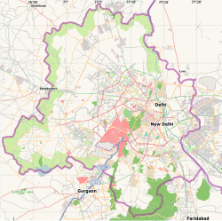
West Delhi is one of the 11 main administrative districts in the National Capital Territory of Delhi in India. It's like a big neighborhood or region within the larger city of Delhi.
For managing the area, West Delhi is split into three smaller parts called subdivisions. These are Patel Nagar, Rajouri Garden, and Punjabi Bagh.
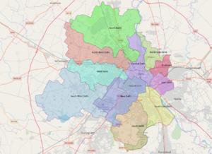
West Delhi shares its borders with other districts. To the north, it's next to North West Delhi. To the east, you'll find North Delhi and Central Delhi. To the south, it borders South West Delhi. On its western side, it touches the Jhajjar District in the state of Haryana. Many important living areas and shopping spots, like Janakpuri and Tilak Nagar, are located here.
West Delhi covers an area of 129 square kilometers. It's a very crowded place, with almost 14,000 people living in every square kilometer. In 2011, about 2.5 million people lived here. More than half of them were males. The number of children aged 0-6 years was over 200,000. Most people in West Delhi can read and write, with a literacy rate above 70%.
Contents
People and Languages in West Delhi
How Many People Live Here?
According to a count done in 2011, West Delhi had a population of 2,543,243 people. That's roughly the same number of people as in the country of Kuwait or the US state of Nevada. This large population makes it the 169th most populated district out of 640 districts in India.
The district is very densely populated, meaning many people live close together. There are about 19,625 people per square kilometer. Between 2001 and 2011, the population grew by about 18.91%.
Gender Balance and Education
For every 1000 males in West Delhi, there were about 876 females. This is called the sex ratio. The ability to read and write, known as the literacy rate, was very high at 87.12%. Almost all the people (99.75%) in West Delhi live in urban, or city, areas. A group of people known as Scheduled Castes make up about 14.80% of the population.
Religions and Languages Spoken
| Religions in West Delhi district (2011) | ||||
|---|---|---|---|---|
| Religion | Percent | |||
| Hinduism | 82.07% | |||
| Sikhism | 10.69% | |||
| Islam | 5.89% | |||
| Christianity | 0.72% | |||
| Jainism | 0.45% | |||
| Other or not stated | 0.18% | |||
Languages of West Delhi district (2011) Hindi (75.46%) Punjabi (14.52%) Bhojpuri (1.66%) Urdu (1.32%) Rajasthani (1.06%) Others (5.98%)
In 2011, most people in West Delhi spoke Hindi as their main language, about 75.46%. Other languages spoken include Punjabi (14.52%), Bhojpuri (1.66%), Urdu (1.32%), and Rajasthani (1.06%).
See also
 In Spanish: Distrito de Delhi occidental para niños Here are some other topics and places related to West Delhi:
- Districts of Delhi
- Bali Nagar
- Meera Bagh
- Najafgarh
- Indira Gandhi International Airport
- Ashok Nagar (Delhi)
- Tilak Nagar
- Janakpuri
- Vikaspuri
- Paschim Vihar
- Punjabi Bagh
- NANGLOI
- Rajouri Garden
- Mayapuri
- Chander Vihar
- Patel Nagar
- Dwarka
- Dashrath puri
- South Delhi
- Hari Nagar
- Subhash Nagar
- Uttam Nagar
- Shadipur Depot (Baljit Nagar, Kathputli Colony)
- Naraina Ind. Area
- Kirti Nagar
- Saraswati Garden
- Mansarover Garden


