West Lafayette, Indiana facts for kids
Quick facts for kids
West Lafayette, Indiana
|
||
|---|---|---|
|
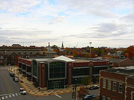
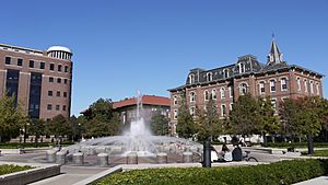
West Lafayette Public Library and Purdue University in background
West Lafayette City Hall, formerly Morton School
Celery Bog nature area
|
||
|
||
| Nickname(s):
"West Side"
|
||
| Country | United States | |
| State | Indiana | |
| County | Tippecanoe | |
| Township | Wabash | |
| Incorporated | 1888 | |
| Area | ||
| • City | 13.82 sq mi (35.80 km2) | |
| • Land | 13.59 sq mi (35.20 km2) | |
| • Water | 0.23 sq mi (0.60 km2) | |
| • Metro | 904.6 sq mi (2,343 km2) | |
| Elevation | 705 ft (215 m) | |
| Population
(2020)
|
||
| • City | 44,595 | |
| • Density | 3,281.46/sq mi (1,266.93/km2) | |
| • Metro | 182,821 | |
| Time zone | UTC−5 (EST) | |
| • Summer (DST) | UTC−4 (EDT) | |
| ZIP Code |
47906
|
|
| Area code(s) | 765 | |
| FIPS code | 18-82862 | |
| GNIS feature ID | 2397268 | |
| Website | www.westlafayette.in.gov | |
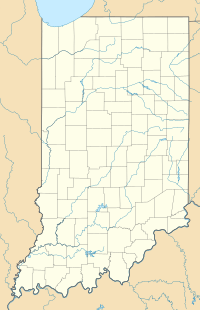
West Lafayette (/ˌlɑːfiˈɛt, ˌlæf-/ la(h)f-EE-et) is a city in Tippecanoe County, Indiana, United States. It is about 65 miles (105 km) northwest of Indianapolis, the state capital, and 113 miles (182 km) southeast of Chicago. West Lafayette is located right across the Wabash River from its sister city, Lafayette.
As of 2020, about 44,595 people live here. West Lafayette is famous for being home to Purdue University, a very large college. This makes it a "college town," meaning a lot of its life revolves around the university. It is also the most densely populated (crowded) city in Indiana.
Contents
History of West Lafayette
How West Lafayette Began
In 1836, a man named Augustus Wylie tried to start a town near the Wabash River. However, this area flooded often, so the town was never built there. The city we know today was formed in 1888. It was created by combining three smaller towns: Chauncey, Oakwood, and Kingston. These towns were located on a higher area across the Wabash River from Lafayette, Indiana.
Kingston was planned in 1855. Chauncey was planned in 1860 by the wealthy Chauncey family from Philadelphia. In 1866, Chauncey and Kingston joined together and chose the name "Chauncey" for their new government.
Growth with Purdue University
The town of Chauncey stayed small until Purdue University opened in 1869. By 1871, Chauncey wanted to join Lafayette because it needed better roads, water systems, and police and fire protection. However, Lafayette voted against this because it would cost too much to improve Chauncey.
In May 1888, the town of Chauncey voted to change its name to West Lafayette. This happened after 152 people signed a petition. By this time, Purdue University was growing fast, which helped the small town grow too. For many years, Purdue University's address was even listed as "Lafayette, Indiana."
West Lafayette did not get its own train station for a long time. It also took several years to get the same city services as Lafayette. Today, West Lafayette is its own city with its own services and unique neighborhoods.
Recent Changes to City Limits
In November 2013, the city of West Lafayette approved a plan to expand its borders. For the first time, much of the Purdue University campus and student housing became officially part of the city. This expansion also included a large part of the US Highway 231 area, which used to be outside the city limits.
Historic Places in West Lafayette
Several buildings and areas in West Lafayette are listed on the National Register of Historic Places. These include the Alpha Tau Omega Fraternity House, Jesse Andrew House, Chauncey-Stadium Avenues Historic District, John E. and Catherine E. Christian House, Curtis-Grace House, Happy Hollow Heights Historic District, Hills and Dales Historic District, Morton School, and The Varsity.
Geography of West Lafayette
West Lafayette is located in the middle of Tippecanoe County. It overlooks the Wabash River, which forms its eastern and southern borders. Most of the city is in eastern Wabash Township. A small part in the northeast extends into Tippecanoe Township.
The land elevation ranges from just over 500 feet (152 m) near the river to more than 720 feet (219 m) in the northern parts of the city. According to the 2010 census, West Lafayette covers about 7.63 square miles (19.76 sq km). Most of this area, about 7.62 square miles (19.74 sq km), is land, and only a tiny part is water.
| Climate data for West Lafayette, Indiana | |||||||||||||
|---|---|---|---|---|---|---|---|---|---|---|---|---|---|
| Month | Jan | Feb | Mar | Apr | May | Jun | Jul | Aug | Sep | Oct | Nov | Dec | Year |
| Record high °F (°C) | 69 (21) |
73 (23) |
86 (30) |
89 (32) |
94 (34) |
105 (41) |
105 (41) |
100 (38) |
98 (37) |
92 (33) |
78 (26) |
73 (23) |
105 (41) |
| Mean daily maximum °F (°C) | 34 (1) |
39 (4) |
50 (10) |
63 (17) |
73 (23) |
83 (28) |
85 (29) |
84 (29) |
78 (26) |
65 (18) |
51 (11) |
38 (3) |
62 (17) |
| Mean daily minimum °F (°C) | 19 (−7) |
23 (−5) |
31 (−1) |
41 (5) |
51 (11) |
61 (16) |
64 (18) |
63 (17) |
55 (13) |
44 (7) |
34 (1) |
23 (−5) |
42 (6) |
| Record low °F (°C) | −23 (−31) |
−20 (−29) |
−3 (−19) |
7 (−14) |
25 (−4) |
35 (2) |
43 (6) |
37 (3) |
29 (−2) |
19 (−7) |
6 (−14) |
−16 (−27) |
−23 (−31) |
| Average precipitation inches (mm) | 1.86 (47) |
1.84 (47) |
2.67 (68) |
3.54 (90) |
4.19 (106) |
4.10 (104) |
3.97 (101) |
3.46 (88) |
2.66 (68) |
2.89 (73) |
2.97 (75) |
2.51 (64) |
36.66 (931) |
| Average snowfall inches (cm) | 6.5 (17) |
4.8 (12) |
2.9 (7.4) |
0.7 (1.8) |
0 (0) |
0 (0) |
0 (0) |
0 (0) |
0 (0) |
0.3 (0.76) |
0.8 (2.0) |
5.2 (13) |
21.2 (54) |
| Average precipitation days (≥ 0.01 in) | 9.6 | 7.7 | 10.2 | 10.9 | 10.6 | 10.4 | 8.9 | 8.4 | 7.6 | 8.3 | 9.8 | 10.1 | 112.5 |
| Average snowy days (≥ 0.1 in) | 5.3 | 3.3 | 1.7 | 0.3 | 0 | 0 | 0 | 0 | 0 | 0.1 | 0.9 | 3.5 | 15.1 |
| Source 1: The Weather Channel (January record high) | |||||||||||||
| Source 2: NOAA: Lafayette | |||||||||||||
Neighborhoods to Explore
West Lafayette has many different neighborhoods. Some of these include:
- Amberleigh Village
- Arbor Chase
- Avondale
- Bar Barry Heights
- Camelback
- Glenwood Heights
- Happy Hollow
- Hills and Dales
- New Chauncey Neighborhood
- Northwestern Heights
- Park Ridge
- Peppermill Village
- Plaza Park
- Prophets Ridge
- Stonebridge
- University Farm
- Wabash Shores
Population and People
| Historical population | |||
|---|---|---|---|
| Census | Pop. | %± | |
| 1880 | 717 | — | |
| 1890 | 1,242 | 73.2% | |
| 1900 | 2,302 | 85.3% | |
| 1910 | 3,867 | 68.0% | |
| 1920 | 3,830 | −1.0% | |
| 1930 | 5,095 | 33.0% | |
| 1940 | 6,270 | 23.1% | |
| 1950 | 11,873 | 89.4% | |
| 1960 | 12,680 | 6.8% | |
| 1970 | 19,157 | 51.1% | |
| 1980 | 21,247 | 10.9% | |
| 1990 | 25,907 | 21.9% | |
| 2000 | 28,778 | 11.1% | |
| 2010 | 29,596 | 2.8% | |
| 2020 | 44,595 | 50.7% | |
| U.S. Decennial Census | |||
What the 2020 Census Shows
The census is a count of people. In 2020, the census showed that 44,595 people lived in West Lafayette.
What the 2010 Census Showed
In 2010, there were 29,796 people living in the city. There were 11,945 households, which are groups of people living together. The city had about 3,884 people per square mile (1,499 per sq km).
The people in West Lafayette came from many different backgrounds:
- 60.2% were White
- 9.8% were African American
- 0.1% were Native American
- 17.3% were Asian
- 1.9% were from other races
- 2.1% were from two or more races
- 7.6% were Hispanic or Latino (who can be of any race)
About 16% of households had children under 18. The average age in the city was 22.8 years old. Many residents were young, with 49.4% being between 18 and 24 years old. This is because of the large number of college students.
After the 2010 census, West Lafayette expanded its city limits to include more of the Purdue University campus. An updated report showed that the population grew to 44,910 people.
Economy and Jobs
The economy of West Lafayette is greatly shaped by Purdue University. The university has over 50,000 students, which is more than the city's population! Purdue University also employs 12,000 people, and most of them live in West Lafayette or Lafayette.
Purdue Research Park
The Purdue Research Park was started in 1961. It is a large area, about 725 acres (2.9 sq km), where many companies are located. More than 140 companies are there, and almost 100 of them are related to technology. In 2009, these companies employed over 3,000 people.
The park offers special facilities for research and helps new businesses get started. It also has nice walking trails and lakes. This research park is one of the biggest ones connected to a university in the United States. The Purdue Research Foundation, which supports the university, owns the park.
Shopping and Entertainment
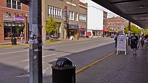
Most of the big shopping areas are across the river in Lafayette. However, West Lafayette has a lively area called Wabash Landing/Levee. This area has been rebuilt and now includes shops, restaurants, coffee houses, a movie theater with 9 screens, a hotel, and the Riverside Skating Center. A pedestrian bridge now connects it to Lafayette.
Arts and Culture
West Lafayette has its own public library, the West Lafayette Public Library. There is also a branch of the county library in the Klondike area, west of the city.
Cool Places to Visit
Here are some interesting places you can visit in West Lafayette:
- Purdue University
- Purdue University Horticulture Gardens - a beautiful garden area.
- Fort Ouiatenon - an old French trading post.
- Purdue State Bank - a historic bank building designed by famous architect Louis Sullivan.
- Samara (John E. Christian House) - a special house designed by another famous architect, Frank Lloyd Wright.
- Celery Bog Nature Area and Lilly Nature Center - a great place to explore nature.
- Purdue Horticulture Park
Education in West Lafayette
West Lafayette is home to the main campus of Purdue University. It has over 40,000 students!
Local Schools
The West Lafayette Community School Corporation manages three schools for younger students:
- West Lafayette Elementary School (for students up to third grade)
- West Lafayette Intermediate School (for grades 4–6)
- West Lafayette Junior-Senior High School (for students in 7th grade and above)
This school district is highly rated and has received many awards. Not all areas annexed by the city are served by these schools; some are still served by county schools.
There are also private schools like Pleasantview SDA School (grades K–8) and the Montessori School of Greater Lafayette (K–6). Some other schools have a West Lafayette address but are actually outside the city limits.
West Lafayette has a very educated population. About 77% of adults aged 25 or older have a bachelor's degree or higher. This makes it one of the top cities in the U.S. for education levels among its residents.
Media and News
People in West Lafayette often use the news and media from its sister city, Lafayette. However, West Lafayette also has its own media outlets:
- The Purdue Exponent: This is Purdue University's independent student newspaper. It covers news for Purdue, West Lafayette, and Lafayette.
- WPBI-LD 16: This TV station broadcasts Fox, NBC, and ABC channels.
- WLFI-TV 18: This TV station broadcasts CBS, The CW, Ion Television, getTV, and Start TV.
- WPBY-LD 35: This TV station broadcasts ABC and MeTV/MyNetworkTV.
- WBAA Radio: This includes WBAA 920 AM and WBAA-FM 101.3 FM. They are National Public Radio (NPR) stations with studios on the Purdue University campus.
- WLQQ Radio: This is a radio station at 106.7 FM.
Getting Around West Lafayette
Public transportation in West Lafayette is managed by the Greater Lafayette Public Transportation Corporation.
Airports
- Purdue University Airport
Major Roads
Several important highways pass through or near West Lafayette:
 Interstate 65: Connects to Gary, Indiana (near Chicago) and Indianapolis.
 US 52: Connects to Joliet, Illinois (also near Chicago) and Indianapolis.
 US 231: Connects to Rensselaer, Indiana and Owensboro, Kentucky.
 State Road 26: Runs from the Purdue University campus to Kokomo, Indiana.
 State Road 43: Connects to Brookston, Indiana and Reynolds, Indiana.
Train Services
- Amtrak (Lafayette station): Passenger train service.
- CSX Transportation: A freight railroad company.
- Kankakee, Beaverville and Southern Railroad: A freight railroad company.
- Norfolk Southern Railway: A freight railroad company.
Famous People from West Lafayette
Here are some notable people who have lived in West Lafayette:
- Moungi Bawendi: A Nobel Prize winner in chemistry.
- Brian Binnie: A test pilot for SpaceShipOne.
- Katie Bouman: A computer scientist who helped capture the first image of a black hole.
- Bob Friend: A Major League Baseball player.
- Gen Fukunaga: The person who started Funimation Entertainment.
- Sanjay Ghemawat: A computer scientist and senior fellow at Google.
- Anissa Jones: An actress known for her role as "Buffy" on the TV show Family Affair.
- Cleve Jones: He came up with the idea for the AIDS quilt.
- George Karlaftis: An NFL player for the Kansas City Chiefs.
- Tom Kelly: A songwriter.
- Harry G. Leslie: A former governor of Indiana.
- Jay McDowell: A bassist for the country music band BR549.
- Chike Okeafor: An NFL player.
- Eric Rodwell: A multiple world champion bridge player.
- Erik Sabel: An MLB player.
- Randy Truitt: A former member of the Indiana House of Representatives.
See also
 In Spanish: West Lafayette (Indiana) para niños


